AIR – HIGHWAY – RAIL – WATER – PRT
West Virginia Studies


<< Here are the topics on this page; Click to jump/scroll down >>
“Transportation” – West Virginia Archives and History
- General
- Air: (Kanawha Airport; National Guard Plane Crash; Marshall Plane Crash)
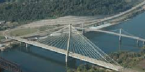
- Bridges: (Wheeling Bridge; New River Gorge Bridge)
- Bus and Trolley
- Railroads: (B&O; C&O; Holly River and Addison; Coal & Coke)
- Roads: (Staunton and Parkersburg Turnpike; Good Roads; West Virginia Turnpike)
- Water: (James Rumsey; Steamer H. K. Bedford)
“West Virginia Department of Transportation”
 “It is the mission of the West Virginia Department of Transportation to create and maintain for the people of West Virginia, the United States and the world a multi-modal and inter-modal transportation system that supports the safe, effective and efficient movement of people, information, and goods that enhances the opportunity for people and communities to enjoy environmentally sensitive and economically sound development.”
Explore “West Virginia of Transportation” Website
The West Virginia Department of Transportation contains the following Agencies/Divisions: (Click on agency name to explore website.)
Explore West Virginia Department of Transportation’s “Agencies” Website
Aeronautics Commission
Highways
Motor Vehicles
Parkways
Public Port Authority
Division of Public Transit
State Rail Authority
[The Division of Multimodal Transportation Facilities was created in early 2022, which includes the former departments/agencies: Aeronautics Commission, Public Port Authority, Division of Public Transit and State Rail Authority. As of early 2023, it does not have its own website – individual agency websites are still active]
“Maps” – West Virginia DOT
 “The [West Virginia Department of Transportation (WVDOT) Geospatial Transportation Information Section] is responsible for producing the following maps and is currently in the process of reproducing them in a GIS format. Please be aware that these maps are snapshots of spatial data at a certain time and therefore the information presented on the maps may not be current.”
Explore West Virginia DOT’s “Maps” Website — includes: Official State Tourism Map; State General Highway Map; Functional Classification Map; State Highway Base Map; County General Highway Maps; and others.
“Great West Virginia Map”
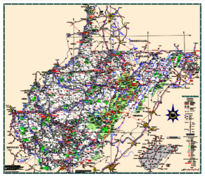 The “Official State Highway Map 2010” pdf is one of the best for education. Railroads, roads, highways, airports, and other important locations are clearly shown while waterways are bright blue and easily seen. Though dated 2010, it is missing only some of the most recent highway construction–such as Corridor H, Rt 9, Rt 10, and the Coalfields Expressway–projects which are shown as under construction but may be completed now. It is also more accurate than many more recent Official Highway Maps from the DOT.
Explore “Official State Highway Map 2010” (pdf )
AIR TRANSPORTATION
“West Virginia Aeronautics Commission”
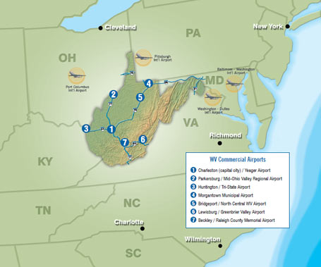
 “Airports are a vital key to our transportation system. From private to commercial and passenger to air cargo, West Virginia’s airports play a significant role in the state’s economy and the communities they serve. These airports are also located close to other intermodal forms of transportation, thereby allowing greater access and competitive transportation opportunities to businesses and individuals.”
Explore “West Virginia Aeronautics Commission” Website
“West Virginia has 35 public airports and dozens of private airports and landing strips. Of the state’s 35 public airports, 7 offer commercial airline service, with the remaining offering general aviation airfields, among additional support services.”
Explore West Virginia Aeronautics Commission’s “Airport Websites” List
HIGHWAY TRANSPORTATION
“West Virginia Division of Highways”
 “The Division of Highways is responsible for planning, engineering, right-of-ways acquisition, construction, reconstruction, traffic regulation, and maintenance of more than 35,000 miles of state roads. Additional duties include highway research, outdoor advertising contiguous to state roads, roadside development, safety, and weight enforcement, and dissemination of highway information.
Traversing mountains, valleys, wild rivers, and rolling countryside, the roadways maintained by the Division of Highways include:
- 38,770 miles of public roads (2016 Public Certified Mileage)
- 34,691 miles of state owned highways, 835 miles of federally owned roads, and 3,244 miles of municipally owned roads
- 555 miles of State owned Interstate Highway
- 87 miles of West Virginia Turnpike
- 1,988 miles included in the National Highway System, 23 miles of which are connectors to other modes of transportation such as airports, trains and buses
- 6,958 bridges of which 33 percent are more than 100 feet in length
- 1 All American Road, 5 National Byways, 14 State Byways and 8 Backways.
“The more than 4,800 men and women of the Division of Highways (DOH) are proud to preserve the quality and integrity of this world-class mountain transportation system.”
Explore “West Virginia Division of Highways” Website
“Highway Facts”
 “The Division of Highways plans, designs, builds and maintains the state highway system. There are some 36,000 miles of state-maintained highways that include 6,636 bridges (this figure does not include 238 railroad bridges, 117 city and county bridges, 99 West Virginia Turnpike bridges, 20 state park bridges, two private toll bridges and 132 other non-highway bridges.)”
Explore West Virginia Division of Highways’ “Highway Facts” Website
(Thanks to the WVDOH, many of the highways in WV have their own pages in Wikipedia. Use search terms such as: U.S. Route 50, West Virginia Route 2, Interstate 77 or Corridor G.)
“State and National Highway – Related Milestones”
“The economic growth and prosperity of the United States (US) is attributable in no small part to the quality of its transportation system—a system greatly dependent upon highways. In order to fully appreciate the West Virginia (WV) highway system, a brief summary of national and State transportation milestones is presented.” (Last updated 1997)
Explore WVDOH’s “State and National Highway-Related Milestones” Website pdf
“Bridges”
“Bridge Facts”
“The construction of bridges must be viewed in the context of a society bent on internal improvements, expansion and the exploitation of the nation’s natural resources,’ noted Dr. Emory Kemp, West Virginia University professor and head of its History of Science and Technology graduate program, in his 1984 survey for the state Division of Highways, West Virginia’s Historic Bridges. . .”
Continue reading at West Virginia DOH’s “Bridge Facts” Website
“Crossings: Bridge Building in West Virginia”
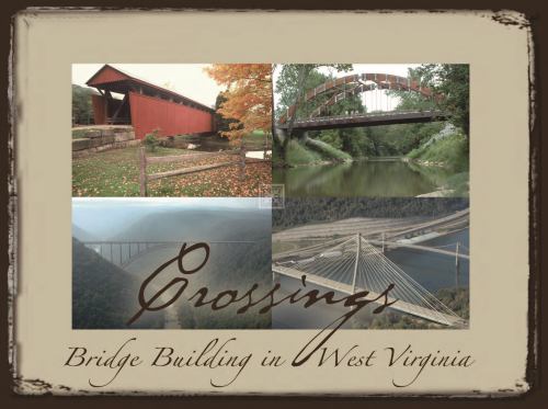 ‘“Crossings – Bridge Building in West Virginia” is an hour-long documentary, completed in 2006, that shows the formidable terrain early settlers faced as they crossed over the Appalachian Mountains, and how they overcame these transportation barriers with innovative, award-winning structures. The documentary covers all 17 of West Virginia’s covered bridges and highlights engineering masterpieces such as the world famous New River Gorge Bridge. “Crossings” presents a tremendous amount of historic, cultural, aesthetic, engineering, and geo-political information in a fresh and entertaining fashion.’
The Video: (55:33/2006/ WV Division of Highways) [Introduction: 0:00 — Part 1: Stone Arch Bridges 4:30 — Part 2: Covered Bridges 7:30 Part 3: Newer Bridges 23:10 — Part 4: Modern Bridges 37:48]
“Stone Arch Bridges”
 – Clendenin
– Elm Grove
– Van Metre Ford
Explore West Virginia DOH’s “Stone Arch Bridges” Website for information on each of these bridges
“West Virginia’s Oldest Bridge Celebrates 200th Birthday”
![]() “Built 200 years ago to carry Conestoga wagons and stagecoaches across Little Wheeling Creek on the National Road, America’s first federally funded highway, West Virginia’s oldest bridge still is an active component of the national highway system, carrying more than 16,000 vehicles a day across the Ohio County stream. . .”
“Built 200 years ago to carry Conestoga wagons and stagecoaches across Little Wheeling Creek on the National Road, America’s first federally funded highway, West Virginia’s oldest bridge still is an active component of the national highway system, carrying more than 16,000 vehicles a day across the Ohio County stream. . .”
Explore Charleston Gazette-Mail’s “West Virginia’s Oldest Bridge Celebrates 200th Birthday” article
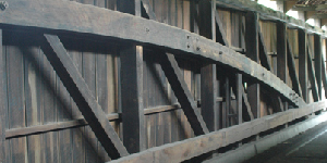
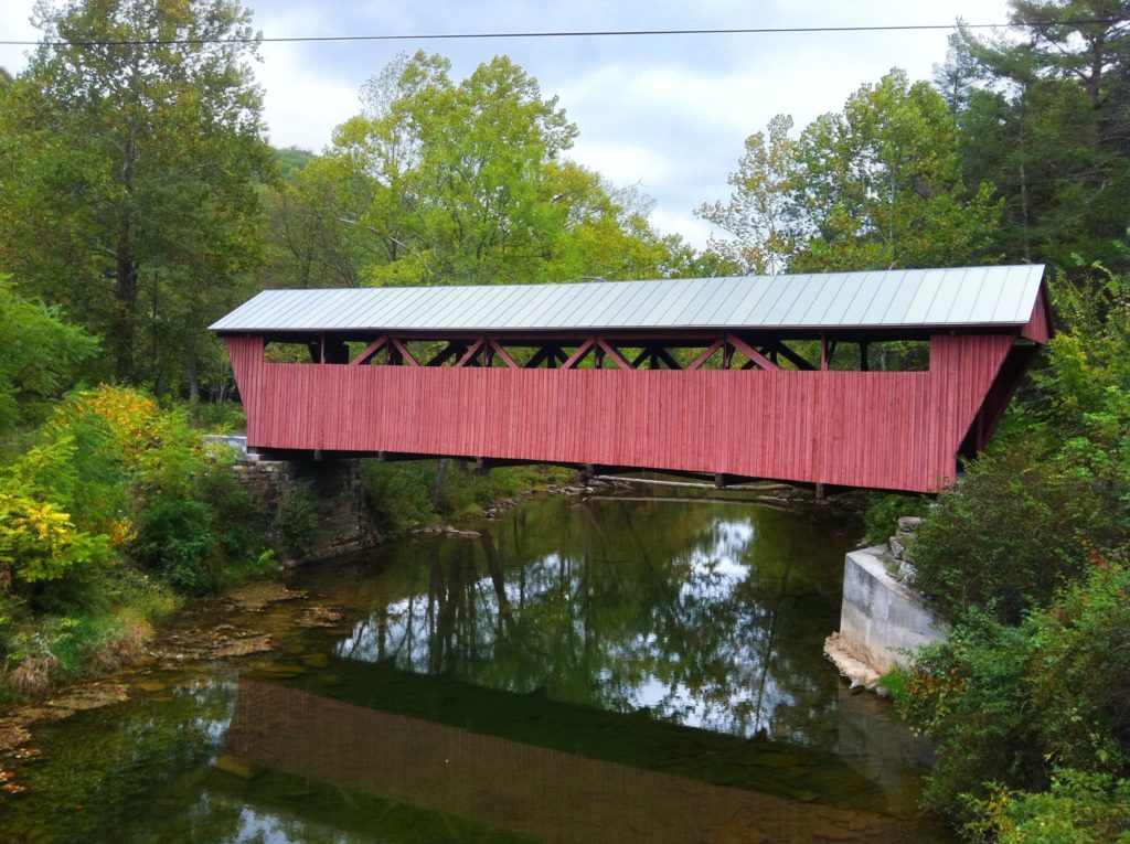
“West Virginia Covered Bridges”
- Barrackville
- Carolton
- Center Point
- Dents Run
- Fish Creek
- Fletcher Creek
- Herns Mill
- Hokes Mill
- Indian Creek
- Laurel Creek
- Locust Creek
- Milton
- Philippi
- Sarvis Fork
- Simpson Creek
- Statts Mill
- Walkersville
Explore West Virginia DOH’s “Covered Bridges” Website
“Covered Bridges Photos”
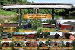 “Here you can find the final prints for the West Virginia Covered bridges. To download, please click the size in blue above the version you want.”
Explore West Virginia DOH’s “Covered Bridges Photos/Posteeer” Website
“More about West Virginia’s Covered Bridges”
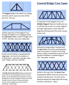
Explore “Truss Types” used in West Virginia ‘s Covered Bridges (pdf)
Explore West Virginia Covered Bridge “Location Map” (pdf)
Explore “West Virginia Covered Bridges” Brochure 1988 (pdf)
“West Virginia Covered Bridges”
 “Discover West Virginia’s most endearing highway structures–its seventeen remaining covered bridges. These transportation treasures will take you back to a simpler time. Enjoy the history, engineering specifications, directions and beautiful images of West Virginia’s covered bridges!” (57:37/2014/Vandalia Productions)
“17 Most Scenic Covered Bridges in the West Virginia Countryside”
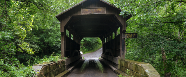
![]() “West Virginia’s covered bridges are some of the most photographed landmarks in the state.
“West Virginia’s covered bridges are some of the most photographed landmarks in the state.
“Set against a backdrop of autumn color, they are perfect for leaf-peeping drives. The Mountain State has 17 covered bridges, dating back to the late 19th and early 20th century– each unique in its own respect.”
Explore West Virginia Tourism’s “17 Most Scenic Covered Bridges in the WV Countryside” Website
“West Virginia Covered Bridges” – Steve Shaluta
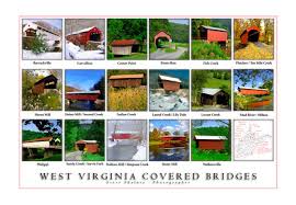 Several pages of photos and descriptions by professional photographer Steve Shaluta.
“A Wheeling Suspension Bridge Tour”
 “The history of the Wheeling Suspension Bridge is intimately involved in the history of Wheeling and must be viewed in terms of a national emphasis on
 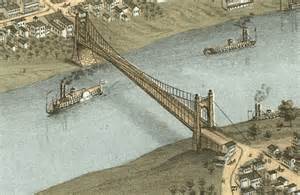 what was then called “internal improvements,” which meant the construction of a network of transportation systems to join the untapped natural resources of the Midwest with the commercial centers on the eastern seaboard. One of the earliest advocated for “internal improvements” was Albert Gallatin, who as Secretary of the Treasury published his influential report on roads and canals in 1808. However, before the dawn of the nineteenth century Ebenezer Zane, the founder of Wheeling, received approval from the U. S. Congress to build a post road in the Northwest Territory from Wheeling to Limestone (now Maysville), Kentucky. This established Wheeling as a gateway to the Northwest Territories. This position was greatly enhanced with the construction of the National Road from Cumberland, Maryland to Wheeling. . .”
Explore Ohio Co. Public Library’s “A Wheeling Suspension Bridge Tour” Website to continue reading
“Wheeling Suspension Bridge” – American Society of Civil Engineers
 “We have seen the stones laid one upon another, and like the workman who builds himself to the top of the highest tower, we scarcely appreciate the work we have done. … But the stranger, who sees it for the first time, looks up with awe and wonder to those immense towers and gigantic cables. … Wonderful as the age is, this is truly one of its most wonderful and majestic works. …” – The Daily Wheeling Gazette, Oct. 1, 1849
Explore ASCE’s “Wheeling Suspension Bridge” Website
“Wheeling, West Virginia Suspension Bridge”
“First long span wire-cable suspension bridge and longest clear-span bridge built pre Civil War. In Wheeling, West Virginia crosses the Ohio River.” (4:29/2010/Wanda Kaluza) (Ms. Kaluza is from NJ, and probably an elementary teacher)
“Modern Bridges”
– Blennerhassett Bridge
– Charles C. Rogers Bridge
– Clifford Hollow Bridge
– High Level Bridge
– Lower Buffalo Bridge
– New River Bridge
– Star City Bridge
– Weirton-Steubenville Bridge
– Robert C. Beach (formerly West Buckeye) Bridge
Explore WV DOH’s “Modern Bridges” Website for information on each of these bridges
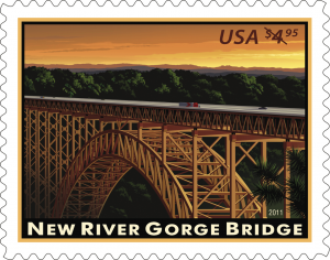
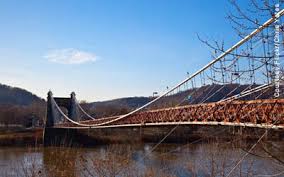
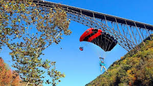
“New River Gorge Bridge”
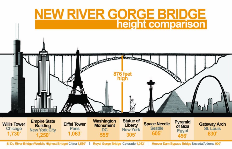
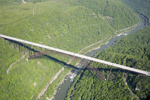

Explore National Park Service’s “New River Gorge Bridge” Website
“Why the New River Gorge Bridge Was Built”
“This video features vintage footage of the building of the New River Gorge Bridge, along with interviews with people who were there during construction.” (5:38/2012/Bridge Day)
“1993 GMC Jimmy Commercial – Bungee Jumping from New River Gorge Bridge”
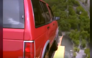 “Recorded in 1992 in West Virginia from the New River Gorge Bridge, A GMC Jimmy was flung off the side from 876 feet above the river below. GMC, the WV state department of roads, the designers of the bridge worked together with a company named Bungee adventures to engineer the stunt. Computer modeling showed that the factory hitch receiver was adequate and no modifications were made to the vehicle. With seven cameras in position, the commercial was filmed in just one take, as they only had one chance to do it. With the Jimmy dangling hundreds of feet below the bridge, a worker was lowered down by cable to attach the winching hardware to return it to the road deck. Popular Mechanics featured the production of the commercial in their March 1993 issue.” (:40/2021/Pete’s S10 Page)
“GMC Truck Bungee Jumping” (0:32/2007/bungeeadventures99) [Alternate version]
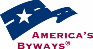
“America’s Byways”

 “America’s Byways® is the umbrella term we use for the collection of 150 distinct and diverse roads designated by the U.S. Secretary of Transportation. America’s Byways include the National Scenic Byways and All-American Roads. America’s Byways are gateways to adventures where no two experiences are the same. The National Scenic Byways Program invites you to Come Closer to America’s heart and soul…”
Explore Federal Highway Administration’s “America’s Byways” Website
Explore America’s Byways’ “West Virginia Byways” Website
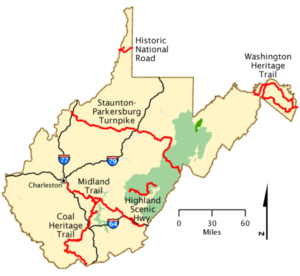
“West Virginia’s Byways And Backways”
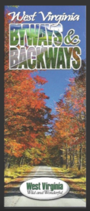 “While most roads in West Virginia are beautiful and fun to drive, these 23 byways and backways were chosen because they offer a unique and picturesque glimpse into the Mountain State’s history and natural beauty. From the largely unpaved backways to state byways to the National Scenic Highways, Heritage Trails and the All-American Historic National Road, these roadways are a slower-paced alternative to frantic Interstate traffic.”
Explore West Virginia Tourism’s “West Virginia Byways Map” pdf – A much larger version of the map.
Explore West Virginia Department of Transportation’s “Byways and Backways” map (pdf) (2006)
“ALL-AMERICAN ROAD”
“To be designated as an All-American Road, a byway must meet criteria for at least two intrinsic qualities that are nationally significant and have one-of-a-kind features that do not exist elsewhere. The road or highway must also be considered a “destination unto itself.” That is, the road must provide an exceptional traveling experience so recognized by travelers that they would make a drive along the highway a primary reason for their trip.”
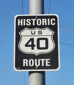
“Historic National Road”
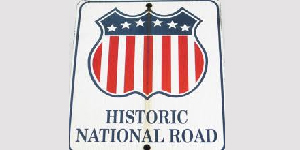 “The National Road, today called U.S. Route 40, was the first highway built entirely with federal funds. The road was authorized by Congress in 1806 during the Jefferson Administration. Construction began in Cumberland, Maryland in 1811. The route closely paralleled the military road opened by George Washington and General Braddock in 1754-55.”
Explore National Park Service’s “Historic National Road” Website
“Historic National Road”
 “The Historic National Road was the nation’s first federally funded interstate highway. It opened the nation to the west and became a corridor for the movement of goods and people. Today, visitors experience a physical timeline, including classic inns, tollhouses, diners, and motels that trace 200 years of American history.”
Explore America’s Byways’ “Historic National Road” Website – see menu at top for Maps and Photos
“Historic National Road”
![]()
 “While America was still in its infancy, a novel idea was hatched – to build a roadway that would connect the fertile frontiers of the Midwest to the seaport of Baltimore, Maryland. There had been pikes and toll bridges before, but never had the federal government decided to build a toll-free road of this length. Eventually this road – aptly named Historic National Road – would stretch from Baltimore, Maryland to East St. Louis, Illinois, and on its way, it would have to pass through the narrow northern panhandle of what is now West Virginia. While the Mountain State contains only 16 of the 800 miles of roadway, these 16 miles would grow and prosper and attract many of the nation’s elite. These wealthy businessmen . . .”
“NATIONAL SCENIC BYWAYS” (5)
“To be designated as a National Scenic Byway, a byway must meet the criteria for at least one of six “intrinsic qualities”: archeological, cultural, historic, natural, recreational, and scenic. The features contributing to the distinctive characteristics of the corridor’s intrinsic quality are recognized throughout the region and are considered regionally significant.”
(1) – “Staunton-Parkersburg Turnpike“
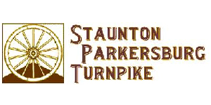 ”The Staunton – Parkersburg Turnpike National Scenic Byway is an historic highway from Staunton, Virginia across West Virginia to the Ohio River. Enjoy outdoor recreation, historic sites, unique shopping, arts and entertainment, railroading, and more. Follow US 250, US 33 and WV 47 to enjoy what this National Scenic Byway has to offer!”
Explore “Staunton-Parkersburg Turnpike National Scenic Byway” Website
“Staunton-Parkersburg Turnpike”
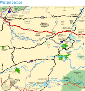
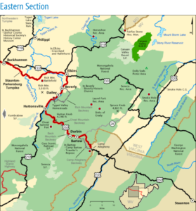 “Crucial in the First Campaign of the Civil War, this road now features pristine Civil War sites and charming historic towns. Hike through vast forests; fish in secluded waters; ride a wild mountain railroad. Explore this byway whose woods, small farms and beautiful mountain vistas take you back to an earlier time.”
“Staunton-Parkersburg Turnpike”
![]() “Spanning the width of the state, the Staunton-Parkersburg Turnpike National Scenic Byway witnessed some of the great Civil War battles that determined the future of western Virginia. Begun in 1838, the turnpike followed ancient Indian paths from Staunton, Virginia to the Ohio River port at Parkersburg, (present-day) West Virginia. . . “
“Spanning the width of the state, the Staunton-Parkersburg Turnpike National Scenic Byway witnessed some of the great Civil War battles that determined the future of western Virginia. Begun in 1838, the turnpike followed ancient Indian paths from Staunton, Virginia to the Ohio River port at Parkersburg, (present-day) West Virginia. . . “
“Parkersburg’s Early Boom Attracted Major Turnpikes” – The Blennerhassett Hotel
 “Parkersburg was certainly a major hub of transportation throughout the 1800s. Parkersburg was the terminus for two early major turnpike routes, the Northwestern Turnpike and the Staunton and Parkersburg Turnpike. These two roads brought traffic from the east to the Ohio River and beyond. . . ”
Explore Information from The Blennerhassett Hotel’s Commercial Website to read story (pdf)
(2) – “Midland Trail”
 “Midland Trail National Scenic Byway is the road of choice for those who want to leave the interstate behind and see the Best of West Virginia as Route 60 winds the 180-miles across West Virginia’s midsection offering a drive filled with fabulous vistas, world-class rafting, outdoor fun, art and artisan treasures & pioneer history. “
Explore “Midland Trail National Scenic Byway” Website
As of early 2023, it appears the Midland Trail website is inactive – here is a previous version:
Explore Midland Trail National Scenic Byway Website” as found on Archive.org’s “Wayback Machine”
“Midland Trail”
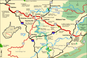 “Begin at the State Capitol and travel through Malden, boyhood home of Booker T. Washington. Then continue through white-water mountain country and the breathtaking scenery of New River Gorge and Hawks Nest State Park. On the eastern end, encounter colonial Lewisburg, and the oldest golf course in the US.”
Explore America’s Byways’ “Midland Trail” Website – see menu at top for Maps and Photos
“Midland Trail”
![]() “Once a major migration route for vast herds of buffalo, Midland Trail has seen many changes in the Mountain State’s landscape. Whether it’s the large Native American burial mounds in South Charleston and Dunbar or the Civil War re-enactments held in Carnifex Ferry State Park, history surrounds this byway.”
“Once a major migration route for vast herds of buffalo, Midland Trail has seen many changes in the Mountain State’s landscape. Whether it’s the large Native American burial mounds in South Charleston and Dunbar or the Civil War re-enactments held in Carnifex Ferry State Park, history surrounds this byway.”
Includes: “Huntington, Charleston, Historic Sites, Opportunities for Recreation”
“Highway to History: West Virginia Author Helps Illustrate History of Midland Trail” – AppalachianHistory.net
 AppalachianHistory.net: “Stories, quotes and anecdotes from Appalachia”
“The route U.S. 60 follows as it traverses the breadth of Southern West Virginia has gone through a number of name changes.”
Explore “Appalachian History.net” Website to read story
(3) – “Washington Heritage Trail“
 “WELCOME TO THE ONLINE GUIDE TO WEST VIRGINIA’S WASHINGTON HERITAGE TRAIL. Use this site to discover and explore the natural and cultural history of 18th-century towns, 19th-century industrial sites, Washington family homes, springs, rivers and mountain ranges located along 136 miles of the scenic Eastern Panhandle of West Virginia.”
Explore “Washington Heritage Trail National Scenic Byway” Website
“Washington Heritage Trail”
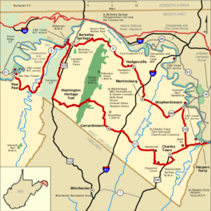 “Follow the footsteps of George Washington through West Virginia’s Eastern Panhandle and a landscape rich in historic, natural, and scenic resources. Mountains and valleys, rivers and springs, vestiges of bygone industries and five picturesque 18th-century towns highlight a rural retreat combined with rich cultural attractions.”
Explore America’s Byways’ “Washington Heritage Trail” Website – see menu at top for Maps and Photos
“Washington Heritage Trail”
![]()
 “Driving down the Washington Heritage Trail, it is hard to determine whether the history of the land or the scenery is more amazing… this 112-mile loop (with a 25 mile spur to Paw Paw, WV) passes by more than 100 sites listed on the National Register for Historic Places. Everything from Civil War battle sites to historic spas dot the landscape on this national scenic byway.”
Includes: “A Tumultuous History, The Nation’s First Spa, A Famous Tunnel, Belle Boyd House”
(4) – “Coal Heritage Trail”
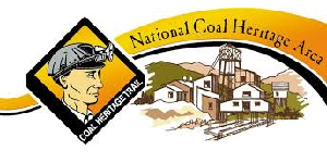 “The Coal Heritage Trail is a nationally designated scenic highway showcasing America’s remarkable industrial heritage. The isolated and remote Appalachian coalfields exploded in population and coal production one hundred years ago, as European immigrants African-Americans migrated in search of jobs and new lives.”
Explore “The Coal Heritage Trail National Scenic Byway” Website
“Coal Heritage Trail”
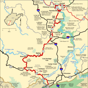 “Wind through mountains and valleys showcasing America’s remarkable industrial heritage. The region commemorates the history and culture of the coal industry and the impact it has had on the physical and social environment. Numerous resources line the corridor, including coal company towns, tipples, railroad structures, and reclaimed mining lands.“
Explore America’s Byways’ “Coal Heritage Trail” Website – see menu at top for Maps and Photos
“Coal Heritage Trail”
![]() “This journey through southern West Virginia’s coal country takes visitors back to a time when coal was king and business was booming. Thousands of men came from all over the world making the coal fields a melting pot of race and religion. Mansions built by wealthy coal barons and miners’ shanties still stand in the storied coal towns.”
“This journey through southern West Virginia’s coal country takes visitors back to a time when coal was king and business was booming. Thousands of men came from all over the world making the coal fields a melting pot of race and religion. Mansions built by wealthy coal barons and miners’ shanties still stand in the storied coal towns.”
Includes: “Beckley Exhibition Coal Mine, Hatfield-McCoy Trails, Bramwell’s Coal Boom, Outdoor Fun”
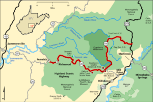
(5) – “Highland Scenic Highway“
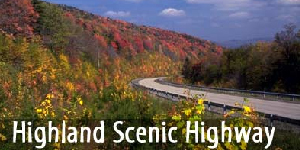 “The Highland Scenic Highway, a designated National Scenic Byway, is a beautiful corridor through the National Forest. This Byway extends 43 miles from Richwood to US Route 219. It has four developed scenic overlooks. Each site provides a comfortable rest stop, with a beautiful view of the surrounding mountains and valleys. The Highway traverses the mountainous terrain of the Allegheny Highlands and Plateau, and rises from Richwood, elevation 2,325 feet, to over 4,500 feet along the Parkway.”
Explore US Forest Service’s “Highland Scenic Highway” Website
“Highland Scenic Highway”
 “Travel through a wild and undeveloped portion of the Monongahela National Forest. Hardwood forests cover rolling, mountainous terrain capped by dark spruce at high elevations. Traverse a narrow and steep-walled valley with views of clear mountain streams. Sights include Cranberry Glades Botanical Area, Summit Lake, and Falls of Hills Creek.”
Explore America’s Byways’ “Highland Scenic Highway” Website – see menu at top for Maps and Photos
“Highland Scenic Highway”
![]() “Entirely surrounded by the Monongahela National Forest, the Highland Scenic Highway makes its way through some of the most breathtaking and unique scenery on the continent. Nestled in the Allegheny Mountains, this byway rises as high as 4,500 feet above sea level giving motorists plenty of opportunities to take amazing pictures. Once covered by glaciers, this area hosts some of the most unusual plant life found in the United States.
“Entirely surrounded by the Monongahela National Forest, the Highland Scenic Highway makes its way through some of the most breathtaking and unique scenery on the continent. Nestled in the Allegheny Mountains, this byway rises as high as 4,500 feet above sea level giving motorists plenty of opportunities to take amazing pictures. Once covered by glaciers, this area hosts some of the most unusual plant life found in the United States.
WEST VIRGINIA’S STATE BYWAYS AND BACKWAYS (3+)
(1) – “New/Greenbrier Valley Byways and Backways”
![]() “This drive through the verdant fields where so many farmers worked to feed their families consists of gently flowing creeks, rolling hills, and a ridge called Peters Mountain. Bird watchers should enjoy the view from Hanging Rock Tower as thousands of hawks and even a few bald eagles make their way through the area. What attracts most people to the Farm Heritage Road is the chance to see an area that has been left relatively unscathed by industrialization resulting in farms and barns that have been around for close to 200 years . . .”
“This drive through the verdant fields where so many farmers worked to feed their families consists of gently flowing creeks, rolling hills, and a ridge called Peters Mountain. Bird watchers should enjoy the view from Hanging Rock Tower as thousands of hawks and even a few bald eagles make their way through the area. What attracts most people to the Farm Heritage Road is the chance to see an area that has been left relatively unscathed by industrialization resulting in farms and barns that have been around for close to 200 years . . .”
(2) – “North Central Byways and Backways”
![]() “Once used as a lush hunting ground for the Mingo and Delaware tribes, north central West Virginia has been known as a source of natural abundance for centuries. With many rich deposits of coal and natural gas, vast tracts of timber, and glass-quality sand, the Morgantown-area became a magnet for industry. Three roads: the Cheat River Byway, Old Route 7, and the Northwestern Turnpike, came from humble beginnings as hunting trails to become toll roads and railroad access roads. As time progressed, these roads grew to become major thoroughfares before the age of highways. Today, the history of these roads is still celebrated as the area continues to grow with new industry and the ever-expanding West Virginia University. . .”
“Once used as a lush hunting ground for the Mingo and Delaware tribes, north central West Virginia has been known as a source of natural abundance for centuries. With many rich deposits of coal and natural gas, vast tracts of timber, and glass-quality sand, the Morgantown-area became a magnet for industry. Three roads: the Cheat River Byway, Old Route 7, and the Northwestern Turnpike, came from humble beginnings as hunting trails to become toll roads and railroad access roads. As time progressed, these roads grew to become major thoroughfares before the age of highways. Today, the history of these roads is still celebrated as the area continues to grow with new industry and the ever-expanding West Virginia University. . .”
(3) – “Little Kanawha Byway”
![]() “Perhaps the most accessible of all of West Virginia’s byways, the Little Kanawha Byway is bookended by I-77 and I-79. Starting in the west at I-77, the parkway begins its journey in Mineral Wells and mirrors the banks of the Little Kanawha River. Being totally paved, this roadway is perfect for RVs and others wanting a smooth ride so they can take in all of the beautiful pastoral sights . . .’
“Perhaps the most accessible of all of West Virginia’s byways, the Little Kanawha Byway is bookended by I-77 and I-79. Starting in the west at I-77, the parkway begins its journey in Mineral Wells and mirrors the banks of the Little Kanawha River. Being totally paved, this roadway is perfect for RVs and others wanting a smooth ride so they can take in all of the beautiful pastoral sights . . .’
(+) – “Other Backways”
![]() <<For Camp Allegheny Backway, Back Mountain Backway, Cheat Mountain Backway, and Rich Mountain Backway, see “Staunton-Parkersburg Turnpike” above.>>
<<For Camp Allegheny Backway, Back Mountain Backway, Cheat Mountain Backway, and Rich Mountain Backway, see “Staunton-Parkersburg Turnpike” above.>>
<<For Williams River Backway, see “Highland Scenic Highway” above>>
“Weston and Gauley Bridge Turnpike Trail” – USACE
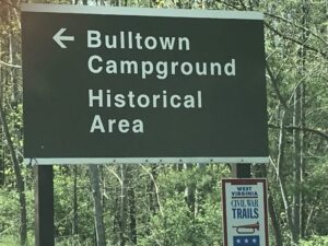 History of the Turnpike, Battle of Bulltown, Bulltown Historical Area, Map of the Area
Explore US Army Corps of Engineers’ “Weston and Gauley Bridge Turnpike Trail” Brochure (pdf)
“Appalachian Development Highway System”
 “In 1964, the President’s Appalachian Regional Commission (PARC) reported to Congress that economic growth in Appalachia would not be possible until the Region’s isolation had been overcome. Because the cost of building highways through Appalachia’s mountainous terrain was high, the Region had never been served by adequate roads. Its network of narrow, winding, two-lane roads, snaking through narrow stream valleys or over mountaintops, was slow to drive, unsafe, and in many places worn out. The nation’s interstate highway system had largely bypassed the Appalachian Region, going through or around the Region’s rugged terrain as cost-effectively as possible.
 “The PARC report and the Appalachian governors placed top priority on a modern highway system as the key to economic development. As a result, Congress authorized the construction of the Appalachian Development Highway System (ADHS) in the Appalachian Regional Development Act of 1965. The ADHS was designed to generate economic development in previously isolated areas, supplement the interstate system, connect Appalachia to the interstate system, and provide access to areas within the Region as well as to markets in the rest of the nation.”
Explore Appalachian Regional Commission’s “Appalachian Development Highway System” Website
RAIL TRANSPORTATION
“West Virginia Rail Heritage”
S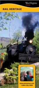 hort history of major railroads in West Virginia, plus current excursion / tourist trains, historic depots, stations, and museums.
Explore West Virginia Tourism’s “West Virginia Rail Heritage” Brochure pdf (2012)
“Machines, Nature and Human Grit”
![]() “New River Gorge’s Rail Heritage in 2022 Historical Calendar”
“New River Gorge’s Rail Heritage in 2022 Historical Calendar”
The West Virginia rail system historically had at least 6 major railroads, as shown on the cover of this book.
 The New York Central no longer exists – its routes were taken over by other railroads. The Norfolk & Western and the Virginian are among those that merged to form the present day Norfolk Southern. The Baltimore & Ohio, the Chesapeake & Ohio and the Western Maryland merged into CSX.
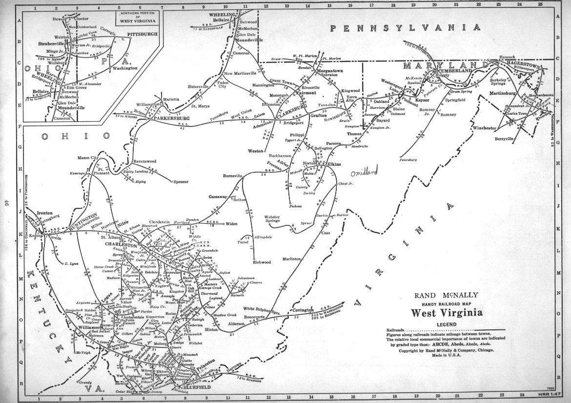
“Historic West Virginia Railroad Maps”
1893:
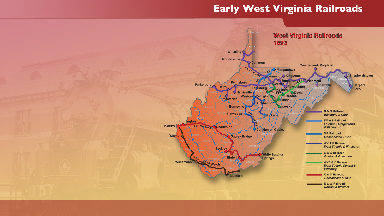
Explore West Virginia State Museum’s “Early West Virginia Railroads – 1893” map – (pdf)
1903:
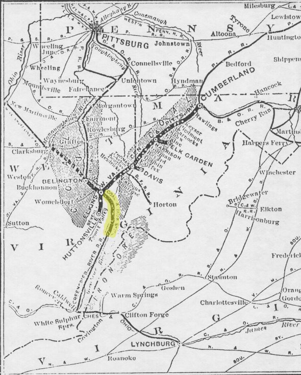
Explore West Virginia Bike’s “1903 Railroad Map” (Only part of West Virginia) — (click to enlarge)
1913:

about 1940:
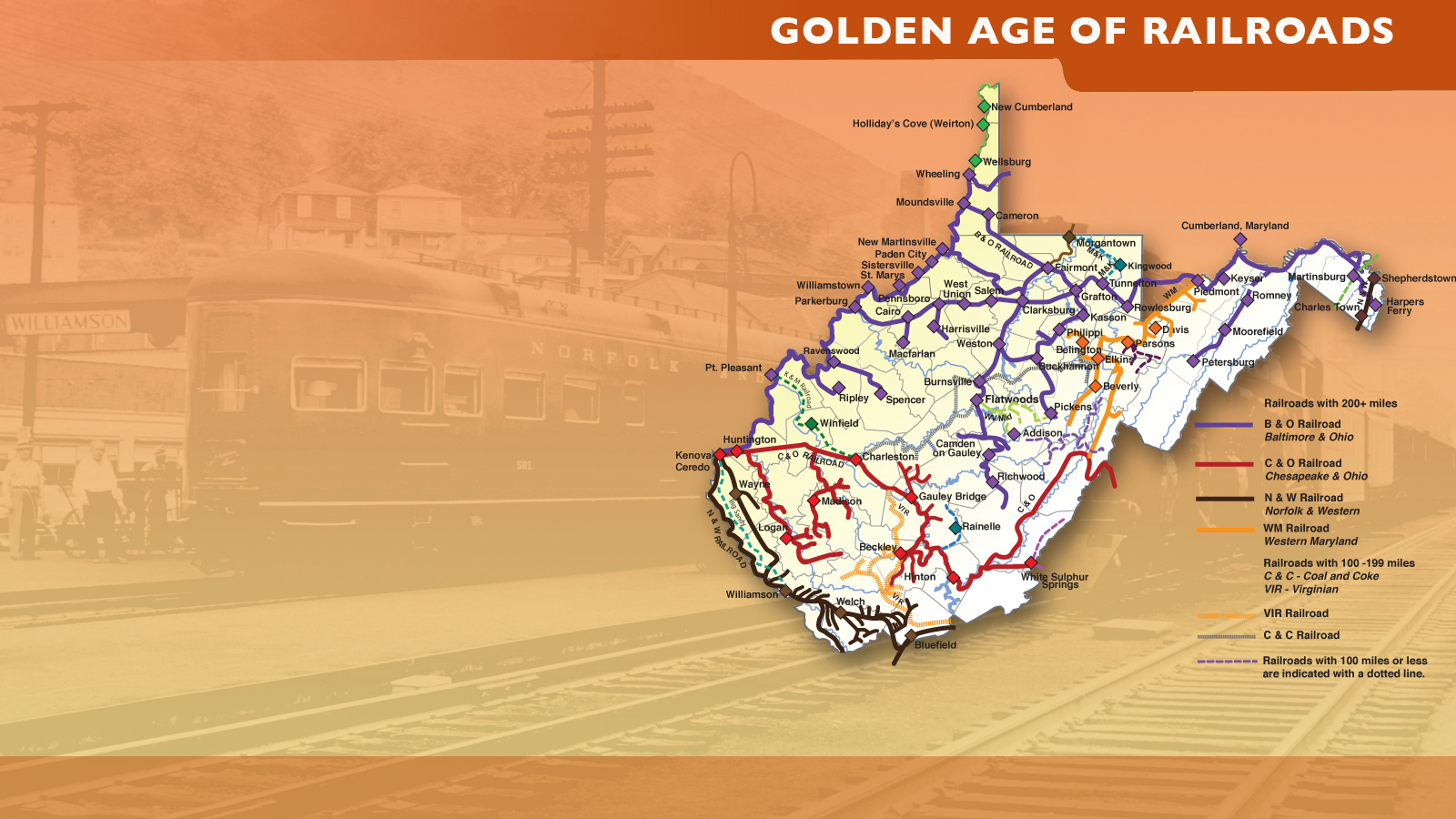
Explore West Virginia State Museum’s “Golden Age of Railroads” map – (pdf)
1948:
Explore Hawkdawg’s “1948 West Virginia Railroad Map” — (click to enlarge)
Current (2020):
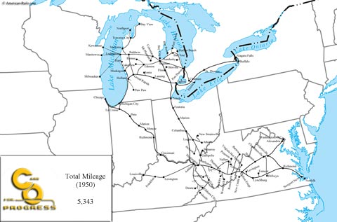
“New York Central”
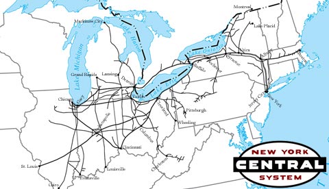 “Like its rival, the Pennsylvania Railroad, entire libraries could be written on the New York Central System (the “System” was included to recognize the markets the railroad served and the number of railroads which comprised it) and its history ranging from its famous passenger trains (like the 20th Century Limited) and commuter operations to its fast, efficient, high-speed freight services. For history’s sake you cannot really speak of the NYC without also mentioning the PRR (and vice versa) as both lines competed in many of the same markets stretching from New York City, through Ohio, Indiana and reaching St. Louis, Chicago and parts of Michigan. It’s quite amazing how similar, outside of operations, both were. They were institutions, two of the largest railroads in the country, and the class of the industry for decades.”
“The NYC had its humble beginnings as the Mohawk & Hudson Railroad, chartered and built in 1831 to connect Albany with Schenectady, New York. . .”
“Norfolk & Western”
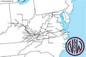 “The N&W is remembered as one of the most highly respected railroad companies in history and for good reason. Aside from well-managed operations the railroad’s property was meticulous and its equipment was always in excellent working order. Of course, operations aside, from a railfan and historical standpoint the railroad is remembered for many other things such as being the last Class I to operate steam locomotives (until 1960), its symbolism with coal, and legendary photographer O. Winston Link whose black and white photos of the railroad’s final days of steam are now considered all but priceless works of art (not only for the photography itself but also the historical images captured).”
“The formation of the Norfolk & Western occurred in 1881 when the bankrupt AM&O was purchased by the Clark Family. By the time the Norfolk and Western had entered its second and final reorganization the railroad was already well on its way to reap the rewards brought by black diamonds. . .”
“The Virginian Railway”
By Rick Steelhammer The Charleston Gazette May 2015
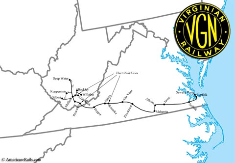 “. . .The Virginian Railway traces its roots to 1898 in Fayette County, where Ansted civil engineer and coal operator William Nelson Page began developing a rail route extending southward from Deepwater on the Kanawha River into the then-untapped coalfields of Southern West Virginia. When the Chesapeake & Ohio and Norfolk & Western railroads charged prohibitive rates to transship coal on their lines to reach the nearest seaport at Norfolk, Virginia, Page joined forces with a silent partner, Henry Huttleston Rogers, then one of the richest men in America, after having helped John D. Rockefeller develop his Standard Oil Trust.”
“After extending the Deepwater Railroad through his namesake Fayette County town of Page to Glen Jean, Mullens and Princeton and on to the Virginia border near Glen Lyn, Page, with Rogers’ secret backing, quietly purchased the assets of the Tidewater Railway, an all-Virginia line that stretched from Giles County, which borders West Virginia at Glen Lyn, to Norfolk. In 1907, the Deepwater Railroad and the Tidewater Railway were merged to form the Virginian Railway, with Page serving as president. New track, rolling stock, trestles and maintenance facilities were bought with Rogers’ cash. Building out the railroad without accruing public debt allowed Page and Rogers to temporarily hide their expansion plans from their competitors and begin turning a profit sooner, since there were no financing costs to repay.”
 “Rogers spared no expense in buying rolling stock and upgrading and expanding the new rail line, which when complete, stretched from Deepwater to the Norfolk area, with spurs extending into Beckley and the Winding Gulf coalfield along the Raleigh- Wyoming County line and then on to Gilbert in Mingo County. While executives at competing railroads “planned to starve Page out” by denying affordable access to their lines, Page and Rogers “had their rights of way bought and all ready to go before the C&O and N&W knew what hit them.” The last spike for the Virginian Railway was driven in January of 1909, on the West Virginia side of the New River at Glen Lyn, where a new trestle had been built. A celebration dinner was held in April in Norfolk to celebrate completion of the “Mountains to the Sea” railroad, during which Rogers’ author friend Samuel Clements, better known by his pen name of Mark Twain, gave the keynote speech. Rogers left the next day on his first and only tour of his completed railroad, but died of a stroke one month later. The railroad merged with the N&W in 1959.”
Also: Explore American-Rails.com’s “The Virginian Railway” Website – multiple advertisements
“Chesapeake & Ohio”
 “The Chesapeake and Ohio Railway was one of several Appalachian coal haulers and is perhaps best remembered for its buyout of the Baltimore & Ohio Railroad in the early 1960s and its excellent management through much of the second-half of the 20th century, which earned the company substantial profits, especially during the waning years of the railroad industry in the 1960s and 1970s. It thrived on West Virginia and Kentucky coal and was a gateway between Chicago and the ports of Virginia.”
“The Chesapeake and Ohio Railway had its beginnings in the mid-1830s when the Louisa Railroad was chartered to connect Virginia’s larger cities. In 1850 the company was renamed the Virginia Central because it operated through much of the state’s central regions, west and north of Richmond. By the late 1860s the railroad was again reorganized, this time as the Chesapeake & Ohio Railroad when Virginia Central management decided to push the railroad to the Ohio River, eventually reaching Huntington, West Virginia during the winter of 1873 after building a main line through the Alleghenies and the tight confines of the Kanawha River valley (which is such a beautiful route that today it hosts the famous New River Train each fall). . .”
“Baltimore & Ohio”
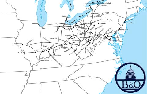 “The goal of the Baltimore & Ohio Railroad was to connect Baltimore, Maryland with the Ohio River near Wheeling, Virginia (now part of West Virginia). This connection with the Ohio River enticed passengers to take the B&O Railroad because they could then head north or south along the river’s transportation networks. Although the B&O’s original goal was to head west, the directors quickly realized that a connection with the nation’s capital would be beneficial because of all the passenger travel into and from that city. The B&O was the first railroad into the nation’s capital.”
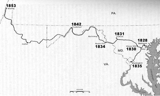 “Eastern railroading is also riddled with tunnels, low and tight clearances, and a lot of single-tracked territory (as the cost of double-tracking some of these mountainous main lines has simply been too expensive). One need only look at the B&O’s former St. Louis main line to understand all three of these concepts. This line was by far the steepest and toughest of the original trunk lines (those serving the large East Coast and Midwest markets). Almost its entire line between Baltimore/Washington and St. Louis was single-track territory and its battles over Cranberry Grade in eastern West Virginia were legendary. Couple this with its Parkersburg Branch between Clarksburg and Parkersburg, West Virginia where clearances were very tight and one has a better understanding as to why the B&O had such a tough time competing with the larger New York Central and PRR [Pennsylvania Railroad.] . . .
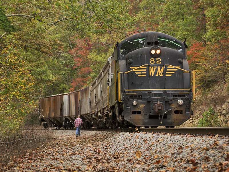
“Western Maryland Railway”
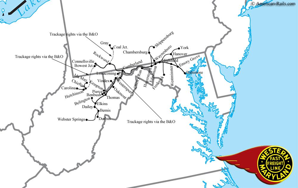 “While the Western Maryland Railway, affectionately known as the Wild Mary was never a large carrier (only roughly a 700-mile system) although for those who followed it, it was a legendary line. The railroad was built over rough terrain and thus used numerous tunnels and bridges to achieve a manageable grade. While aspects of the system were difficult to operate from a railroad perspective (Black Fork Grade, for instance) the WM allowed for some of the most fantastic photography one could ever hope or wish for with everything from big 4-8-4s bursting from Knobley Tunnel and crossing the Potomac River to brawny 4-6-6-4s lugging freight through legendary Helmstetter’s Curve. To put it bluntly, what a fantastic scenic railroad (at the very least) the entire WM main line (especially through Maryland and West Virginia) would have made if it were all still intact today. Its territory would easily rival anything offered today from other famous tourist lines like the Strasburg Railroad and Durango & Silverton.”
“The “Wild Mary” has its beginnings dating back to 1852 when the Baltimore, Carroll & Frederick Railroad was chartered by the Maryland General Assembly on May 27th to connect Baltimore with Hagerstown in Washington County. . .”
“American-Rails.com”
 Most of the above information on the Western Maryland, Baltimore & Ohio, Norfolk & Western, Chesapeake & Ohio, and New York Central railroads, and the accompanying maps (including the Virginian), are from a very comprehensive railroad website: “American-Rails.com,” especially the section “Fallen Flags.” Other sections include “Railroad History”, “Rail Travel,” “Today’s Industry,” “Rolling Stock,” “Tourism,” and much, much more.
Created and maintained by a native West Virginian (there is a page devoted strictly to West Virginia railroads), it is a great starting point for research on US and Canadian railroads– “. . .a website dedicated not only to bringing awareness about our country’s railroad history, both past and present, but also as a resource tool describing and educating about the country’s railroads in general.” Includes many, many great photographs.
Explore “American-Rails.com” Website–several sponsor advertisements
Explore American-Rails.com’s “Fallen Flags” Website–several sponsor advertisements
Explore American-Rails.com’s “West Virginia Railroads” Website–several sponsor advertisements – includes: Baltimore & Ohio, Chesapeake & Ohio, Chessie System, Conrail, Monongahela Railway, Pennsylvania Railroad, New York Central, Penn Central, Pittsburgh & West Virginia, West Virginia Northern, Western Maryland, Norfolk & Western, Virginian
“WVNC Rails”
![]() “. . . The primary focus of this web page is rail history in both West Virginia and North Carolina because both of these states are “home”. But it will also include contemporary topics such as general pages about locomotives, rail lines, and specific locations. A major priority in creating pages on the site is to research historical topics that have received scant coverage either in printed form or digital media. Where possible, this will be done in a before and after format. Topics from bordering states will also find their way on to this page as there areas and subjects located in these regions of interest as well. And, finally, topics of a non-railroad nature will be added such as general history and the outdoors of a scenic or natural perspective. . .”
“. . . The primary focus of this web page is rail history in both West Virginia and North Carolina because both of these states are “home”. But it will also include contemporary topics such as general pages about locomotives, rail lines, and specific locations. A major priority in creating pages on the site is to research historical topics that have received scant coverage either in printed form or digital media. Where possible, this will be done in a before and after format. Topics from bordering states will also find their way on to this page as there areas and subjects located in these regions of interest as well. And, finally, topics of a non-railroad nature will be added such as general history and the outdoors of a scenic or natural perspective. . .”
“West Virginia State Rail Authority”
 “The West Virginia Railroad Maintenance Authority was formed by an act of the Legislature in 1975 to facilitate railroad transportation and commerce in the state. In 1989, it was made a division of the new West Virginia Department of Transportation so that its program might be better coordinated with an overall state transportation improvement strategy. In 1994, its name was changed to the West Virginia State Rail Authority.”
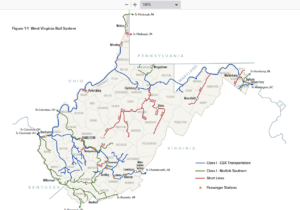
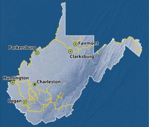
“The West Virginia rail system is comprised of 2 Class I railroads and 11 short line or regional railroads. The system contains 2,401 route miles of track. CSX Transportation is West Virginia’s largest carrier with 1,113 route miles of track. Norfolk Southern is next in size with 801 route miles of track. Short lines and Regional roads make up the remaining 487 route miles of track.”
Explore “West Virginia State Rail Authority” Website
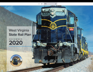
“West Virginia Rail Plan”
2013:
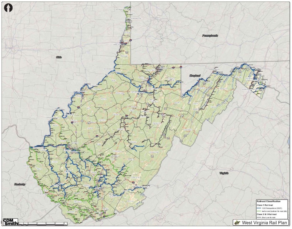
2020:
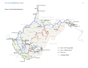
 “The FRA-required State Rail Plan plays a key role in helping the West Virginia Department of Transportation (WVDOT) and the West Virginia State Rail Authority (WVSRA) to achieve their mandate of providing safe, effective and efficient movement of people, information and goods in West Virginia, enhancing the opportunity for people and communities to enjoy environmentally sensitive and economically sound development.”
Explore West Virginia State Rail Authority’s “West Virginia Rail Plan” (2013) (pdf)
Explore West Virginia State Rail Authority’s “West Virginia Rail Plan” (2020) (pdf)
Explore West Virginia State Rail Authority’s “West Virginia Railroads” map (2020) (pdf)
“Freight Railroads”
Includes: Appalachian & Ohio Railroad; Beech Mountain Railroad; CSXT; Elk River Railroad; Kanawha River Railroad; Little Kanawha River Rail; Norfolk Southern; RJ Corman Railroad Company/WV Lines; South Branch Valley Railroad; Vaughan Railroad Company; West Virginia Central Railroad; Wheeling & Lake Erie Railroad; Winchester & Western Railroad; Winifrede Railroad Company.
The Kanawha River Railroad (A former Norfolk Southern route purchased in 2016): “The Kanawha River Railroad (KNWA) consists of 309 miles of track running south from Refugee, Ohio, to Maben, West Virginia. The railroad’s name is derived from the Kanawha River in West Virginia which the railroad follows south through the state. The KNWA ships approximately 20,000 carloads of product annually for the energy, aggregate, agriculture, and chemical industries.”
Explore WATCO Companies’ “Kanawha River Railroad” Website
“South Branch Valley Railroad”
 “The South Branch Valley Railroad (SBVR) is owned and operated by the West Virginia State Rail Authority. The SBVR generally parallels the South Branch of the Potomac River, from which the railroad takes its name. On October 11, 1978, West Virginia became the first state in the nation to both own and operate a commercial freight railroad.”
Explore West Virginia DOT’s “South Branch Valley Railroad” Website
“West Virginia Central Railroad”
 “The West Virginia Central Railroad (WVCR) is located near the center of the state and passes through Barbour, Randolph, Pocahontas and Webster counties. The Durbin & Greenbrier Valley Railroad (DGVR), under contract with the State Rail Authority, operates the WVCR and provides both freight and excursion services on the line.” [As of Spring, 2015, the DGVR also operates the Cass Scenic Railroad.]
Explore West Virginia DOT’S “West Virginia Central Railroad” Website
“CSX”
 “CSX Corporation, together with its subsidiaries based in Jacksonville, Fla., is one of the nation’s leading transportation suppliers. The company’s rail and intermodal businesses provide rail-based transportation services including traditional rail service and the transport of intermodal containers and trailers. Overall, the CSX Transportation network encompasses about 21,000 route miles of track in 23 states, the District of Columbia and the Canadian provinces of Ontario and Quebec. Our transportation network serves some of the largest population centers in the nation. Nearly two-thirds of Americans live within CSX’s service territory.”
Explore CSX’s “About CSX” Commercial Website
“CSX in West Virginia”
 “CSX Operations in West Virginia:
- Operates and maintains nearly 2,030 miles of track*
- Maintains nearly 1,600 public and private grade crossings
- Handled nearly 1.7 million carloads of freight on the state’s rail network
- At the end of 2014, CSX employed more than 1,600 people
- Throughout 2014, CSX reported nearly $140.1 million in compensation for employees**
- In 2014, CSX invested more than $95.5 million in its West Virginia network.
- [See CSX Website for more current information]
CSX Facilities in West Virginia:
- Major rail yards in Charleston, Huntington, Logan, and Parkersburg
- TRANSFLO terminals in Clarksburg, Fairmont, and South Charleston
- Huntington Locomotive Shop in Huntington
Division Headquarters in Huntington— (The Huntington Division was eliminated in 2016, though many administrative employees remain.)
“CSX West Virginia Fact Sheet” (2021) (pdf) (click on image)

“CSX Pride in Service Commemorative Locomotives”
“Learn about the team and process behind the Spirit of our Armed Forces and the Spirit of our First Responders locomotives painted by CSX railroaders in celebration of our CSX Pride in Service community investment initiative.” (3:32/2019/CSX Transportation)
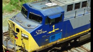
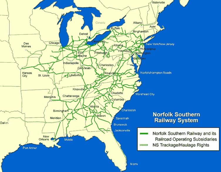
“Norfolk Southern”
“The Thoroughbred of Transportation”
 “As a leading transportation provider, Norfolk Southern operates 20,000 route miles in 22 states and D.C., supports international trade with service to every major Eastern seaport, 10 river ports, and nine lake ports, and operates the most extensive intermodal network in the East.”
Explore “Norfolk Southern” Commercial Website
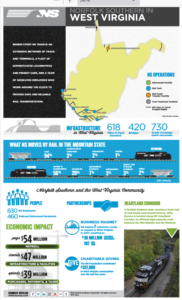
“NS West Virginia Fact Sheet” (2017) (pdf) (click on image)
“Passenger Railroads”
“Intercity Service” – AMTRAK
 “The National Railroad Passenger Corporation, Amtrak, is a corporation striving to deliver a high quality, safe, on-time rail passenger service that exceeds customer expectations.
![]() “Amtrak, the national rail operator, connects America in safer, greener and healthier ways. With 21,000 route miles in 46 states, the District of Columbia and three Canadian provinces, Amtrak operates more than 300 trains each day — at speeds up to 150 mph — to more than 500 destinations. Amtrak also is the operator of choice for state-supported corridor services in 15 states and for four commuter rail agencies.”
“Amtrak, the national rail operator, connects America in safer, greener and healthier ways. With 21,000 route miles in 46 states, the District of Columbia and three Canadian provinces, Amtrak operates more than 300 trains each day — at speeds up to 150 mph — to more than 500 destinations. Amtrak also is the operator of choice for state-supported corridor services in 15 states and for four commuter rail agencies.”
Explore AMTRAK’s “West Virginia 2016 Economic Impact Brochure” pdf
Explore AMTRAK’s “West Virginia Fact Sheets” – 2016– 2017 – 2018 – 2019 – 2020 – 2021 – 2022 – 2023
“The Cardinal” – AMTRAK
New York – Washington, DC – Cincinnati – Indianapolis – Chicago
![]() “The Cardinal operates between New York and Chicago three days a week, offering unforgettable views of the Southeast’s stunning natural beauty. You’ll see gently rolling horse country, the Blue Ridge and Allegheny Mountains, the Shenandoah Valley, and the wild white-water rivers of West Virginia as they can only be seen by train. Heading westward, the train rolls along the banks of the mighty Ohio River — from the quaint towns of Ashland and Maysville, to the skyline of Cincinnati. From there, your journey continues to Indianapolis, and then northward to Chicago.”
“The Cardinal operates between New York and Chicago three days a week, offering unforgettable views of the Southeast’s stunning natural beauty. You’ll see gently rolling horse country, the Blue Ridge and Allegheny Mountains, the Shenandoah Valley, and the wild white-water rivers of West Virginia as they can only be seen by train. Heading westward, the train rolls along the banks of the mighty Ohio River — from the quaint towns of Ashland and Maysville, to the skyline of Cincinnati. From there, your journey continues to Indianapolis, and then northward to Chicago.”
Explore AMTRAK’s “The Cardinal” Website
“Stunning Natural Beauty” – The Cardinal Route Guide
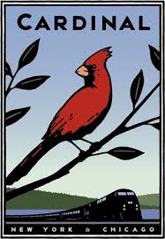 “From twinkling Northeast cityscapes to famous Civil War battlefields; from the Blue Ridge Mountain chain and the Shenandoah Valley to West Virginia’s wild and wonderful whitewater rivers; from the fabulous window on geologic history at the New River Gorge to the Kanawha River’s thunder over wide, 20-foot high waterfalls; from quiet coal mining towns to the beautifully illuminated nighttime skyline of Charleston, the capital city, and on to Chicago – the Cardinal takes you on an unforgettable journey through history and adventure. The Collis P. Huntington Railroad Historical Society narrators provide historical and sightseeing commentary on select Cardinal trips eastbound from Charleston to Clifton Forge, VA.”
Explore “The CARDINAL ROUTE GUIDE” – (2009) (pdf)
“The Capitol Limited” – AMTRAK
Washington, DC – Pittsburgh – Cleveland – Chicago
![]() “The Capitol Limited train runs daily between Washington, DC and Chicago. You’ll follow the historic B&O line on your journey through the Potomac Valley, past historic Harpers Ferry and the Allegheny Mountains into Pittsburgh and then across Ohio and Indiana into the center of Chicago. On select dates, the Capitol Limited has a seasonal, onboard Trails & Rails program operating between Cumberland, MD and Washington, DC and is hosted by the Chesapeake and Ohio Canal and the Harpers Ferry National Historical Parks.”
“The Capitol Limited train runs daily between Washington, DC and Chicago. You’ll follow the historic B&O line on your journey through the Potomac Valley, past historic Harpers Ferry and the Allegheny Mountains into Pittsburgh and then across Ohio and Indiana into the center of Chicago. On select dates, the Capitol Limited has a seasonal, onboard Trails & Rails program operating between Cumberland, MD and Washington, DC and is hosted by the Chesapeake and Ohio Canal and the Harpers Ferry National Historical Parks.”
Explore AMTRAK’s “Capitol Limited” Website
“The Floridian” — AMTRAK
Chicago – Pittsburgh – Washington, DC – Savannah – Tampa/Miami
“Capitol Limited Merging with Silver Star” – (Beginning late 2024)
“Amtrak’s East River Tunnel Rehabilitation Project in New York requires closing one tunnel tube at a time to safely and efficiently conduct modernization work, resulting in minor capacity limits on train operations in this area. As a result, Amtrak has temporarily combined the Capitol Limited and Silver Star trains to create the Floridian, which will run between Chicago and Miami via Washington, DC.”
“The Floridian journeys across Indiana and Ohio, through the Allegheny Mountains into Pittsburgh, past scenic Harper’s Ferry, along the historic B&O line through the Potomac Valley to Washington, and then across the south towards Florida’s beaches, cities, and family attractions. Onboard, you will witness scenery not accessible by other modes of transportation while experiencing the unique comfort and relaxation of rail travel.”
Explore AMTRAK’s “Floridian” Website
“An Historic Journey” – The Capitol Limited Route Guide
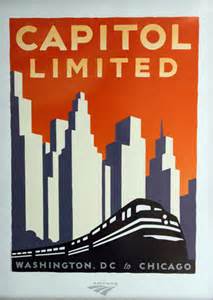 “Combining impressive geologic formations, man-made wonders and rich American history, this route is rife with feature attractions between the “City of Broad Shoulders” and its terminus in the nation’s capital and city of magnificent monuments, Washington, D.C. From orderly farms in the heartland to spectacular views of the mountains above Pennsylvania and West Virginia valleys, the scenes are unforgettable. Today, their quiet beauty belies the ferocity of the many Civil War battles fought in and around the area. From striking rock formations to national historic landmarks, the Capitol Limited presents a journey upon which you will continue to reflect for some time to come. So relax and enjoy this unique view of Americana from your picture window!”
“Amtrak’s Capitol Limited was named after the former Baltimore & Ohio Railroad’s flagship passenger trains — for many years the choice of travel between Chicago and Washington.”
Explore “The CAPITOL LIMITED ROUTE GUIDE” – (2010) (pdf)
“Commuter Service” – MARC
 “Maryland Rail Commuter (MARC) train service operates Monday through Friday between Martinsburg, WV and Washington, DC. The West Virginia State Rail Authority maintains stations at Harpers Ferry and Duffields.”
“Tourist Trains”
“West Virginia offers numerous tourist trains throughout the state. Whether you are satisfying your wild side or simply looking for a relaxing time with the family, one of the following tourist trains excursions will have something just for you.”
![]() Cass Scenic Railroad – Operated by Durbin and Greenbrier Railroad but still a State Park
Cass Scenic Railroad – Operated by Durbin and Greenbrier Railroad but still a State Park
![]() Durbin and Greenbrier Valley Railroad – (doing business as Mountain Rail West Virginia) – also operates Greenbrier Express and New Tygart Flyer
Durbin and Greenbrier Valley Railroad – (doing business as Mountain Rail West Virginia) – also operates Greenbrier Express and New Tygart Flyer
![]() Potomac Eagle
Potomac Eagle
Autumn Colors Express (formerly the New River Train) – no longer operating as of late 2023.
Explore West Virginia DOT’s “Tourist Trains” Website — includes links to each Tourist Train
“West Virginia Tourist Trains Association”
 “Before the turn of the 20th century the state’s coal, timber, oil and natural gas were nearly inaccessible. Railroad construction allowed access to these resources, the materials that drove the nation’s Industrial Age.
“The Baltimore & Ohio Railroad (B&O) is the nation’s oldest line, and more than half of it is within West Virginia’s borders. During the Civil War, the B&O was so important that both the Union and the Confederacy fought to keep it from falling into the other side’s hands.
“As American factories became mechanized, the Chesapeake & Ohio Railroad (C&O) hauled coal to heat the furnaces. The C&O also produced the legend of the “steel drivin’ man” John Henry. Today that legend is memorialized with a monument near Talcott, W.Va. The C&O Heritage Museum is housed in a newly-refitted depot in Huntington.”
Explore “WV Tourist Train Association” Website — [As of late 2016, the website has been deactivated and, apparently, the WV Tourist Train Association no longer exists.]
“Tourist Trains of Wild & Wonderful West Virginia”
“Come Ride the WV Tourist Trains”(10:33/2012 / Doug Obert)
“From Elkins to Durbin”
 “Producer Glynis Board takes a scenic trip from Elkins to Durbin, W.Va., on the Durbin and Greenbrier Valley Railroad. This piece aired Jan. 17, 2008, on the program Outlook.” (6:49/2008 / WV Public Broadcasting)
“Cass Scenic Railroad Postcard”
“The sights and sounds of a trip to Whitaker Station on West Virginia’s Cass Scenic Railroad. This piece was produced by Chuck Frostick for the show “Outlook” on WVPBS.” (2:50/2008 / WV Public Broadcasting)
WATER TRANSPORTATION
“The Role of the River in the Development of West Virginia Commerce”
 “In the beginning there were pre-historic settlements along the Ohio and all its tributaries. These inhabitants, and later the Shawnee, traveled the river in canoes in search of food and an easy transportation to points along the river. They lived in relative quiet until 1660 when Sieur De La Salle, looking for the Pacific, found his way to the banks of the Ohio River. With him, and those who followed, came trade, conquest, and the desire for profit. At first there were only small bands of explorers and trappers. That started to change in 1729 when the British completed the first survey of the Ohio [and] adjoining rivers and streams from Quebec to Louisiana. Both the French and the British governments took great interest in the Ohio River Valley. Both governments started to encourage the settlement to beef up their claims to the territory. War ensued, and the British ended up with a very lucrative piece of property . . .”
“US Army Corps of Engineers”
“Navigation systems across the United States, and especially in this region, significantly contributed to the growth and economic prosperity of our Nation. For centuries, settlers in the Ohio River basin used the system of rivers in the region to expand commerce and industrial enterprise. Navigation structures are necessary to make inland waterways viable, year-round transportation corridors. Prior to the construction of the locks and dams in the region, some river depths were less than 12 inches at times during the year and would not support commercial or pleasure boat traffic.”
Explore “US Army Corps of Engineers” Website
“Who Uses the Rivers” – “Why We Need Locks and Dams” – “How Locks & Dams Work”
“Navigation systems across the United States, and especially in this region, significantly contributed to the growth and economic prosperity of our Nation. For centuries settlers in the upper Ohio River basin used the system of rivers . . .to expand commerce and industrial enterprise. However, it was not until 1824 that Congress tasked the Corps of Engineers with improving navigation on the Ohio River.”
Explore USACE’s “Navigation” Website includes: Who Uses the Rivers – Why We Need Locks and Dams – How Locks & Dams Work –
“How Canals and Locks Work”
Whether on a canal or river, locks work in the same way. (0:55/2009 / dan izzo)
“Locking Through”
“Animated video shows a boat on a river approaching a lock and fixed crest dam. The boat then locks through to the lower pool. No audio dialog. Audio of a fog horn when boat is ok’d to enter/exit lock.” (1:03/2012/Corps Connection)
“Locking Through: A Guide for Navigating Locks and Dams” (2:58/2013 / Friends of the Riverfront-Pittsburgh)
“Navigation was the Corps of Engineers’ earliest Civil Works mission, dating to Federal laws in 1824 authorizing and funding the Corps to improve safety on the Ohio and Mississippi Rivers and several ports. The Corps provides safe, reliable, efficient, and environmentally sustainable waterborne transportation systems (channels, harbors, and waterways) for movement of commerce, national security needs, and recreation.”
“From the days of wooden wicket dams to today’s modern technology, improving and maintaining the navigability of our nation’s waterways has been a priority for the U.S. Army Corps of Engineers.”
[Several of these dams now have hydroelectric generating facilities. Locks and dams were also located on the Coal, Big Sandy, Tug Fork, and Little Kanawha Rivers, though all have have been removed or fallen into disrepair.]
<<For USACE Flood Control Lakes and Dams, see MH3WV’s “National Parks, Forests, More” page.>>
“Ohio River”
“The U.S. Army Corps of Engineers began improving the Ohio River in 1824 by dredging sandbars and removing snags. The first lock and dam was completed in 1885 about five miles below Pittsburgh, and 12 more were built in 1910. Channelization of the river was completed in 1929 with 50 lock and dam structures in operation. This system was later replaced by a high rise system of 20 dams, seven of them on the West Virginia owned section of the Ohio.”
1 – “New Cumberland Locks and Dam”
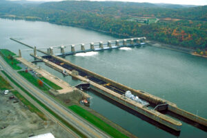
“New Cumberland Locks and Dam is located on the right descending bank of the Ohio River, just off Ohio State Route 7 at the small town of Stratton, OH. Across the river and two miles downstream lies New Cumberland, WV, the originally planned site of the lock and dam, and hence its namesake.”
2 – “Pike Island Locks and Dam”
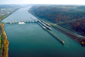
“The lock chambers lie on the West Virginia side of the Ohio River along West Virginia Route 2, just north of the Warwood district of the city of Wheeling, WV”
3 – “Hannibal Locks and Dam”
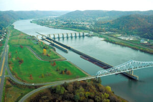
“The locks are directly across from the town of New Martinsville, WV”
4 – “Willow Island Locks and Dam”
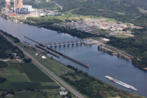
“3.4 miles upstream from Waverly, WV”
5 – “Belleville Locks and Dam”
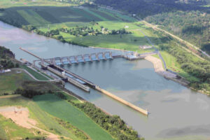
“0.5 miles below Belleville, WV”
6 – “Racine Locks and Dam”
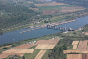
“1.5 miles downstream from Letart Falls, OH”
7 – “Robert C. Byrd Locks and Dam”
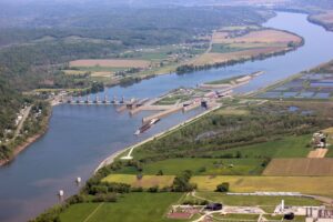
“9 miles below the City of Gallipolis, OH”
“Great Kanawha River”
“The Kanawha River is West Virginia’s largest inland waterway. Most history books and maps refer to it as the ‘Great Kanawha River’”.
Explore The Great Kanawha River Navy’s “Great Kanawha River” Website
“London Locks and Dam”
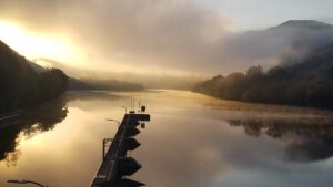
“About 2 miles downstream from Montgomery, WV”
8 – “Marmet Locks and Dam”
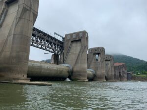
“Marmet, WV – Marmet Locks and Dam are currently the busiest locks in the Ohio River System in terms of commercial lockage cuts.”
9 – “Winfield Locks and Dam”
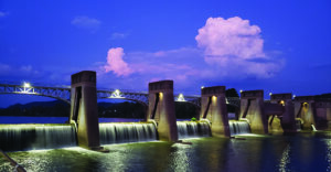
“31.1 miles above mouth of river at Winfield, WV”
“Monongahela River”
“Nine navigation structures [three in West Virginia] provide for year-round navigation on the Monongahela River between Pittsburgh, PA, and Fairmont, WV”
10 – “Opekiska Lock and Dam”
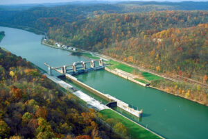
“Opekiska Lock and Dam is located at river mile 115.4, about 7 miles northeast of the city of Fairmont.”
11 – “Hildebrand Lock and Dam”
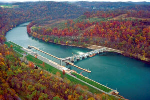
“Hildebrand Lock and Dam is located at river mile 108.0, six miles southwest of the city of Morgantown and near Hildebrand and Round Bottom.”
13 – “Morgantown Lock and Dam”
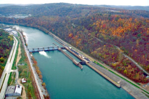
“Morgantown Lock and Dam is located at river mile 102.0 at the city of Morgantown.”
“WVU’s PRT – Personal Rapid Transit”
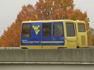
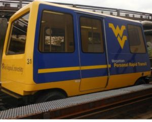 “The Personal Rapid Transit (PRT) system is a unique and easy-to-use transportation solution for WVU students, faculty, staff, and the Morgantown community. There are five stations: Walnut Street Downtown; Beechurst Avenue for the Downtown campus; Engineering Sciences; the Evansdale Residential Complex; and Health Sciences. Powered by electric motors, the computer-driven cars arrive at your station within five minutes after you swipe your Mountaineer Card or employee ID.”
Explore West Virginia University PRT’s “Home” Website
Explore West Virginia University PRT’s “About the PRT” Website
“Pod Cars of the Past and Future: The Morgantown PRT”
“The Morgantown Personal Rapid Transit system threads its way through West Virginia University, taking thousands of people a day around the campus, non-stop. It’s a system that was meant to be the future: so why isn’t it?” (4:44/2016 / TomScott)
“Morgantown PRT End to End”
“This ride is end to end, southbound, on the Morgantown Personal Rapid Transit system, linking the various campuses of West Virginia University and downtown Morgantown. WVU students and staff ride for free – others pay 50¢. There’s a good article on this on Wikipedia of course…” (9:46/2008/Craig White)
“The Other Direction – In Fast Forward – With Captions!”
“Morgantown PRT: A time lapse. Morgantown, West Virginia, has one of the most unique rapid-transit systems in the world. On 10 April 2012, we took a trip there to check it out. Here’s a taste.” (3:12/2012/DialannTV)
“PRT Booklet and Brochure”
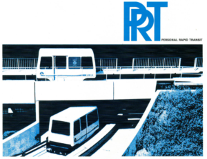
 Scans of a brochure and a multi-page booklet from the mid 1970s.
Explore “PRT Brochure” (pdfs): front back
Explore “PRT Information Booklet” (pdf)
“A Ride of the Future, 1977”
“A Ride of the Future,” produced in 1977 by Ellis Dungan for West Virginia University, looks at the development of the university’s PRT system. (17:42/2013/wvarchivesandhistory)
“The road not taken — How we found (and lost) the dream of Personal Rapid Transit“
![]() “Half a century after its heyday, the Alden StaRRcar clearly wasn’t made for its world. It looks like a white flatiron with wheels or a sleek, plastic bullet, dwarfed by the regal sedans of 1960s Detroit. It belongs in one of Buckminster Fuller’s domed cities, a vehicle for traveling under the geodesics of a bubble-topped Manhattan. Its future wasn’t one of highways, but of narrow cement tracks looping gracefully between city and suburb, connecting increasingly alienated parts of the American landscape. . .”
“Half a century after its heyday, the Alden StaRRcar clearly wasn’t made for its world. It looks like a white flatiron with wheels or a sleek, plastic bullet, dwarfed by the regal sedans of 1960s Detroit. It belongs in one of Buckminster Fuller’s domed cities, a vehicle for traveling under the geodesics of a bubble-topped Manhattan. Its future wasn’t one of highways, but of narrow cement tracks looping gracefully between city and suburb, connecting increasingly alienated parts of the American landscape. . .”
![]()
WV Air Transportation/ WV Highway Transportation / WV Railroad Transportation/ WV Water Transportation
West Virginia Air / Highway / Railroad / Water Transportation
WVU PRT / West Virginia University Personal Rapid Transit / Morgantown PRT
WV West Virginia Covered Bridges Covered Bridges in West Virginia WV