West Virginia State Parks and State Forests
West Virginia Studies

West Virginia State Parks and State Forests
<< Here are the topics on this page; Click to jump/scroll down >>
—————————————————————————————————————————————————————–
“West Virginia Division of Natural Resources”
![]()
 “It is the statutory mission of the West Virginia Division of Natural Resources to provide and administer a long-range comprehensive program for the exploration, conservation, development, protection, enjoyment, and use of the natural resources of the State of West Virginia.”
Explore “West Virginia Division of Natural Resources” Website
—————————————————————————————————————————————————————–
“West Virginia State Parks System” – WV DNR
“…to ‘promote conservation by preserving and protecting natural areas of unique or exceptional scenic, scientific, cultural, archaeological, or historical significance and to provide outdoor recreational opportunities for the citizens of this state and its visitors.’ This mission statement, embodied in state law, has been the guiding principal for operating the West Virginia State Parks system since its inception in the late 1920s. Additionally, West Virginia state parks and state forests continue to serve as major tourist attractions and travel destinations.”
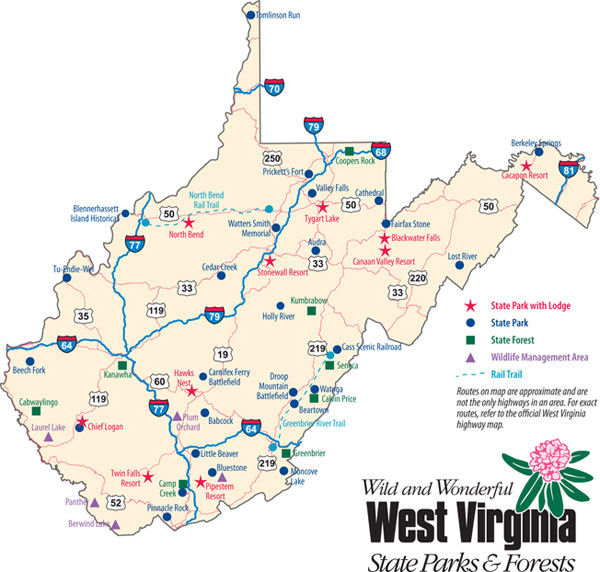
![]() “The system is composed of 34 state parks, nine state forests, the Greenbrier River Trail, and the North Bend Rail Trail. The State Parks Section manages or assists in managing more than 197,000 acres of public land and sees up to 7-million visitors annually in locations as diverse as undeveloped natural areas to multi-faceted resort parks. The park system manages more than 1,900 campsites, 800 lodge rooms, 350 cabins, and six golf courses, an early 20th century era railroad and logging town, and an Ohio River sternwheeler. . . West Virginia State Parks and State Forests protect watersheds and wildlife habitat; provide fishing and natural education opportunities; and have numerous other environmental and cultural benefits.”
“The system is composed of 34 state parks, nine state forests, the Greenbrier River Trail, and the North Bend Rail Trail. The State Parks Section manages or assists in managing more than 197,000 acres of public land and sees up to 7-million visitors annually in locations as diverse as undeveloped natural areas to multi-faceted resort parks. The park system manages more than 1,900 campsites, 800 lodge rooms, 350 cabins, and six golf courses, an early 20th century era railroad and logging town, and an Ohio River sternwheeler. . . West Virginia State Parks and State Forests protect watersheds and wildlife habitat; provide fishing and natural education opportunities; and have numerous other environmental and cultural benefits.”
Explore West Virginia State Parks’ “ABOUT” Page
—————————————————————————————————————————————————————–
—————————————————————————————————————————————————————–
“General Guide to the West Virginia State Parks System”

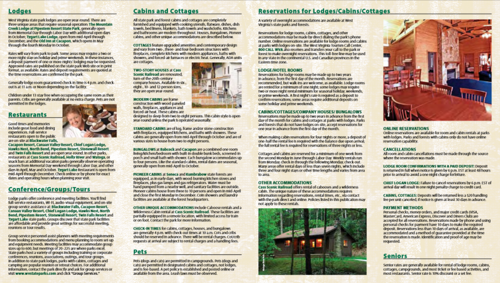

Explore WV DNR’s “GENERAL GUIDE to the WEST VIRGINIA STATE PARKS SYSTEM” Brochure (pdf) (2010)
—————————————————————————————————————————————————————–
“Where People and Nature Meet” – West Virginia State Parks and Forests
 “The West Virginia State Parks system is composed of 34 state parks, eight state forests, five wildlife management areas, the Greenbrier River Trail, and the North Bend Rail Trail.”
—————————————————————————————————————————————————————–
“Creation Dates of West Virginia State Parks and Forests”
1924
- Seneca (Forest)
1928
- Droop Mountain Battlefield
1931
- Carnifex Ferry Battlefield
1933
- Cabwaylingo (Forest)
1934
- Babcock
- Lost River
- Kumbrabow (Forest)
- Watoga
1935
- Hawks Nest
- Tomlinson Run
1936
- Coopers Rock (Forest)
1937
- Blackwater Falls
- Kanawha (Forest)
- Cacapon
1938
- Holly River
- Greenbrier (Forest)
- Pinnacle Rock
1940
- Panther (Forest)
1942
- Cathedral
1945
- Tygart Lake
1949
- Watters Smith Memorial
1950
- Audra
- Bluestone
1951
- North Bend
1953
- Calvin Price (Forest)
- Camp Creek (Forest)
- Cedar Creek
1956
- Tu-Endie-Wei
1957
- Canaan Valley
- Fairfax Stone
1961
- Cass Scenic Railroad
- Chief Logan
1963
- Pipestem Resort
1964
- Twin Falls
- Valley Falls
1970
- Beartown
- Berkeley Springs
1971
- Little Beaver
1975
- Prickett’s Fort
1978
- Beech Fork
1980
- Greenbrier River Trail
1987
- Camp Creek
1989
- Blennerhassett Island Historical
1990
- Stonewall Resort
1991
- Moncove Lake
- North Bend Rail Trail
2022
- Elk River Rail Trail
2023
- Summersville Lake
—————————————————————————————————————————————————————–
“West Virginia State Parks – Special Places – Past, Present & Future” (6 parts)
“History rolls along!”
![]() “Connect with special places that helped form the character of the State of West Virginia. From architecture and design, community spirit, and battle sites that shaped the formation of the 35th state in these United States of America, West Virginia, you’ll find lessons in history – and like they say at Cass Scenic Railroad: ‘Preserving America’s Past for the Future.’”
“Connect with special places that helped form the character of the State of West Virginia. From architecture and design, community spirit, and battle sites that shaped the formation of the 35th state in these United States of America, West Virginia, you’ll find lessons in history – and like they say at Cass Scenic Railroad: ‘Preserving America’s Past for the Future.’”
Extensive information on the historical aspects of several West Virginia State Parks and Forests.
Includes:
(1) Architecture
(2) The 18th Century Frontier (1774)
(3) Civil War Sites (1860’s)
(4) The Civilian Conservation Corps (CCC)
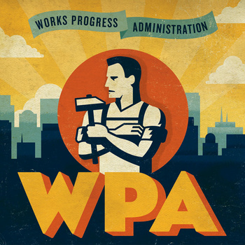
(5) The Works Progress Administration (WPA)
(6) USDA Farm Security Administration Resettlement Project
<<Information from the deactivated website for each of these topics is in the sections immediately below>>
(1) “Architecture” – (from “West Virginia State Parks – Special Places – Past, Present & Future”)
“Palladian style architecture in the late 1700’s is showcased by the mansion at Blennerhassett Island Historical State Park.”
“The Bauhaus movement and its influence is found at three West Virginia state parks: Hawks Nest State Park, Pipestem Resort State Park, Twin Falls Resort State Park.”
Topics: A Mansion on an Island; Lodge Architecture in West Virginia State Parks; Architect, Walter Gropius; Modernist Movement–Bauhaus; TAC-The Architects Collaborative; Lodge Architecture–A Trio; Historic Photos
Explore Information from West Virginia State Parks and Forests’ “Special Places. . .Architecture” Website (deactivated) (pdf)
(2) “The 18th Century Frontier (1774)” – (from “West Virginia State Parks – Special Places – Past, Present & Future”)
Prickett’s Fort State Park
“Interpreters recreate late 18th century lifestyle through period attire, demonstrations of a variety of colonial crafts, and the fort.”
Tu-Endie-Wei State Park
“At the junction of the Ohio and Kanawha Rivers in what is now West Virginia, this area commemorates the frontiersmen who fought and died at the Battle of Point Pleasant.”
(3) “Civil War Sites (1860’s)” – (from “West Virginia State Parks – Special Places – Past, Present & Future”)

Carnifex Ferry Battlefield
September 10, 1861
“Nestled on the rim of the Gauley River Canyon near Summersville, West Virginia, Carnifex Ferry Battlefield State Park is an important Civil War battle site.”
James Connell, a 2011 summer intern at the Nicholas Chronicle, researched and wrote about the history of the Battle of Carnifex Ferry in a series of 5 articles.
Droop Mountain Battlefield
November 6, 1863
“Droop Mountain Battlefield State Park is located in the Greenbrier River Valley north of Lewisburg and is the site of West Virginia’s last significant Civil War battle.”
“A neat little booklet” about the Battle at Droop Mountain:
(4) “The Civilian Conservation Corps (CCC)” – (from “West Virginia State Parks – Special Places – Past, Present & Future”)
Babcock State Park
SP-3, Camp Beaver – 1934, Co. 1522
SP-6, Camp Lee – 1935, Co. 532
Cabwaylingo State Forest
S-61, Camp Anthony Wayne – 1935, Co. 3532
S-71, Camp Twelvepole (or Aracoma) – 1935, Co. 3540
Cacapon State Park
SP-4, Camp Morgan – 1934, Co. 1523
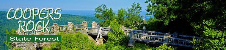
Coopers Rock State Forest
P-73, Camp Preston – 1935, Co. 3527
S-75, Camp Rhododendron – 1937, Co. 3527
Droop Mt. Battlefield State Park
P-68, Camp Price – 1935, Co. 2598
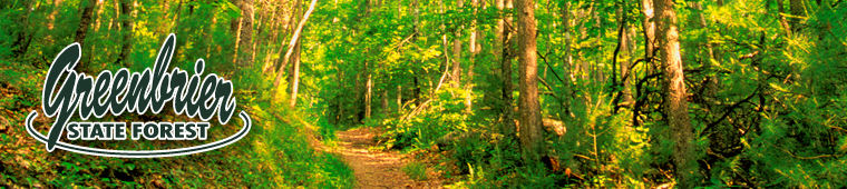
Greenbrier State Forest
SP-67, Camp White Sulphur – 1935, Co. 549
Hawks Nest State Park
See camps under Babcock
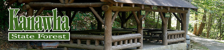
Kanawha State Forest
S-76, Camp Kanawha – 1938, Co. 2599
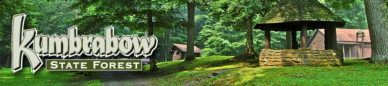
Kumbrabow State Forest
S-62, Camp Bowers – 1935, Co. 2594
S-72, Camp Randolph – 1935, Co. 3520

Lost River State Park
SP-2, Camp Hardy – 1934, Co. 1522
Seneca State Forest
S-51, Camp Seneca – 1933, Co.1537

Watoga State Park
SP-1, Camp Seebert – 1934, Co. 1535
SP-5, Camp Watoga – 1934, co. 1525
SP-7, Camp Will Rogers – 1935, Co. 3537
S-52, Camp Watoga – 1933, Co. 1525
<<More information about CCC projects in West Virginia is in the “West Virginia Historic New Deal / CCC Trail” brochure on the “Special Places” page. Also, the “CCC Museum” on the “Museums” page>>
(5) “Other Work Programs of the 1930s – 1940s Influencing Development of West Virginia State Parks.” – (from “West Virginia State Parks – Special Places – Past, Present & Future”)
The Works Progress Administration (WPA)

“Located along Route 52, near historic Bramwell in Mercer County, Pinnacle Rock State Park is one of the more interesting day use parks operated by the West Virginia State Park system.”
“Located near the tip of the Northern Panhandle along the Ohio River, Tomlinson Run can claim the title of West Virginia’s ‘top park.’ ”
USDA Farm Security Administration Resettlement Project

“The dense forests of Holly River State Park provide guests with a natural feeling of peaceful solitude.”
(6) “History Rolls Along” – (from “West Virginia State Parks – Special Places – Past, Present & Future”)
Babcock State Park
Berkeley Springs State Park
Blennerhassett Island Historical State Park
Cass Scenic Railroad State Park
Explore information from West Virginia State Parks – Special Places – Past, Present & Future’s “Cass Scenic Railroad” (deactivated) website – includes Whittaker Station, The Town of Cass, Spruce, and Locomotives (pdf)
—————————————————————————————————————————————————————–
“eBrochures Online” – West Virginia State Parks
![]() WV DNR has indicated it will no longer print brochures for West Virginia State Parks and Forests, using digital media instead. MH3WV has been able to retrieve and archive the pdf of each printed brochure and will keep them available–the date of the printed version is usually in the lower right corner, in small type, on the back of the brochure and is also noted at the end of each link below. These brochures are linked in each park/forest/wildlife management area’s section below.
WV DNR has indicated it will no longer print brochures for West Virginia State Parks and Forests, using digital media instead. MH3WV has been able to retrieve and archive the pdf of each printed brochure and will keep them available–the date of the printed version is usually in the lower right corner, in small type, on the back of the brochure and is also noted at the end of each link below. These brochures are linked in each park/forest/wildlife management area’s section below.
—————————————————————————————————————————————————————–
“Pollinator Zones at WV State Parks”
“Butterflies. Bees. Beetles.“
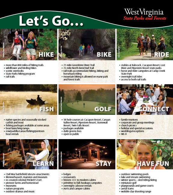
![]() “What do these insects have in common? They carry the key to the earth’s survival in their tiny bodies. That’s not an exaggeration, either. According to the United States Department of Agriculture, neither the human race nor any of earth’s terrestrial ecosystems would survive without pollinators. Of the 1,400 crop plants grown around the world, nearly 80 percent require pollination by animals. That’s why several WV State Parks, Cacapon Resort, Beech Fork, Chief Logan, and Camp Creek State Park and Forest, have established pollinator zones to help sustain a diverse population of pollinator species. (3:23/2020/ West Virginia Department of Commerce)
“What do these insects have in common? They carry the key to the earth’s survival in their tiny bodies. That’s not an exaggeration, either. According to the United States Department of Agriculture, neither the human race nor any of earth’s terrestrial ecosystems would survive without pollinators. Of the 1,400 crop plants grown around the world, nearly 80 percent require pollination by animals. That’s why several WV State Parks, Cacapon Resort, Beech Fork, Chief Logan, and Camp Creek State Park and Forest, have established pollinator zones to help sustain a diverse population of pollinator species. (3:23/2020/ West Virginia Department of Commerce)
Explore West State Parks’ “Pollinator Zones at State Parks Are Abuzz with Action” Website
—————————————————————————————————————————————————————–
“On the Road in West Virginia: Our 55 Counties”

![]() “On the Road in West Virginia: Our 55 Counties is a video documentary of the History and Culture of each West Virginia County in under 10 minutes. Keeping it short, sweet, and entertaining.”
“On the Road in West Virginia: Our 55 Counties is a video documentary of the History and Culture of each West Virginia County in under 10 minutes. Keeping it short, sweet, and entertaining.”
<<The project has expanded to include a series on WV State Parks and Forests, which is still in progress. Available segments are in each park’s/forest’s section below.>>
Explore “On the Road in West Virginia: Our 55 Counties” Website
—————————————————————————————————————————————————————–
“West Virginia’s 37 State Parks in 1 Minute”
“My COVID project…to get outside (and be socially distanced) over the last 6 months I photographed each of WV’s 37 state parks. Here is a short teaser video (I’m going to put together a longer version in a few weeks). I have visited all of the parks but want to revisit some to capture the fall colors.” (1:00/2020/Alex Wilson)
—————————————————————————————————————————————————————–
“WEST VIRGINIA STATE PARKS”
—————————————————————————————————————————————————————–
AUDRA State Park
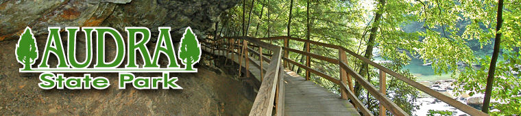
“Audra State Park is a heavily wooded area bisected by the Middle Fork River located in southwestern Barbour County and a portion of Upshur County. Each year, visitors are drawn to the natural beauty of the Middle Fork and its surroundings, which offers opportunities for hiking, camping and family picnics. This park is an ideal destination for families who enjoy the outdoors. The clear, clean water of the Middle Fork River and the rock overhang of the Alum Cave offer picture-perfect backdrops.”
“Audra State Park is named after the small, early 20th-century town of Audra, which sat on property owned by the Baltimore & Ohio Railroad. Once the site of commercial logging, the area was later turned into Barbour County’s 4-H Club camp. The state of West Virginia purchased some of the B&O property in 1948, built the first rustic facilities and opened the park to the public in 1950. As the park became popular, additional land was purchased in 1960, and more modern facilities, including a campground, bathhouse and playgrounds, were constructed. In the early 1970s, the campground was expanded to include accommodations for trailer campers with electrical hookups.”
Explore WV DNR’s “Audra State Park” Website
View WV DNR’s “Audra State Park” Brochure pdf (2011)
Explore WV DNR’s “Audra State Park” Map (pdf) (2018)
Explore WV DNR’s “Audra State Park” Campground Map (pdf) (2018)
(2:20/2019/On the Road in West Virginia: Our 55 Counties)
———————————————————————————————————————
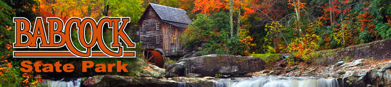
BABCOCK State Park
“Babcock State Park and its 4,127 acres of rhododendron-lined trails and rippling, rock-strewn streams is one of West Virginia’s most iconic locations. Located 20 miles south of the New River Gorge Bridge, the park is most known for the Glade Creek Grist Mill, a fully functional replica of the original Cooper’s Mill, located nearby. Other attractions include recreational activities like hiking, fishing and boating.
“The Glade Creek Grist Mill at Babcock State Park also is a popular destination for nature and landscape photographers and artists capturing this iconic site.”
“In the 1930s, two CCC camps located in Clifftop, Camp Beaver and Camp Lee became the site of what is now known as Babcock State Park. The original camp buildings are gone today, but Babcock’s Campground is located at the former site of Camp Lee. All plans for the administration building, cabins, and other work were drawn up by park staff at the park and approved by the Department of the Interior. The camps at Babcock, Watoga, Cacapon, Lost River, and Oglebay were operated by the Civilian Commission of West Virginia in cooperation with the National Park Service of the Department of the Interior. Other help included a skilled stonemason foreman who supervised the park’s stone quarry and work on the administration building.
“The Glade Creek Grist Mill at Babcock is a new mill that was completed in 1976. Fully operable, this mill was built as a re-creation of a previous one that once ground grain on Glade Creek long before Babcock became a state park. Known as Cooper’s Mill, it stood on the present location of the park’s administration building parking lot. Of special interest, the mill was created by combining parts and pieces from three mills which once dotted the state. The basic structure of the mill came from the Stoney Creek Grist Mill which dates back to 1890. After an accidental fire destroyed the Spring Run Grist Mill near Petersburg, Grant County, only the overshot water wheel could be salvaged. Other parts for the mill came from the Onego Grist Mill near Seneca Rocks in Pendleton County. A living monument to the over 500 mills which thrived in West Virginia at the turn of the century, the Glade Creek Grist Mill provides freshly ground cornmeal, which park guests may purchase depending on availability and stream conditions. Visitors to the mill may journey back to a time when grinding grain by a rushing stream was a way of life, and the groaning mill wheel was music to the miller’s ear.”
Explore WV DNR’s “Babcock State Park” Website
View WV DNR’s “Babcock State Park Brochure” pdf (2013)
Explore WV DNR’s “Babcock State Park Map’ (pdf) (2018)
Explore WV DNR’s “Babcock State Park Campground Map” (pdf) (2018)
Explore WV DNR’s “Babcock State Park Cabin Map 1-13” (pdf) (2018)
Explore WV DNR’s “Babcock State Park Cabin Map 14-28” (pdf) (2018)
(2:38/2020/On the Road in West Virginia: Our 55 Counties)
“Glade Creek Gristmill: Babcock’s world-class attraction”
“You’ve seen it pictured on calendars, mugs and coffee table books. It’s the Glade Creek Grist Mill — one of the most photographed images in the world. But there’s more to this beautiful old structure than just Instagram-worthy material.” (2:13/2020/West Virginia Department of Commerce)
“A Frozen Babcock State Park, West Virginia”
“A fresh snowfall coats the ground at Babcock State Park in Clifftop, WV. Babcock is know for its picturesque grist mill which sits along side Glade Creek. But the park also offers amazing vistas and trails.” (1:00/2021/Alex Wilson)
———————————————————————————————————————
BEARTOWN State Park
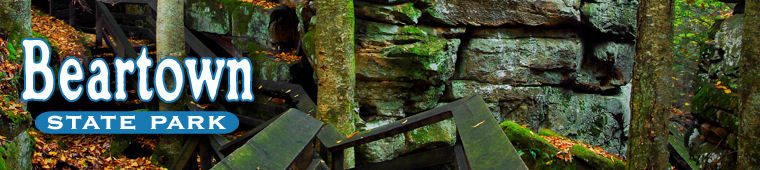
“Beartown State Park is a 110-acre natural area located on the eastern summit of Droop Mountain in northern Greenbrier County and a small portion of Pocahontas County. This park is known for its unusual rocky formations, massive boulders, overhanging cliffs and deep crevices. The park’s main attraction is a half-mile boardwalk showcasing these spectacular sights. The park is open April to October, and off-season access is available by appointment.”
“The land now known as Beartown State Park was purchased in 1970 with funds from the Nature Conservancy and a donation from Edwin G. Polan, given in memory of her son, Ronald Keith Neal, a local soldier killed in the Vietnam War. Since then, development of the park has been minimal so the area’s natural beauty may be preserved. The park’s name comes from residents who claimed the many cave-like openings in the rocks made ideal winter dens for black bears in the area. It also refers to the many deep, narrow crevasses that crisscross the area and appear from above like the streets of a small town.
“Recreation at Beartown State Park consists of hiking the boardwalk. The park’s simplicity is what attracts visitors, who often come to the park for a walk and nothing more. For those looking for an educational experience, a walk through the park’s rock formations is aided by informational markers along the trail, explaining the geological processes at work in the area.”
Explore WV DNR’s “Beartown State Park” Website
View WV DNR’s “Beartown State Park” Brochure pdf (2013)
Explore WV DNR’s “Babcock State Park Map’ (pdf) (2018)
(2:11/2019/On the Road in West Virginia: Our 55 Counties)
———————————————————————————————————————
BEECH FORK State Park
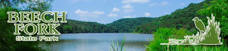
“Beech Fork State Park offers some of the best recreational opportunities in West Virginia’s southwestern region. Visitors to this 3,144-acre park can hike in the hills, watch birds, fish or take a boat out on Beech Fork Lake. The lake is a 720-acre reservoir, with 31 miles of shoreline. Located 12 miles south of Huntington and Barboursville, Beech Fork State Park is the perfect getaway for visitors from neighboring states and cities, like Cincinnati, Ohio and Lexington, Kentucky.”
“The U.S. Army Corps of Engineers created Beech Fork Lake in the 1970s by damming the Beech and Miller forks of Twelvepole Creek near Lavalette. This was done to control flooding and provide recreational opportunities and wildlife management in the area. The lake is the centerpiece of the park, which officially opened in 1979. Beech Fork has been popular with locals and travelers ever since!”
Explore WV DNR’s “Beech Fork State Park” Website
View WV DNR’s “Beech Fork State Park” Brochure pdf (2011)
Explore WV DNR’s “Beech Fork State Park Map’ (pdf) (2018)
Explore WV DNR’s “Beech Fork State Park Map’ (pdf) (2018)
Explore WV DNR’s “Beech Fork State Park Map’ (pdf) (2018)
(2:06/2021/On the Road in West Virginia: Our 55 Counties)
———————————————————————————————————————
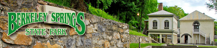
BERKELEY SPRINGS State Park
“Located in the center of Berkeley Springs, a small resort town in West Virginia’s Eastern Panhandle, Berkeley Springs State Park is home to a historic mineral spa that has been in use since colonial times. The park is renowned for its warm spring water, which flows at a constant temperature of 74.3 degrees. The park’s Roman bathhouse offer many spa services, including massages, saunas, baths and showers.”
“Long before the first Europeans discovered the warm waters of Berkeley Springs, it was already a famous health mecca which attracted Indians from the St. Lawrence Seaway in Canada and the Great Lakes to the Carolinas. Those first settlers, who came in 1730, learned the uses and value of the springs from the Indians and began spreading the word of its benefits throughout the settlements of the east.
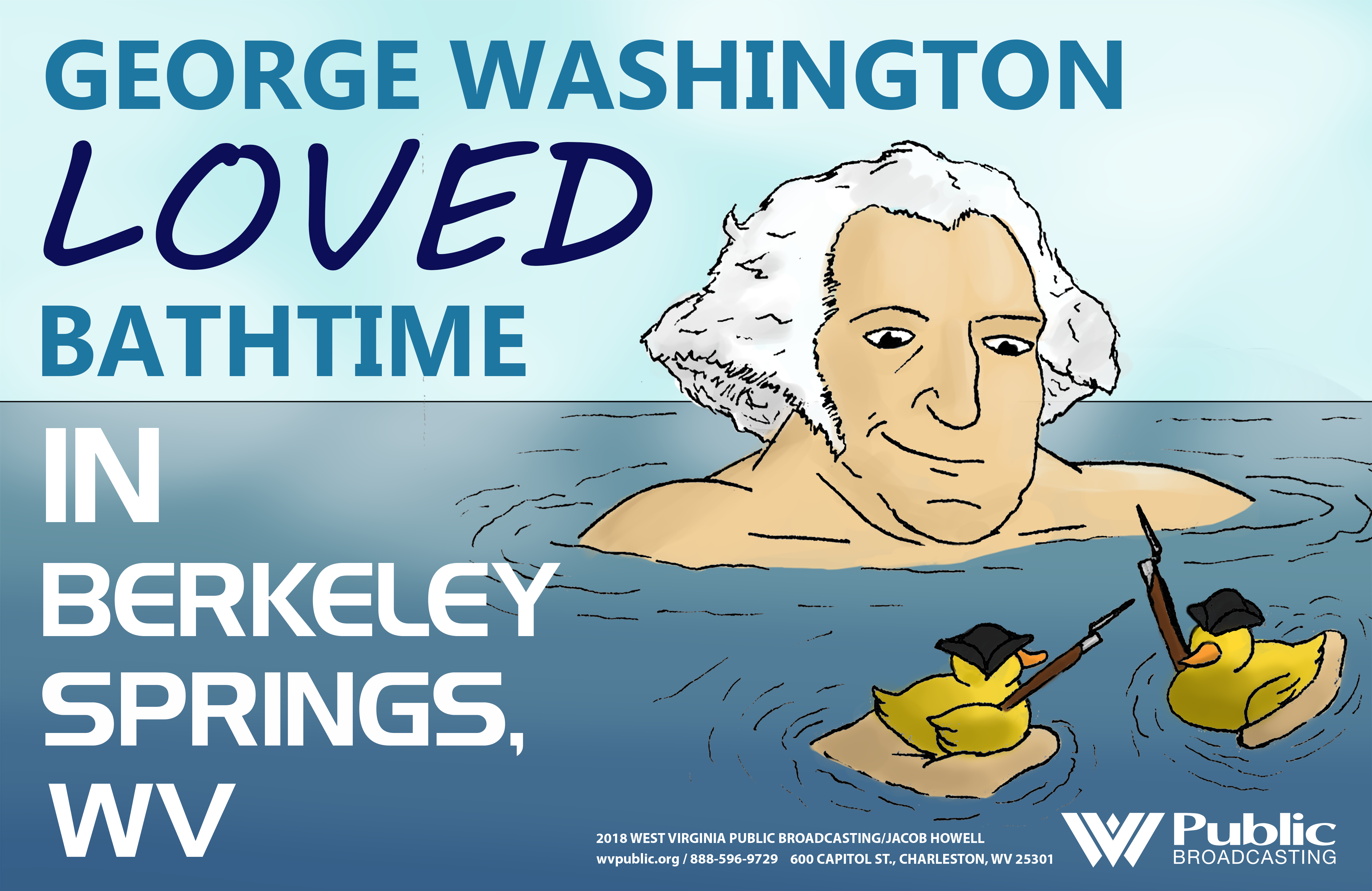 “Perhaps the most notable and influential advocate of the curative powers of the springs was George Washington, who, at 16, visited them as a member of a survey party. As the party, which was surveying the western limits of Thomas Lord Fairfax’s lands, camped there for the night, young Washington noted in his diary, “March 18th, 1748, We this day called to see Ye Fam’d Warm Springs.” For many years afterwards, George Washington visited the springs regularly, and it was largely through his efforts that its fame as a health spa grew throughout the colonies. At the urging of the Colony of Virginia and in the public interest, Lord Fairfax conveyed his land holdings at the springs and fifty adjacent acres to the Colony of Virginia in 1776. Shortly thereafter, the land was offered for public sale.
“George Washington, three signers of the Declaration of Independence, four signers of the Constitution, seven members of the Continental Congress and five Revolutionary generals were among the prominent colonists who made initial purchases there. Hence, the springs’ reputation as a health resort became firmly established.
“Borrowing the name of a famous counterpart in England, the General Assembly of Virginia formed the town of Bath on this location in 1776 and created a board of trustees to govern the new town. James Rumsey, who later invented the first successful steamboat, was then contracted to construct five bathhouses and several other public buildings. This officially established the springs as a resort facility.”
Explore WV DNR’s “Berkeley Springs State Park” Website
View WV DNR’s “Berkeley Springs State Park” Brochure pdf (2013)
View Berkeley Springs State Park’s “Taking the Waters” Brochure pdf (2012)
(2:40/2020/On the Road in West Virginia: Our 55 Counties)
—————————————————-
———————————————————————————————————————
BLACKWATER FALLS State Park

“Located in the Allegheny Mountains of Tucker County, Blackwater Falls State Park is named for the amber waters of Blackwater Falls, a 62-foot cascade tinted by the tannic acid of fallen hemlock and red spruce needles. The falls, the main attraction of Blackwater Falls State Park, are accessible from steps and several viewing platforms that allow visitors to enjoy scenic views year-round. Blackwater Falls, and nearby Elakala Falls, Lindy Point and Pendleton Point Overlook, are some of the most photographed sites in West Virginia. The park offers lodging and many outdoor recreational opportunities.”
“The area that is now Blackwater Falls State Park has been a favored destination for adventurers since the 1800s. The land came under the protection of the state parks system in the 1930s when the West Virginia Power and Transmission Company, which owned the Blackwater Canyon, donated 446 acres around a scenic overlook at the head of the canyon, including the falls itself. The park was formerly established in 1937. In 1955, the state began adding cabins, a lodge and fishing facilities.”
Explore WV DNR’s “Blackwater Falls State Park” Website
View WV DNR’s “Blackwater Falls State Park” Brochure pdf (2013)
(2:33/2020/On the Road in West Virginia: Our 55 Counties)
“The serenity and beauty of West Virginia is now on the next level with the newly renovated Blackwater Falls State Park. Located in Tucker County among the trees of the Allegheny Forest, your next destination for downtime is a welcoming experience from the moment you arrive. Let’s explore the renovations and plan your next trip!” (1;10/2023/West Virginia Department of Commerce)
“Blackwater Falls, Blackwater Falls State Park, Davis, WV”
“Shot from both lookouts just after a rain on 4/30/14 and then again on 5/2/14. Also went down to the river on 5/2/14.” (2:00/2014/colong7034)
———————————————————————————————————————
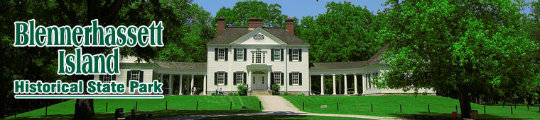
BLENNERHASSETT ISLAND HISTORICAL State Park
“Located on a small island in the Ohio River, Blennerhassett Island Historical State Park features a Palladian mansion and museum visited by 40,000 people each year. This historical park is accessed by sternwheeler riverboat from Point Park on 2nd Street in Parkersburg. Once on the island, visitors may enjoy tours of the grounds and mansion and horse-drawn carriage rides. Tours are offered when the park is open, from May through the last weekend of October.”
“The history of Blennerhassett Island has made it the Ohio River’s most famous island. In 1789, the island was settled by Harman and Margaret Blennerhassett, wealthy Irish aristocrats fleeing political persecution and personal scandal. Over the years, the couple’s mansion gained a reputation for being the West’s most beautiful home. Then, in 1805, they allowed their estate to become headquarters for Aaron Burr’s military expedition to the Southwest, an episode that raised the island to national renown and awarded it a permanent footnote in American history. The Burr conspiracy, which is suspected to have involved a treasonous plot to create a new country independent of the United States, has become the subject of many stories, poems, artwork and Broadway shows. The Blennerhassetts fled the island when Burr’s scheme collapsed but the mansion and history remain.”
Explore WV DNR’s “Blennerhassett Island Historical State Park” Website
View WV DNR’s “Blennerhassett Island Historical State Park” Brochure pdf (2011)
View WV DNR’s Blennerhassett Island Historical State Park “Park Map and Trails” pdf
View WV DNR’s Blennerhassett Island Historical State Park “Vicinity Map” pdf
(3:09/2020/On the Road in West Virginia: Our 55 Counties)
 August 21, 2021
“Island Eden – New Film Tells the Story of the Blennerhassetts”
“In the middle of the Ohio River lies an island steeped in early American history. It’s where an Irishman and his bride hid from scandal, then built the grandest home west of the Alleghenies, a paradise enmeshed in treason, love, betrayal, political intrique and the ‘Trial of the Century.’”
———————————————————————————————————————
BLUESTONE State Park
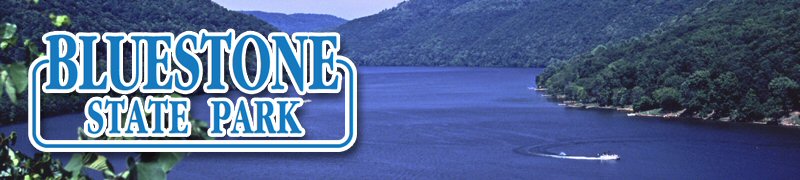
“Wild and wonderful – you’ll find both at Bluestone State Park. This wilderness park, located five miles south of Hinton in southern West Virginia, is best known for Bluestone Lake, the state’s third-largest body of water. The park’s 2,155 acres of forest and rugged mountain terrain are perfect for hiking, fishing and camping.”
“Bluestone State Park was established in 1950 and is named after the Bluestone National Scenic River, which flows into the New River at the park. The park’s signature lake was created by the Bluestone Dam, which was authorized by presidential proclamation and approved by an act of Congress in the 1930s. It was created to control flooding in the area, and went through several phases of construction before, during and after World War II.”
Explore WV DNR’s “Bluestone State Park” Website
View WV DNR’s “Bluestone State Park” Brochure pdf (2012)
(1:49/2020/On the Road in West Virginia: Our 55 Counties)
———————————————————————————————————————
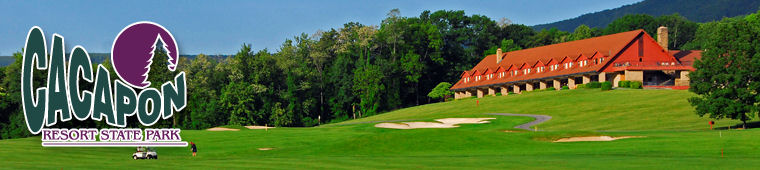
CACAPON RESORT State Park
“Sitting in the shadows of the highest peak in the eastern portion of West Virginia, Cacapon Resort State Park offers 6,000 acres of exciting outdoor getaways all year-round. The park provides lake activities and hiking opportunities, vacation cabins, golfing, and restaurants in West Virginia’s Eastern Panhandle. The word Cacapon is a derivative of a Shawnee Indian word meaning “medicine waters,” a reference to the area’s mineral waters that have been renowned throughout history for their healing powers.”
“Cacapon State Park was constructed by the Federal Civilian Conservation Corps on land that had been clear-cut for its viable timber in the early 20th century. It officially opened July 1, 1937. Most of the construction of the park took place in the 1940s by CCC workers, with additional construction of cabins and the lodge in the 1950s. The famous Robert Trent Jones golf course was added to the park in 1973, advancing it to the status of a resort park.”
Explore WV DNR’s “Cacapon Resort State Park” Website
View WV DNR’s “Capacon Resort State Park” Brochure pdf (2010)
(2:20/2021/On the Road in West Virginia: Our 55 Counties)
“Cacapon Lodge Tour”
———————————————————————————————————————
CAMP CREEK State Park
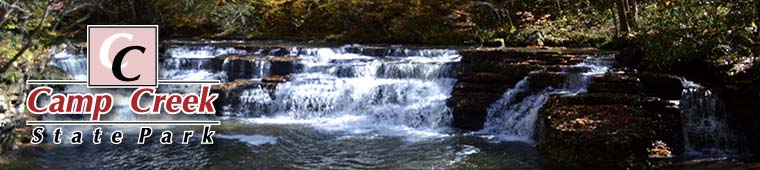
“Camp Creek State Park and Forest is known for beautiful waterfalls and great camping. With nearly 6,000 acres of lush forest, 35 miles of trails and seven miles of seasonally stocked trout streams, there is something for every hiker, biker, horseback rider and angler to explore and enjoy. Located in Mercer County, two miles off Interstate 77, Camp Creek is ideal for family vacations and stop-overs during a long drive through the beautiful mountains of southern West Virginia.”
“Camp Creek State Park became part of the West Virginia parks system in 1987 after 550 acres were marked off from the existing Camp Creek State Forest. The name of Mash Fork, one of the park’s streams, suggests a moonshining past not uncommon in the region.”
Explore WV DNR’s “Camp Creek State Park” Website
View WV DNR’s “Camp Creek State Park and Forest” Brochure pdf (2012)
(2:38/2020/On the Road in West Virginia: Our 55 Counties)
“Camp Creek State Park, West Virginia” “Camp Creek State Park in Camp Creek, WV. Video by Alex Wilson” (1:02/2020/Alex Wilson)
———————————————————————————————————————
—————————————————-
CANAAN VALLEY RESORT State Park

“Canaan Valley Resort is a four-season destination tucked into a high plateau in the Allegheny Mountains in an area known for its unique tundra-like wetlands. Canaan Valley is a major ski resort and one of West Virginia’s largest state parks. It has a full-service lodge, cabins and campgrounds, has been named one of America’s Best Parks by Arthur Frommer’s magazine, and has been listed among the 50 Great Places to Stay by Washingtonian Magazine.”
“Canaan Valley State Park was established in 1963 on 6,014 acres of land, part of which had been willed to the state by resident S. Maude Kaemmerling for recreational use. In 1971, the park opened its ski slopes on the 4,420 foot Weiss Knob. It was the state’s first ski resort and sparked a new industry in West Virginia. The park’s lodge has been managed by a private operator since the mid-1970s, but the state park system still provides certain services.”
Explore “Canaan Valley Resort State Park” Website
Explore WV DNR’s “Canaan Valley Resort State Park” Website
View WV DNR’s Canaan Valley Resort State Park State Park “Park Map and Trails” pdf
(Though owned by the State, Canaan Valley Resort State Park is managed by a private company. It does not have a WV DNR Brochure.)
(2:23/202020/On the Road in West Virginia: Our 55 Counties)
———————————————————————————————————————
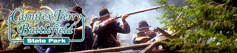
CARNIFEX FERRY BATTLEFIELD State Park
“Set on the rim of the Gauley River Canyon, the 156-acre Carnifex Ferry Battlefield State Park is an important Civil War battle site. The park is part of the Civil War Discovery Trail, which links more than 300 historical sites in 16 states, and commemorates the 1861 Battle of Carnifex Ferry, a major Union victory that led to the eventual Confederate withdrawal from western Virginia. Carnifex Ferry is one of the oldest state parks in the United States and is a popular site for Civil War reenactments.”
“Nestled on the rim of the Gauley River Canyon near Summersville, West Virginia, Carnifex Ferry Battlefield State Park is an important Civil War battle site. On September 10, 1861 Union troops led by Brigadier General William S. Rosecrans engaged the Confederates and forced them to evacuate an entrenched position on the Henry Patterson Farm which overlooked Carnifex Ferry. The Confederate commander, Brigadier General John B. Floyd, retreated across the ferry to the south side of the Gauley River and on eastward to Meadow Bluff near Lewisburg. This Civil War battle represented the failure of a Confederate drive to regain control of the Kanawha Valley. As a result, the movement for West Virginia statehood proceeded without serious threat from the Confederates.
“Today, Carnifex Ferry is recognized as part of The Civil War Discovery Trail which links more than 300 sites in 16 states to inspire and to teach the story of the Civil War and its haunting impact on America. The Trail, an initiative of the Civil War Trust, allows visitors to explore battlefields, historic homes, railroad stations, cemeteries, parks and other destinations that bring history to life.”
Explore WV DNR’s “Carnifex Ferry Battlefield State Park” Website
View WV DNR’s “Carnifex Ferry Battlefield State Park” Brochure pdf (2011)
Also see “Civil War Sites (1860’s)” (above, on this page) — and the MH3WV “Statehood/Civil War” page for more information on the battle.
(2:57/2020/On the Road in West Virginia: Our 55 Counties)
———————————————————————————————————————
CASS SCENIC RAILROAD State Park
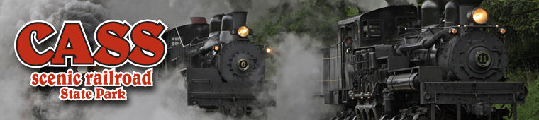
“Nestled in the mountains of West Virginia, Cass Scenic Railroad State Park features an era when steam-driven locomotives were an essential part of everyday life. Trips to Cass are filled with rich histories of the past, unparalleled views and the sights and sounds of original steam-driven locomotives. The park’s 11-mile long heritage railroad and authentic company town are some of the state’s most popular tourist attractions. Cass Scenic Railroad State Park is one of America’s only authentic operating museums of lumber railroading.”
“The town of Cass remains relatively unchanged since its founding in 1901 by the West Virginia Pulp and Paper Company. Cass was built as a company town for the loggers who worked in the nearby mountains. Construction of the railroad started in 1901. It was used to haul lumber to the mill at Cass. The railroad track was eventually extended to the top of Bald Knob, the third highest mountain peak in West Virginia. In June 1942, the Cass operation was sold to Mower Lumber Company, which operated the town until July 1960, when the mill and railroad were shut down due to rapid decline of the timber industry in the region. In 1961, Cass was brought into the state parks system. In 1977, the company town also was made part of the parks system. Over the years, the railroad was turned into a tourist line and the town was repaired and restored. Today, the railroad is still in full operation, and is managed by the Durbin Greenbrier Valley Railroad.”
Explore WV DNR’s “Cass Scenic Railroad State Park” Website
View WV DNR’s “Cass Scenic Railroad State Park” Brochure pdf (2009)
View WV DNR’s Cass Scenic Railroad State Park “Park Map and Route” pdf
View WV DNR’s Cass Scenic Railroad State Park “Town of Cass” pdf
<<More information about the Cass Locomotives, including Shay #5, is on the MH3WV “State Symbols” page>>
(2:51/2019/On the Road in West Virginia: Our 55 Counties)
“Cass Scenic Railroad State Park in West Virginia offers excursions that transport you back in time and lets you relive an era when steam-driven locomotives were an essential part of everyday life. Trips to Cass are filled with rich histories of the past, unparalleled views of a vast wilderness area and close-up encounters with the sights and sounds of original steam-driven trains. Cass has the world’s largest roster of operating geared steam locomotives.” (2:21/2010/West Virginia Department of Commerce)
———————————————————————————————————————
CATHEDRAL State Park
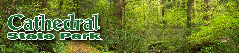
“Cathedral State Park is the state’s largest old-growth forest and contains the only stand of virgin hemlock in West Virginia. Designated a National Natural Landmark, this 133-acre park offers sanctuary for these ancient trees, as well as 170 species of trees, ferns and wildflowers. During spring and summer Cathedral State Park offers excellent hiking on its six miles of trails and unique photography opportunities.”
“This ancient forest was once the site of the Brookside Resort, which was built in 1882. Summer visitors from Washington and Baltimore flocked from the cities to the West Virginia mountains for the cool, clean air and natural beauty. In 1922, Brookside caretaker Branson Haas purchased the land, and later sold it to the state of West Virginia with the stipulation that the forest remain uncut. In 1966, the park was entered in the National Registry of Natural Landmarks.”
Explore WV DNR’s “Cathedral State Park” Website
View WV DNR’s “Cathedral State Park” Brochure pdf (2013)
(2:16/2019/On the Road in West Virginia: Our 55 Counties)
———————————————————————————————————————
CEDAR CREEK State Park
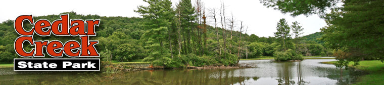
“Set on 2,588 wooded acres near Glenville in West Virginia’s central region, Cedar Creek State Park’s rolling hills and wide valleys provide an ideal backdrop for a variety of recreational activities from hiking to fishing. Park highlights include a furnished one-room schoolhouse and a fully restored log cabin, which serves as the campground check-in station.”
“Cedar Creek joined the state park system in 1955. Two buildings on park grounds allow guests to step back into West Virginia’s pioneer days. The park office, a fully restored log cabin, was formerly a Gilmer County historical landmark. A one-room schoolhouse, built in 1910, was moved to the park from Lewis County in 1989. The school has a tin roof, and is furnished with a pot-bellied stove, student desks, filled bookcases, blackboard and teacher’s desk. It is open to visitors on most Saturdays during the summer.”
Explore WV DNR’s “Cedar Creek State Park” Website
View WV DNR’s “Cedar Creek State Park” Brochure pdf (2012)
(2:18/2020/On the Road in West Virginia: Our 55 Counties)
———————————————————————————————————————
—————————————————-
CHIEF LOGAN State Park

“Chief Logan State Park is a 4,000-acre recreational area with lodging, conference facilities, campgrounds, hiking trails and a variety of outdoor activities and attractions. Located four miles north of Logan in the heart of West Virginia’s southern coalfields, Chief Logan State Park is one of the most visited facilities in the West Virginia State Parks System. It is known for its annual “Christmas in the Park” drive-thru holiday light display. One item of note, the lodge and the surrounding state park are within a few miles drive from each other. Separated by a scenic mountain, guests can stay and enjoy the amenities at Chief Logan Lodge, and then take a short drive to explore the surrounding state park.”
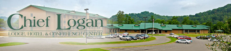
“Like the surrounding town and county, Chief Logan State Park is named after Chief Logan, a leader of the Native American Mingo tribe who lived in the area before the American Revolutionary War. The park was designated a recreation area in 1960 and became part of the state parks system in 1968. The park also has historical ties to the Chesapeake and Ohio Railroad. A Kanawha 2700 Class locomotive, donated by the C&O Railroad in 1961, remains on display today.”
Explore WV DNR’s “Chief Logan State Park” Website
View WV DNR’s “Chief Logan State Park and Chief Logan Lodge” Brochure pdf (2012)
(2:44/2019/On the Road in West Virginia: Our 55 Counties)
———————————————————————————————————————
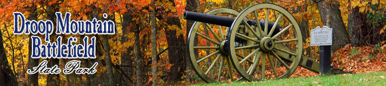
DROOP MOUNTAIN BATTLEFIELD State Park
“Located in the Greenbrier River Valley north of Lewisburg, Droop Mountain Battlefield State Park is part of the Civil War Discovery Trail, which links more than 300 historical sites in 16 states. The park is famous for reenactments of the Battle of Droop Mountain, which was the last major American Civil War conflict in West Virginia. Reenactments occur in October of even-numbered years. The park also provides hiking trails, picnic shelters and play areas for use any time of the year.”
“Located in the Greenbrier River Valley north of Lewisburg, Droop Mountain Battlefield is the site of West Virginia’s last significant Civil War battle.
“On November 6, 1863, the federal army of Brigadier General William W. Averell attempted for the second time to disrupt the Virginia-Tennessee Railroad at Salem, Virginia. Averell and his troops faced the Confederate troops of Brigadier General John Echols. Throughout the morning, Echols’ smaller confederate army held the high ground and blocked the highway with artillery, but was later overwhelmed by the crushing advance of federal infantry on his left flank. Following the collapse of his lines, General Echols retreated south into Virginia with the remnants of his command.
“Federal Troops occupied Lewisburg on November 7, 1863, but being burdened with prisoners and captured livestock, General Averell elected to return to his headquarters in Beverly, West Virginia, waiting until early December to lead a third and ultimately successful attack on the vital railroad. Operations in the Shenandoah Valley in the spring of 1864 drew remaining confederate troops out of West Virginia, thus leaving the new state securely under the control of the federal government for the remainder of the war.
“Today, Droop Mountain Battlefield is recognized as part of The Civil War Discovery Trail, which links more than 300 sites in 16 states to inspire and to teach the story of the Civil War and its haunting impact on America. The Trail, an initiative of the Civil War Trust, allows visitors to explore battlefields, historic homes, railroad stations, cemeteries, parks and other destinations that bring history to life.”
Explore WV DNR’s “Droop Mountain Battlefield State Park” Website
View WV DNR’s “Droop Mountain Battlefield State Park” Brochure pdf (2010)
Also see “Civil War Sites (1860’s)” (above, on this page) — and the MH3WV “Statehood/Civil War” page for more information on the battle.
(2:44/2019/On the Road in West Virginia: Our 55 Counties)
———————————————————————————————————————
FAIRFAX STONE State Park
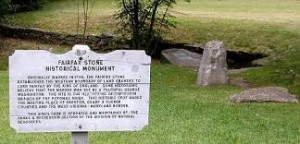 The “Fairfax Stone Historical Monument” sign is no longer at the park, just the stones plus a picnic table, trash can and small parking area.
The park is maintained by staff from Blackwater Falls State Park.
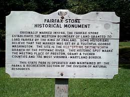
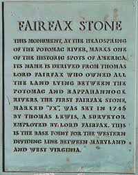
“This four-acre park is the location of the Fairfax Stone, a surveyor’s marker and boundary stone used in the 1700s to settle a boundary dispute over land in the English colonies of Maryland and Virginia. One of the oldest markers in the United States, this stone rests at the junction of Tucker, Grant and Preston counties and marks the boundary between Maryland and West Virginia.”
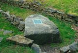 “The Fairfax Stone marks the western boundary of land granted to Lord Fairfax by the King of England in the 1700s. Two centuries later, the stone was used to determine the boundary between West Virginia and Maryland. Over the years, the stone has been changed out for various reasons. The current Fairfax Stone, the fifth, was dedicated as a state historic monument and became part of the West Virginia State Park system in 1957 when the Western Maryland Railroad gave four acres of land surrounding the stone to the state. In 1970, the stone was listed on the National Register of Historic Places.”
Explore WV DNR’s “Fairfax Stone State Park” Website
View WV DNR’s “Fairfax Stone State Park” Brochure pdf (2010)
(2:55/2020/On the Road in West Virginia: Our 55 Counties)
———————————————————————————————————————
HAWKS NEST State Park
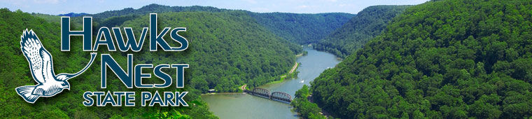
“Nestled in the heart of whitewater rafting country, Hawks Nest State Park is a 270-acre recreational area with a nature museum, aerial tramway, jetboat rides, hiking trails and one of the most challenging whitewater boating waterways in the nation. Its 31-room lodge offers luxurious rooms, fine dining and spacious conference and meeting facilities. Located near Ansted in Fayette County, about 10 miles north of the New River Gorge Bridge, Hawks Nest is known for its scenic overlook, which provides a bird’s eye view of the rugged New River Gorge National River below.”
“Long before Hawks Nest became a state park, the area was a nesting ground for numerous osprey and the site of a trail used by Native Americans. In the late 1800s, the portion of the Chesapeake and Ohio Railway running through the gorge was completed, and scattered most of the birds inhabiting Hawks Nest’s cliffs. In 1934, the Hawks Nest Dam and lake were completed. At the time, they were used to generate hydroelectricity for the growing manufacturing industry and for flood control.
“In 1935, the state of West Virginia purchased much of the property that is now Hawks Nest. In 1963, the Department of Natural Resources took control of the property and built the park lodge and other facilities that now draw visitors from nearly every state, to enjoy the scenic views of the New River Gorge.”
Explore WV DNR’s “Hawks Nest State Park” Website
View WV DNR’s “Hawks Nest State Park” Brochure pdf (2013)
(2:29/2020/On the Road in West Virginia: Our 55 Counties)
“Hawks Nest Lodge Tour”
———————————————————————————————————————
HOLLY RIVER State Park
“With 8,101 acres of dense forest, Holly River is West Virginia’s second largest state park. Located in a narrow valley in the Mountain Lakes region, the park is surrounded by heavily forested mountains, some reaching more than 2,800 feet in height. The dense forests of Holly River provide guests with a natural setting where they can find peaceful solitude. Recreational opportunities in this park include camping, hiking, swimming and tennis. Amenities include picnic shelters, the Holly River Restaurant and corrals for campers with horses. Holly River State Park is known for a wide range of flora, including wildflowers and ferns.”
“The area now known as Holly River State Park was settled around 1870 by a group of immigrants from Switzerland. After years of the land being stripped of useful timber, the U.S. Department of Agriculture began purchasing land, and in 1937 began reforesting and restoring the area to the deep woodlands enjoyed by visitors today. In 1938, Holly River was designated a wildlife refuge and opened as an official state park, but it wasn’t until 1954 that the federal government deeded the land to the state of West Virginia. Since then, many trails have been blazed, cabins have been refurbished and campsites have been constructed. Other improvements have included the construction of game courts, a swimming pool and other outdoor recreational facilities enjoyed by hundreds of visitors each year.”
Explore WV DNR’s “Holly River State Park” Website
View WV DNR’s “Holly River State Park” Brochure pdf (2011)
(2:27/2019/On the Road in West Virginia: Our 55 Counties)
———————————————————————————————————————
—————————————————-
LITTLE BEAVER State Park
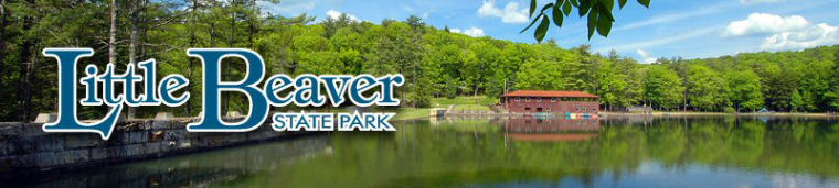
“Little Beaver State Park is a 562-acre day-use park that features many outdoor recreational opportunities. At the center of the park is an 18-acre lake where anglers may fish year-round. Nearly 20 miles of trails challenge hikers, while picnic areas are perfect for family get-togethers and reunions.”
“Little Beaver State Park was established in 1972 as a day-use park, but the site had been a recreational attraction for 4-H campers and anglers since the 1940s when the damming of Little Beaver Creek created an 18-acre lake. In 2011, the park was upgraded with 46 camping sites, expanding opportunities for this popular family reunion and vacation destination.”
Explore WV DNR’s “Little Beaver State Park” Website
View WV DNR’s “Little Beaver State Park” Brochure pdf (2012)
(2:18/2020/On the Road in West Virginia: Our 55 Counties)
———————————————————————————————————————
LOST RIVER State Park
“Located in the wooded mountains of Hardy County in West Virginia’s Eastern Panhandle, Lost River State Park provides cabin lodging and an abundance of outdoor recreation. The park’s quiet 3,712 acres of woods provides a secluded getaway for nature lovers. Lost River is known for its Cranny Crow overlook on top of Big Ridge Mountain, which offers a commanding view of five counties.”
“Lost River State Park is located near the site of the 1756 Battle of Lost River, a battle fought during the French and Indian War. It’s also home to the Lee Cabin, the home of Henry “Lighthorse Harry” Lee, a Revolutionary War general and father of Civil War General Robert E. Lee. The restored cabin is across the creek from Lee Sulphur Spring, known for its sulfuric smell and rumored healing properties. Built by the Civilian Conservation Corps, Lost River State Park opened in 1937.”
Explore WV DNR’s “Lost River State Park” Website
View WV DNR’s “Lost River State Park” Brochure pdf (2013)
(2:31/2020/On the Road in West Virginia: Our 55 Counties)
———————————————————————————————————————
MONCOVE LAKE State Park
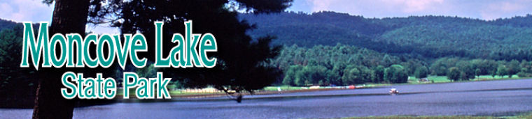
“Moncove Lake State Park offers a peaceful setting for families to enjoy the outdoors. The park is a popular destination for outdoor social gatherings, quiet strolls, camping and water recreation. This 250-acre park contains a larger, 500-acre wildlife management area. Located in the hills of the southeastern edge of the state, near Union in Monroe County, the park offers many opportunities for fishing, hunting, boating, swimming, birdwatching and hiking.”
“The Moncove Lake area was established in 1960, following the damming of Devil Creek in eastern Monroe County. The lake was built as part of the Moncove Lake Hunting and Fishing Area. In 1991, 250 acres were set aside as a state park. The remainder of the land continues to be managed as a wildlife management area.”
Explore WV DNR’s “Moncove Lake State Park” Website
View WV DNR’s “Moncove Lake State Park” Brochure pdf (2011)
(2:22/2020/On the Road in West Virginia: Our 55 Counties)
———————————————————————————————————————
NORTH BEND State Park
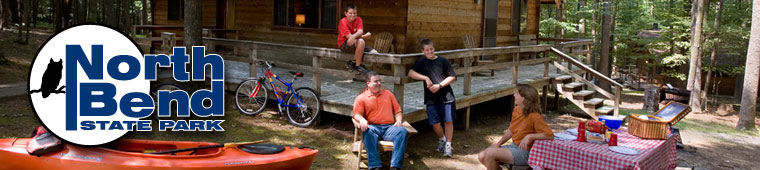
“Found among the Mid-Ohio Valley’s rolling hills, lakes and streams, North Bend State Park offers a multitude of recreational facilities in a beautiful pastoral setting. Named for the horseshoe curve of the North Fork of the Hughes River, this year-round park is lush with fishing streams, hiking trails and abundant wildlife. Located near Cairo and Harrisville, North Bend State Park is best known for the 72-mile North Bend Rail Trail, which follows an abandoned B&O Railroad corridor with several tunnels along the way.”
“Development of North Bend State Park began in 1951 when the state Legislature allotted funds to purchase land in Ritchie County. By 1954, the state had purchased 1,405 acres for the park. The park is located in West Virginia’s historic oil and gas fields. About 50 wells, dating from the 19th century, were once active in the present park area, and visitors may still see a few still standing around the park. As the park grew in popularity over the years, the lodge, campgrounds and recreational facilities were added to accommodate the growing number of visitors.”
Explore WV DNR’s “North Bend State Park” Website
View WV DNR’s “North Bend State Park” Brochure pdf (2011)
(2:46/2020/On the Road in West Virginia: Our 55 Counties)
———————————————————————————————————————
PINNACLE ROCK State Park
“Located on U.S. Route 52 near Bramwell in Mercer County, Pinnacle Rock State Park is known for the 3,100-foot sandstone formation that gives the park its name. The roadside park includes a wooded area with picnic facilities, hiking trails and a fishing lake. An overlook from atop Pinnacle Rock is a popular destination for park visitors.”
“Pinnacle Rock State Park was established in 1938 when the Conservation Commission purchased a 26-acre tract of land surrounding the 3,100-foot- high Pinnacle Rock. Parking areas, a walkway and the picnic shelter were then constructed by the Works Progress Administration in conjunction with the state of West Virginia. Today, the park has more than 400 acres and includes Jimmy Lewis Lake.”
Explore WV DNR’s “Pinnacle Rock State Park” Website
View WV DNR’s “Pinnacle Rock State Park” Brochure pdf (2011)
(1:30/2021/On the Road in West Virginia: Our 55 Counties)
———————————————————————————————————————
—————————————————-
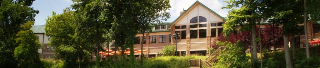
PIPESTEM RESORT State Park

“Pipestem Resort State Park sits on the east rim of the Bluestone River Gorge, which carves through the plateau to the scenic Bluestone River 1,200 feet below. The 4,050-acre park is located on the border of Summers and Mercer counties and features two hotels, one of which lies at the bottom of the gorge and can only be accessed by an aerial tramway. In addition to canyon floor sites, Pipestem offers elevated views from the Bolar Lookout Tower overlook.”
“Pipestem Resort State Park is West Virginia’s premier family adventure resort. . . Pipestem offers something for everyone including exhilarating zipline tours, guided trout fishing trips, mountain bike excursions, rock climbing and more. Spend some time on the water at the park’s new adventure lake and splash park or set out on a kayaking and stand-up paddle board tour, tubing or whitewater adventure on the Bluestone River. The sprawling 4,050-acre park is located on the border of Summers and Mercer counties and features 26 cabins and two lodges, one of which can only be accessed by riding the park’s aerial tramway to the bottom of the Bluestone River Gorge. Just 20 minutes down the road you’ll find even more to do at Bluestone State Park on the banks of Bluestone Lake. If you’re looking for outdoor activities, stunning mountain views and opportunities to make cherished memories with your family, Pipestem is the place to be.”
“Pipestem Resort State Park gets its name from the native pipestem or meadowsweet plant. Native Americans and early pioneers used the hollowed-out twigs as shafts for tobacco pipes. For generations, the descendants of Scotch, Irish and English farmers farmed the relatively flat plateau on the east side of the Bluestone River Gorge. The land was rich in beauty but poor in jobs. In the 1960s, West Virginia received financial assistance to buy property to create a park that would attract visitors who could help grow the local economy. The park was built with grants provided by the Area Redevelopment Administration of the U.S. Department of Commerce under the administration of President John F. Kennedy. The park officially opened on Memorial Day 1970.”
Explore WV DNR’s “Pipestem Resort State Park” Website
View WV DNR’s “Pipestem Resort State Park” Brochure pdf (2011)
View WV DNR’s Pipestem Resort State Park “Canyon Tramway Map” pdf
(3:01/2021/On the Road in West Virginia: Our 55 Counties)
———————————————————————————————————————
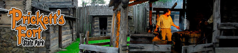
PRICKETT’S FORT State Park
“Prickett’s Fort State Park, located five miles north of Fairmont in Marion County, features a reconstruction of the original Prickett’s Fort, which served as a place of refuge during colonial times. This historical park commemorates late 18th-century life on the Virginia frontier. This day-use park is open mid-April through the end of October. After Labor Day, several attractions are closed on Mondays and Tuesdays. Visitors may enter the park free of charge, but some attractions, such as the fort, charge admission.”
“Perched on a small rise overlooking the confluence of Prickett’s Creek and the Monongahela River, this rustic log fort is a re-creation of the original Prickett’s Fort of 1774, which served as a refuge from Native American war parties on the western frontier of Colonial Virginia. Built in 1976 by the Prickett’s Fort Memorial Foundation, the “new” fort serves as a living history site where interpreters recreate late 18th century lifestyle through period attire and demonstrations of a variety of colonial crafts. Throughout the season, visitors may find blacksmiths, spinners, weavers and other traditional artisans at work, and a gun shop which features the only public demonstrations of 18th century firearm manufacturing in the state.
“When the threat of Native American uprisings occurred, up to 80 families from the surrounding countryside would hurry to the fort. They would stay as long as the threat existed, for days or even weeks. “Forting up” was simply tolerated by settlers, as life in the cramped quarters could be unpleasant. Such sacrifices were necessary for survival on the dangerous frontier of the late 1700s. Today’s fort, just north of Fairmont, still portrays that life and time.
“Just south of the fort stands the Job Prickett House, built in 1859 by the great grandson of Capt. Jacob Prickett, for whom the fort was named. The difference between the 18th century historical reconstruction and the original 19th century house illustrates the development of an increasingly civilized lifestyle and the availability of mass-produced furnishings through an 85 year span of time. The house is listed on the National Register of Historic Places and contains antiques originally used by the Prickett family.”
Explore WV DNR’s “Prickett’s Fort State Park” Website
View WV DNR’s “Prickett’s Fort State Park” Brochure pdf (2013)
———————————————————————————————————————
STONEWALL RESORT State Park

“Just minutes off I-79, Stonewall Resort State Park offers a secluded retreat tucked in to the hills alongside Stonewall Jackson Lake. With a lodge, cottages, campgrounds, three restaurants, and a wide variety of recreational offerings from boating to golf, the resort has amenities and accommodations to suit all ages.”
“Stonewall Jackson Lake State Park was completed in 1990. The park and associated lake were a project of the U.S. Army Corps of Engineers who purchased the property to construct a flood control dam. A portion of the lake covered the former site of Roanoke, WV, which was completely flooded in over 60 feet of water. The finished dam was put in service in 1988. Today, the state park is known as Stonewall Resort State Park.”
“The park is home to an interesting archeological curiosity. A total of 150 unique stone structures, called cairns, are scattered throughout Stonewall Resort State Park. Cairns are man-made structures, ranging from loose piles of stones to fully-formed stone towers. The structures are found throughout the world, which is evidence of historic construction by a variety of cultures. Previously, they have been associated with navigation, natural resource indicators, fortification, burial markings and as indications of former battlefields. These mysterious structures have been remarkably difficult to date. Historians are unsure of who built the cairns or what their original purpose might have been. Some believe they might have been constructed by Native Americans. Also, a 150-foot section of wall can be found at the park, running parallel to the Hevener’s Orchard Trail. Local historians claim that the structures do not fit the pattern of fortification structures, ruling out the possibility of Civil War soldiers constructing them. For now, the origin of the stonework remains a mystery for both historians and archeologists.”
“Stonewall Resort State Park is one of West Virginia ’s newest state parks. The park and lake were completed in 1990 as a project of the U.S. Army Corps of Engineers, which purchased the property to build a flood control dam. The lake and state park are named after Confederate General Stonewall Jackson, who was born in Clarksburg and raised in nearby Jackson’s Mill. Since 2002, Stonewall Resort has been operated by a private developer in partnership with the state.“
Explore “Stonewall Resort State Park” Website
Explore WV DNR’s “Stonewall Resort State Park” Website
View WV DNR’s Stonewall Resort State Park “Park Map and Trails” pdf
(Though owned by the State, Stonewall Resort State Park is managed by a private company. It does not have a WV DNR Brochure.)
(2:42/2019/On the Road in West Virginia: Our 55 Counties)
———————————————————————————————————————
SUMMERSVILLE LAKE State Park

“. . . The 177-acre park is perched on the northern shore of the state’s largest and most picturesque lakes. The lake has been a national and international destination known for its clear blue waters and unique rock formations since opening in 1966. Estimates show more than 1 million visitors enjoy watersports there each year. The new park, just off US-19, will immediately open the lake to additional recreational activities such as hiking, biking, and picnicking. The new park also includes an additional parking lot for those coming to enjoy the incredible views and world-class outdoor recreation.”
“The site is slated to be developed through a public-private partnership and the amenities will make it the greatest outdoor adventure park in the country. Planned amenities include additional climbing and bouldering opportunities, hiking and biking trails, water activities, aerial sports, camping, cabins, and more. . .”
Explore WV DNR’s “Summersville Lake State Park” Website
———————————————————————————————————————
TOMLINSON RUN State Park
“Located near the foremost tip of the Northern Panhandle along the Ohio River, Tomlinson Run can claim the title of West Virginia’s “top park.” This park’s wide range of recreational opportunities attract local and out-of-state visitors and include camping, picnicking, boating, miniature golf, swimming, basketball and volleyball. The park’s 1,398 acres are roughly divided into two sections: a wilderness area with heavily forested hills, overhanging cliffs of sandstone and shale, and many wildflowers and fauna, and a developed area with traditional park offerings.”
“Tomlinson Run State Park was built where several grist mills operated in the 1800s. In the 1930s, land was purchased and developed into a state park, with construction supervised by the National Conservation Commission. The park opened in 1940, and over the following years, buildings and other facilities were constructed for various purposes, many of which are still in use today. Several improvements have been made in recent years, including a swimming pool, an expanded campground and the addition of yurts, for a new type of camping experience.”
Explore WV DNR’s “Tomlinson Run State Park” Website
View WV DNR’s “Tomlinson Run State Park” Brochure pdf (2013)
(2:32/2020/On the Road in West Virginia: Our 55 Counties)
—————————————————-
TU-ENDIE-WEI — POINT PLEASANT BATTLE MONUMENT State Park

“Located on four acres in Point Pleasant, West Virginia, Tu-Endie-Wei State Park is home to an 84-foot granite monument commemorating the frontiersmen who fought and died in the 1774 Battle of Point Pleasant. The monument was erected in 1909, and rests where the Kanawha and Ohio Rivers meet. The name Tu-Endie-Wei is a Wyandotte word meaning “point between two waters.” Tu-Endie-Wei is day park open year-round.”
“At the junction of the Ohio and Kanawha Rivers, Tu-Endie-Wei stands as a monument to commemorate the frontiersmen who fought and died at the Battle of Point Pleasant. On October 10, 1774, Colonel Andrew Lewis’ 1,100 Virginia militiamen decisively defeated a like number of Native Americans lead by the Shawnee Chieftain Cornstalk in a bloody, day-long battle. At the end, 230 Native Americans were killed or wounded and more than 50 Virginians had lost their lives, including Colonel Charles Lewis, brother of the commanding officer. Considered a landmark in frontier history, some believed the battle to be the first of the American Revolution. This action broke the power of the ancient Americans in the Ohio Valley and quelled a general war on the frontier. Significantly, it also prevented an alliance between the British and Native Americans, one which could very possibly have caused the Revolution to have a different outcome, altering the entire history of the nation. In addition, the ensuing peace with the Native Americans enabled western Virginians to return across the Allegheny Mountains to aid Revolutionary forces. The battle is recognized as the decisive engagement in a proactive series of Indian wars.”
Explore WV DNR’s “Tu-Endie-Wei – Point Pleasant Battle Monument State Park” Website
View WV DNR’s “Tu-Endie-Wei – Point Pleasant Battle Monument State Park” Brochure pdf (2011)
(3:29/2021/On the Road in West Virginia: Our 55 Counties)
———————————————————————————————————————
TWIN FALLS RESORT State Park
“Set on a high, wooded ridge in the rugged mountains of Wyoming County in southern West Virginia, Twin Falls Resort State Park is the ideal site for nature lovers. With multiple lodging options, more than 25 miles of hiking trails, a championship golf course and its restored Pioneer Farm, Twin Falls offers an abundance of recreation and relaxation for guests of all ages.”
“Twin Falls Resort State Park was named for Foley Falls and Black Fork Falls, which are found on park grounds. The park was built on 3,776 acres of land donated in 1964 by the Western Pocahontas Corporation and Pocahontas Land Corporation. In the following years, a golf course, cabins and swimming pool were constructed. The lodge was completed in 1970. During the park’s development in the mid-1970s, a pioneer homestead was reconstructed, and has since become the crown jewel of the park. A major renovation to the lodge, completed in 2011, added 27 additional rooms, an indoor swimming pool and fitness center.”
Explore WV DNR’s “Twin Falls Resort State Park” Website
View WV DNR’s “Twin Falls Resort State Park” Brochure pdf (2011)
(2:26/2019/On the Road in West Virginia: Our 55 Counties)
———————————————————————————————————————
TYGART LAKE State Park
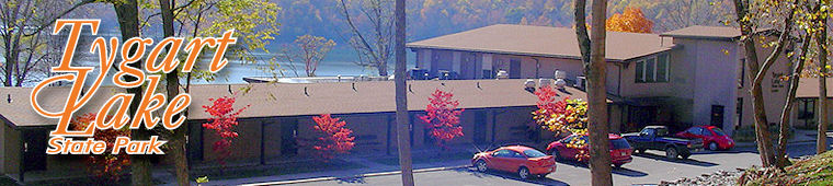
“Located in the foothills of the Allegheny Mountains in scenic north central West Virginia, Tygart Lake provides guests with some of the most breathtaking views across the state. This park is a cozy, quiet destination for couples and families. It’s also a perfect destination for group conferences and retreats. Located just four miles south of Grafton, Tygart Lake State Park is known for its 10-mile long, 1,750-acre lake, which offers watersports like boating, water skiing, scuba diving, swimming, kayaking, canoeing and fishing.”
“The land that is now Tygart Lake State Park was given to the state of West Virginia in 1945 in a deed from the U.S. government. Before that transaction, the area was under development to control and regulate the waters and tributaries of the Tygart Valley, West Fork, Monongahela and Ohio rivers. In 1938, the U.S. Corps of Engineers built a dam that created the Tygart River Reservoir, located two miles south of Grafton in Taylor and Barbour counties. The area quickly became popular with boating enthusiasts. Over the years, the park expanded to accommodate larger crowds of visitors. In 1953, the park opened its campgrounds, making it one of the first two parks in the state to offer camping. Cabins were added in 1955, and the park received additional funds in 1964 to construct a 20-room lodge.”
Explore WV DNR’s “Tygart Lake State Park” Website
View WV DNR’s “Tygart Lake State Park” Brochure pdf (2011)
(3:23/2019/On the Road in West Virginia: Our 55 Counties)
———————————————————————————————————————
VALLEY FALLS State Park
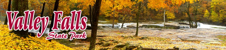
“Once the site of a lumber and grist mill community, Valley Falls State Park is a place of scenic beauty and historical significance. A series of four picturesque falls created by the dark, rushing waters of the Tygart Valley River distinguish this 1,145-acre park. In addition to its scenic charm, Valley Falls State Park offers outdoor recreation and fun. The day use park gates open at 7 a.m. and close at dark.”
“During the 1830s, a trader acquired what is now Valley Falls State Park and built a lumber mill which was later followed in 1847 by a grist mill. With the completion of the Baltimore & Ohio railroad line, from Grafton to Wheeling, in 1853, the community began to boom, with a ferry, post office, shops, a factory and schools. A fire in 1886, followed by floods two years later, destroyed much of the town. In 1964, the West Virginia state park system acquired the falls and surrounding land and created the Valley Falls State Park.”
Explore WV DNR’s “Valley Falls State Park” Website
View WV DNR’s “Valley Falls State Park” Brochure pdf (2013)
(1:49/2019/On the Road in West Virginia: Our 55 Counties)
———————————————————————————————————————
WATOGA State Park
“Located in the mountains of Pocahontas County, just 14 miles south of Marlinton, Watoga State Park is West Virginia’s largest state park. With 10,100 acres of land, Watoga is filled with many recreational activities. There’s hiking, swimming, fishing, boating and vacation cabins, open year-round. Watoga Lake is known for excellent fishing opportunities and is part of the Division of Natural Resources’ stocking program. A multipurpose building, museum and observation tower are a few of the unique attractions at Watoga State Park.”
“Watoga State Park’s name comes from the Cherokee word for “starry waters.” The park opened to the public in July 1937. Before then, it was a state forest designated as a wildlife and timber preserve. Work on developing the forest into a park began in 1934, but improvements stopped during World War II. After the war, work on the park resumed, and the first camping area opened in 1953, and eight deluxe cabins opened in 1956. Recreational use of the park increased during the 60s and 70s, requiring the addition of another camping area. Improvements and additions to the park continue to this day, with growing interest in outdoor activities and cabin lodging.”
Explore WV DNR’s “Watoga State Park” Website
View WV DNR’s “Watoga State Park” Brochure pdf (2013)
(2:14/2019/On the Road in West Virginia: Our 55 Counties)
———————————————————————————————————————
WATTERS SMITH MEMORIAL State Park
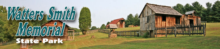
“The heritage of early West Virginia and the pioneer spirit of Watters Smith are both preserved in the homestead restoration at this 532-acre historical park. This historical park, located in Harrison County, features log cabins, period-accurate buildings and a museum that depicts pioneer life from 1796 to the early 1900s. The grounds are open to picnicking and hiking, and the park also is a popular site for birdwatching.”
“The land that is now Watters Smith Memorial State Park was settled in 1796 by Watters Smith and his wife Elizabeth. The couple built a home, farmed the land and raised eight children. In 1876, Smith’s great-grandson, Alexander, reconstructed the family’s original hand-hewn log cabin. The land was donated to the West Virginia Parks system in 1949 when Burr Smith willed the 236-acre farm to the state with instructions it be developed into a park honoring his great-great-grandfather. Today the cabin is used as one of two museums in the park. The farm was operated as a family business for four generations, and the implements on display in the museums and in the barns and sheds were used to keep it running.”
Explore WV DNR’s “Watters Smith Memorial State Park” Website
View WV DNR’s “Watters Smith Memorial State Park” Brochure pdf (2013)
(1:60/2020/On the Road in West Virginia: Our 55 Counties)
—————————————————————————————————————————————————————–
“WEST VIRGINIA STATE TRAILS”
“Rail Trails of West Virginia”
![]()

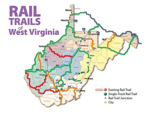 “More than 375 miles of WV train tracks have been converted into trails for walking, hiking, biking and horseback riding.
“The rail trails, with their gentle or level grades and wide rights of way, are easily accessible and among the most beautiful and scenic in the country. With almost 30 rail trails throughout the state, enjoying the outdoors becomes easy and fun for all ages!”
Explore West Virginia Tourism’s “Rail Trails” Website
Explore West Virginia Tourism’s “Rail Trails of WV” Brochure pdf (2010)
———————————————————————————————————————
ELK RIVER TRAIL

“Step outside and discover the scenic beauty of the Elk River along the Elk River Trail, the newest addition to the West Virginia State Parks system. The Elk River Trail currently stretches over 73 miles from Clendenin to Gassaway. The trail provides easy access to the Elk River for canoeing, kayaking or fishing and several beautiful waterfalls await along the trail. Thanks to its flat terrain, the Elk River Trail is perfect for all outdoor enthusiasts and nature lovers. The Elk River Trail is easily accessible from multiple exits off I-79.”
Explore WV DNR’s “Elk River Trail” Website
———————————————————————————————————————
GREENBRIER RIVER TRAIL
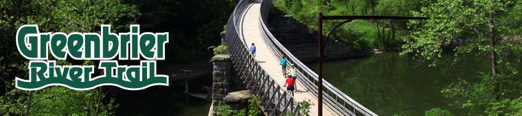
“The Greenbrier River Trail is a 78-mile former railroad now used for hiking, biking and horseback riding. It is the longest trail of its kind in West Virginia. The trail provides many breathtaking views as it passes through several small towns, crosses 35 bridges, goes through two tunnels and cuts through some of West Virginia’s most remote areas. The Greenbrier River Trail is one of 50 Millennium Legacy Trails in the United States, and was rated one of the top 10 hiking trails in the country by Backpacker Magazine. Part of the Greenbrier River Trail lies within a National Radio Quiet Zone so cell phones do not work.”
“The Greenbrier River Trail was once part of the famous Chesapeake & Ohio Railway and was used to carry timber and serve tanneries and other local businesses in the Greenbrier Valley. As the economy changed and the timber industry declined, the line was abandoned during the late 1970s. The tracks were removed in 1979, and the land was donated to the state of West Virginia. The abandoned rail bed was converted to a rail trail operated by the Parks and Recreation Section of the West Virginia Division of Natural Resources.”
“The Greenbrier River Trail runs parallel to the Greenbrier River, from the town of Caldwell to Cass Scenic Railroad State Park. Visitors may access the trail at numerous points along the way.”
Explore WV DNR’s “Greenbrier River Trail” Website
View WV DNR’s “Greenbrier River Trail” Brochure pdf (2011)
View WV DNR’s “Greenbrier River Trail” Map pdf
(2:52/2019/On the Road in West Virginia: Our 55 Counties)
———————————————————————————————————————
NORTH BEND RAIL TRAIL

“North Bend Rail Trail stretches 72 miles across north-central and western West Virginia. This wilderness path takes travelers across 36 bridges and through 10 tunnels and is part of the 5,500-mile American Discovery Trail, which spans the length of the United States. The trail has become one of the most renowned recreational trails through the Appalachians, and is known for its mountainous scenery and varied views of shaded tree canopies, rock cuts and farmland. Highlights include a 2,297-foot tunnel and the “haunted” Silver Run Tunnel.”
“The railroad that now makes up the North Bend Rail Trail was built by the Northwestern Virginia Railroad before the Civil War. The line was later sold to the Baltimore & Ohio Railroad and over the years, the line changed ownership and eventually was railbanked. In the 1980s, CSX Transportation sold the line to the state of West Virginia, which began converting it into a recreation trail for the state park system. Initial trail segments opened in 1991, with additional portions added over the next several years.”
“The North Bend Rail Trail runs parallel to U.S. Route 50, extending for 72 miles from the community of Wolf Summit west of Clarksburg at its eastern end to I-77 near Parkersburg at its western end. Visitors may access the trail at numerous points along the way.”
Explore WV DNR’s “North Bend Rail Trail” Website
View WV DNR’s “North Bend Rail Trail” Brochure pdf (2009)
View WV DNR’s “North Bend Rail Trail Trail” Map pdf
—————————————————————————————————————————————————————–
“WEST VIRGINIA STATE FORESTS”
“West Virginia Division of Forestry”

The West Virginia Division of Forestry (a separate entity from the West Virginia Division of Natural Resources) manages State Forests (except Kanawha.)
“As early as 1911, plans were made to establish State Forests in West Virginia. In 1927 a State Forest and Park Commission was created that consisted of the Governor, Commissioner of Agriculture, Director of Agricultural Extension, State Geologist and Executive Director of the Conservation Commission. Their duty was to determine the availability of land suitable to establish State Forests and Parks in the Mountain State.
“The West Virginia Legislature mandates that the State Forests are an important resource for silvicultural and scientific research; developed and undeveloped outdoor recreation; propagation of forest trees, fish and wildlife; wildlife and fisheries management; aesthetic preservation; hunting and fishing; timber production; and demonstration of state-of-the-art forest management and therefore should be managed on a multiple-use basis. The policy of the Division of Forestry is to manage each State-owned Forest for multiple benefits while guarding that the Division’s actions are ecologically responsible and economically viable.
“The mission of the West Virginia Division of Forestry is to protect and manage all State Forest resources through partnerships emphasizing a stewardship ethic. Forests provide a multitude of benefits and are a source of emotional, spiritual, and financial well being for the population in general. These benefits have tangible and intangible values. It has been said that the quality of life for modern man is in direct proportion to the health, quality, and abundance of the forest resource.
“The Division of Forestry’s goal is to meet the needs of the present without compromising the future. Through public involvement, interagency cooperation, the practice of silviculture, and the implementation of a natural resources stewardship ethic, the Division of Forestry satisfies its legislative mandate to serve the many needs of various user interests.”
Explore West Virginia Division of Forestry’s “Home Page” Website
![]()
———————————————————————————————————————
CABWAYLINGO State Forest
“Cabwaylingo State Forest is located on 8,123 heavily forested acres in southern West Virginia. The forest, located in Wayne County, gets its unique name from the four surrounding counties: (Cab)el, (Way)ne, (Lin)coln and Min(go). Cabwaylingo State Forest was one of the first parks established in West Virginia, and for years has been a vacation retreat for many.”
“Cabwaylingo State Forest was established in the 1930s, by the Civilian Conservation Corps, to rebuild forested land in Southern West Virginia. This effort was instrumental in getting the state’s park system established. Over the years, CCC workers built log cabins as well as the many trails and shelters still in use today.”
ABOUT THE FOREST
“Cabwaylingo State Forest derives its name from the counties it is intended to serve: Cabell, Wayne, Lincoln and Mingo. Land for the forest, totaling 6,196 acres, was purchased in 1933. Since that time, additional purchases have been made which make the forest’s present size 8,150 acres. The area of Cabwaylingo State Forest is not contiguous. There are several inside holdings.
“In July 1935, the Civilian Conservation Corps (CCC) set up a camp just across the Wayne County line, in Mingo County at the mouth of Poor Branch of Twelvepole Creek. This was known as Camp Twelvepole (or Aracoma). The young men of this CCC company worked on fire control, forest stand improvement, recreation development, wildlife feeding, surveys and stream improvement to benefit the forest and the surrounding area.
“Most of the land purchased to create Cabwaylingo State Forest was made up of small farms. One such farm was the homestead of Jennie Wiley, a brave pioneer woman who survived capture by Native Americans. Once the Wiley homestead was added to Cabwaylingo State Forest it was allowed to revert back into woodland. Due to the land’s history of farming, Cabwaylingo State Forest is a mosaic of trees in different stages of maturity. Cabwaylingo State Forest has experienced many destructive forest fires, due in large part to arson, debris burning and moon-shining. Because of the severity of many of the forest fires, parts of the forest were set back hundreds of years in developing to maturity.
“Two early timber harvests were conducted using the multiple-use forest management approach to prepare the forest for sustained management. One was conducted at Turkey Creek in 1956, while the other harvest was made in Gourd Branch in 1960. Seven harvests were conducted under the management plan developed in 1970 beginning in the early 1980s in the form of improvement cuts. These harvests ranged from 50 to 330 acres in size with volumes removed averaging just under 4,000 board feet per acre. These timber harvests not only improved the remaining timber by removing fire- and storm-damaged trees but they also improved wildlife habitat, while providing hiking and other recreational opportunities on the forest. Today, these areas are now fully stocked with mature trees. Cabwaylingo State Forest serves as a testament to proper forest management revitalizing a fire-damaged forest.” (This information/history is from a deactivated Division of Forestry website.)
Explore WV Division of Forestry’s “Cabwaylingo State Forest” Website
Explore WV DNR’s “Cabwaylingo State Forest” Website
View WV DNR’s “Cabwaylingo State Forest” Brochure pdf (2009)
———————————————————————————————————————
CALVIN PRICE State Forest
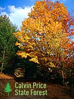
 “Located in eastern Pocahontas and Greenbrier counties, Calvin Price State Forest is covered in more than 9,000 acres of mixed hardwoods and pine. The forest is named in honor of the late Calvin W. Price, a Marlinton newspaper editor who advocated for the purchase and designation of this area as a state forest. Unlike most of the other state forests, Calvin Price is mostly undeveloped, and instead relies on nearby Watoga State Park, one of West Virginia’s largest parks. Of the forest’s 9,482 acres, only 93 are developed and maintained for primitive camping and picnicking.”
“Calvin Price State Forest is the newest addition to West Virginia’s park system, having been mostly purchased in 1953 from the New River Lumber Company. The forest was heavily logged between 1880 and 1920. In the early 1900s, a large tract of timber was harvested by the Maryland Lumber Company. After the land was sold by the company in 1922, it was divided into two sections and resold. The section north of Laurel Run became part of Watoga State Park. The southern tract was purchased by the New River Company and sold to the state in 1953. It was dedicated on May 15, 1954.”
ABOUT CALVIN PRICE STATE FOREST
“Calvin Price State Forest was the last to be added to the West Virginia State Forest system. This State Forest is named in honor of the late Calvin W. Price, a Marlinton newspaper editor, prominent citizen, and leading proponent of the purchase and ultimate designation of this area as a State Forest. Calvin Price State Forest consists of more than 9,400 contiguous acres located in southern Pocahontas County, adjacent to Watoga State Park, near Hillsboro. A small area in the southeast part of the Forest extends into Greenbrier County. The bulk of the Forest was purchased from the New River Lumber Company in 1953.
“The first settlers to this area found vast stands of pine trees that reached a maximum development of approximately 100,000 board feet per acre. After harvesting pine stands in New England and the Great Lakes areas in the 1880s, loggers traveled to the Greenbrier River Valley to harvest this untapped resource. By the 1930’s the task was completed and domestic farming was the predominate activity in the area. When the land was purchased in 1953 the forest had been largely cut over and the land was being heavily grazed by livestock.
“The rich, moist sites of Calvin Price State Forest are home to a high quality mix of oaks and yellow poplar. Current oak stands rarely exceed 15,000 board feet per acre, but are highly valued in today’s multiple-use management scheme. White pine is re-establishing a presence on many managed areas, as well as, poorer, less productive sites. Drier areas of the Forest primarily still produce white pine, which also is found along most of the stream bottoms. Today, pure stands of white pine only are found along the streams of the Forest, with volumes currently approaching 30,000 board feet per acre.
“Unlike most of the other State Forests, Calvin Price has no developed recreational areas. This is due largely to the Forest’s close proximity to Watoga State Park, one of West Virginia’s largest recreational parks. Some primitive camping areas are available at Calvin Price State Forest. Hunting opportunities abound on Calvin Price State Forest for both small game and large game hunters. Nearly two-thirds of the Forest is accessible only by foot.
“Immediately upon acquiring this land in 1953, foresters began using the multiple-use forest management approach. Much of the early work was intended to prepare the forest for sustained management. Some small pulpwood and rail harvests were conducted and some timber stand improvement work was done. A management plan was implemented in the 1970s but harvesting had to be done earlier than expected. A severe ice storm in 1979 felled about 400 acres of timber, necessitating salvage operations. Since that time another harvest has been conducted and a third is scheduled for completion in late 2004. These three harvests average 355 acres in size and will remove about 1.2 million board feet per harvest. The focus of forest management on Calvin Price is directed toward maintaining the vigorous growth and good health of the Forest. These harvests are focused on diseased, damaged, suppressed, or overstocked stands, removing only those trees necessary to sustain productive woodlands while providing for a diverse mixture of wildlife habitat.” (This information/history is from a deactivated Division of Forestry website.)
Explore WV DNR’s “Calvin Price State Forest” Website
Explore WV Division of Forestry’s “Calvin Price State Forest” Website
(Calvin Price State Forest is managed and maintained by adjacent Watoga State Park and the WV Division of Forestry. It does not have a separate brochure.)
———————————————————————————————————————
CAMP CREEK State Forest
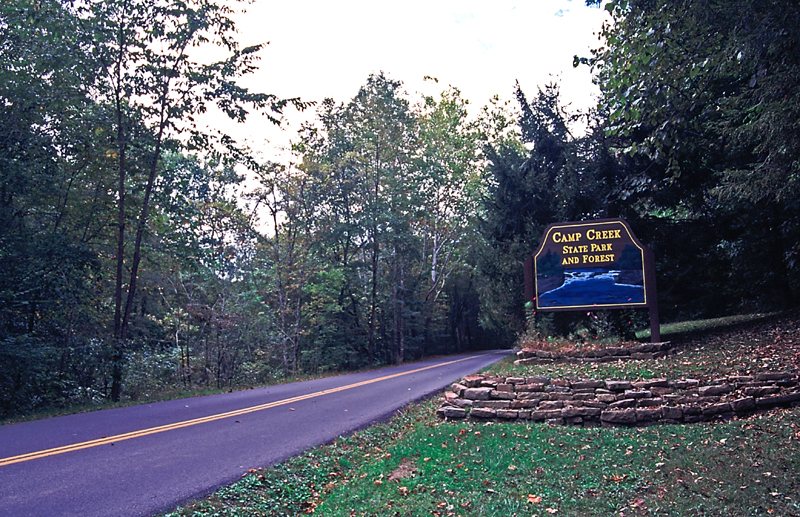 “Camp Creek State Park and Forest is known for beautiful waterfalls and great camping. With nearly 6,000 acres of lush forest, 35 miles of trails and seven miles of seasonally stocked trout streams, there is something for every hiker, biker, horseback rider and angler to explore and enjoy. Located in Mercer County, two miles off Interstate 77, Camp Creek is ideal for family vacations and stop-overs during a long drive through the beautiful mountains of southern West Virginia.”
—–
“Camp Creek State Park became part of the West Virginia parks system in 1987 after 550 acres were marked off from the existing Camp Creek State Forest. The name of Mash Fork, one of the park’s streams, suggests a moonshining past not uncommon in the region.”
CAMP CREEK STATE FOREST
“Camp Creek State Forest is located in the northern part of Mercer County, 16 miles north of Princeton and 19 miles south of Beckley. The forest comprises 5,269 acres, 487 acres of the original Forest were made a State Park by the Legislature in 1988.
“The area in and around Camp Creek State Forest is rich in history and has played an important part in the development of this section of the county. The name Camp Creek was derived because the area was considered good for camping by the troops during the Civil War. At the turn of the century, a grist mill, band saw, and store were established in the Campbell?s Falls area of the Forest. Mountaintop farms removed about one third of the original forest. The original forest was primarily oak and chestnut on the ridges with yellow poplar, hemlock and white pine occupying the bottoms. In the mid 1930’s Blue Jay Lumber Company logged the forested areas. Several logging camps were built and a narrow gauge railroad was built up Camp Creek, with a spur up Mash Fork, over Flat Top Mountain to Blue Jay near Beckley in Raleigh County. Logs were hauled by Shay locomotives over these tracks to the company sawmill, twenty miles away. Approximately sixty million board feet of timber were cut from the existing forest in a five year period. A major fire swept the entire area soon after logging operations were completed. The current forest is primarily of sprout origin, with the exception of the yellow poplar, pines, and hemlock which are of seed origin.
“In 1945, the state of West Virginia began purchasing land for the establishment of Camp Creek State Forest. Sixteen tracts of land were purchased in all. The largest tract was 4,775 acres purchased from Blue Jay Lumber Company. A part of this land was originally the old McCullough tract which had been deeded to Robert McCullough in 1795 by the Commonwealth of Virginia. Some small farms were within the boundary of the Blue Jay Lumber Company holding and all but one of these was purchased to be part of Camp Creek State Forest. In 1951 the Legislature appropriated funds for the development of recreational facilities on Camp Creek State Forest. The forest was opened for general public use in the summer of 1953.
“Camp Creek is stocked with trout in the spring, and the head waters of Camp Creek have been stocked periodically with trout fingerlings. These streams are below areas of active forest management. Excellent small game, deer and turkey hunting can be found on the State Forest.
“The entire forest is crisscrossed with roads, many of which were originally farm access roads. Many of these old roads have been upgraded during harvest operations and natural gas exploration activities and some new roads have been built. Seeded haul roads are used as trails for mountain bikes and horses. Some roads are important brood habitat for wild turkey and are closed to mountain bikes and horses.
“The first planned harvests on Camp Creek State Forest have been conditioning cuts to improve the form, vigor, and diversity of the stands. Since1980 there have been four harvests conducted under the 1970 plan. These harvests averaged 340 acres in size and removed an average of 3,500 board feet per acre. An average of 1.3 million board feet were removed per harvest. Trees that were overmature, declining, or of poor form or condition were removed. The remaining trees have less competition allowing them to grow faster resulting in a healthy and vigorous stand.” (This information/history is from a deactivated Division of Forestry website.)
Explore WV DNR’s “Camp Creek State Forest” Website
Explore WV Division of Forestry’s “Camp Creek State Forest” Website
(Camp Creek State Forest is managed and maintained by adjacent Camp Creek State Park and the WV Division of Forestry. It does not have a separate brochure.)
———————————————————————————————————————
COOPERS ROCK State Forest
“It’s all about the views at Coopers Rock State Forest. Located 13 miles from Morgantown, a few minutes off Interstate 68, the forest has many overlooks of the canyon section of the Cheat River that offer breathtaking views in any season. The forest is an ideal getaway, and has numerous historical sites, hiking trails and recreational opportunities amongst the forest’s enormous boulders and cliffs.”
“Coopers Rock State Forest is named for Coopers Rock, a series of sandstone cliffs above the Cheat River Gorge. Legend has it that a fugitive hid near what is now the overlook. A cooper by trade, he continued to make and sell barrels from his mountain hideout. During the 1800s the iron industry flourished in the area that is now Coopers Rock. Today the remains of the Henry Clay Furnace – the first steam-powered blast furnace in western Virginia – is a popular hiking and biking destination in the forest. The forest proper was established in 1936. Many of its structures, including the main overlook, picnic shelters and superintendent’s house, were built by the Civilian Conservation Corps during the Great Depression. Eleven of these structures have been listed on the National Register of Historic Places.
“At approximately 12,747 acres, Coopers Rock State Forest is the largest in the West Virginia State Forest system. Located 13 miles east of Morgantown and eight miles west of Bruceton Mills, Coopers Rock is easily accessed by Exit 15 of Interstate 68. The spectacular scenic view from the Coopers Rock Overlook and the numerous hiking and biking trails make this State Forest one of the most visited areas in West Virginia.”
History of Coopers Rock State Forest
“The area in and around Coopers Rock State Forest is rich in history and has played an important part in the development of this section of the county and state. As early as 1911, the idea to examine land suitable for state forests was documented. In 1927 a State Forest and Park Commission was created. It consisted of the Governor, Commissioner of Agriculture, Director of Agricultural Extension, State Geologist and Executive Director of the Conservation Commission. Their duty was to determine the availability of land suitable for state forests and parks.
“The early history of Coopers Rock revolves around the iron ore industry. The discovery of low-grade iron ore plus limestone in the Chestnut Ridge area, combined with the abundance of hardwoods for charcoal, made this locality ideal for iron manufacturing. Beginning around 1798 many iron furnaces were constructed in the area, including the Henry Clay Iron Furnace in 1834. Most of the furnaces were located near outcroppings of limestone, and vast amounts of timber were cut near the furnaces. The heaviest cuttings were in the immediate vicinity of the furnaces but spread outward as time progressed. Many old roads exist on the forest as a result of the iron ore industry and the lumber industry that followed. The Cheat Mountain iron industry gradually declined after 1848, and in 1868 suspended operations. This decline was precipitated by the discovery of rich iron ore deposits in the Great Lakes region and the continued problem of poor local transportation.
“In 1900, American chestnut, white oak and red oak were selectively cut to make telephone poles, crossties and shingles. The remaining timber was cut from 1912 into the 1930s, with peak years 1924 and 1925. Everything, except scattered cull trees, was taken because of the various timber markets.
“In 1936, the West Virginia Conservation Commission purchased approximately 12,863 acres from the Lake Lynn Lumber and Supply Company to manage as Coopers Rock State Forest. Two additional purchases increased the Forest by 180 acres. In 1970, a right-of-way was granted to the WV Department of Highways for the construction of Corridor E, now known as Interstate 68, thus reducing the forest by 296 acres.
“During the Great Depression, the Civilian Conservation Corps (CCC) was brought in to develop the land for public use and to suppress forest fires. The local camp, named Camp Rhododendron, was constructed near Fairchance Road (State Route 857) on Kelly Run. Young men, ages 18 to 25, were put to work under the guidance of the U.S. Forest Service building roads, structures, ditches and bridges, as well as planting trees and performing other arduous labor. Their most astounding work was the connection of the Overlook to the ridge top. This was done by constructing a bridge and carving out the stone steps that are still present today. Much of their other construction work is still present, such as the superintendent’s residence, picnic shelters, and the WVU Forest Manager’s residence.
“In 1959, approximately 7,068 acres were leased for 99 years to the Board of Governors of West Virginia University, for use as a research and teaching forest. This area lies north of Interstate 68, and is now known as West Virginia University Research Forest, or ‘University Research Forest ‘ ” (This history is from a deactivated Division of Forestry website.)
Explore WV Division of Forestry’s “Coopers Rock State Forest” Website
Explore WV DNR’s “Coopers Rock State Forest” Website
View WV DNR’s “Coopers Rock State Forest” Brochure pdf (2010)
“Coopers Rock State Forest – A Short Film by Alex Wilson”
“Coopers Rock is a 12,747 acre state forest in Preston and Monongalia Counties in West Virginia. Established in 1936, it is most famous for its Cheat River Canyon Overlook but it also has 50 miles of hiking and biking trails, sandstone cliffs for climbing and bouldering and the remains of an abandoned town around what was the first steam-powered blast furnace in western Virginia.” (2:42/2020/Alex Wilson)
—————————————————-
GREENBRIER State Forest
“Located in the southeastern corner of the state, near the border of Virginia, Greenbrier State Forest encompasses 5,100 acres of forested, mountainous terrain. After spending the day hiking, biking and exploring nature’s playground, guests may relax in one of the forest’s completely furnished cabins. Trips to Greenbrier State Forest provide much needed seclusion and relaxation, but day trips to nearby Lewisburg and White Sulphur Springs are an option, should guests wish to shop and dine in these charming towns.”
“This 5,133-acre forest was purchased by the State of West Virginia from the White Sulphur Springs Park Association in 1938. That same year, the Civilian Conservation Corps established Camp White Sulphur, in the area that presently houses the Forest headquarters and swimming pool. The forest, which stands divided by 3,280-foot high Kate’s Mountain, is rich in Native American history dating back to the 1700’s.”
ABOUT GREENBRIER STATE FOREST
“Greenbrier State Forest is located in southeastern Greenbrier County, two miles west of White Sulphur Springs. The forest can be accessed from U.S. Route 60 or by exiting I-64 and traveling one mile south on Secondary State Route 60/14.
“This 5,133 acre forest is bisected by Kate’s Mountain, named for Kate Carpenter who survived an Indian raid by hiding with her infant in a hollow log. The first settlers in the area cleared land for their farms and started a tradition of burning to help establish herbaceous material for their cattle to graze. This burning and grazing practice continued for decades.
“Prior to the establishment of a timber industry in this portion of the State, the original forest was primarily oak, hard pine and chestnut on the ridges with yellow poplar, hemlock, and white pine occupying the bottoms. The forest was cut over around the turn of the twentieth century. The current forest is primarily of sprout origin, with the exception of the pines and hemlock which are of seed origin.
“Much of the mature timber on the forest carries scars and decay from years of repeated burning. After early settlers and farmers stopped setting fires for agricultural benefits, blazes set by trains became a serious problem. Trains, attempting to slow down on steep grades, threw hot cinders from coal burning engines and pieces of hot brake shoes that set many fires on the area that would become Greenbrier State Forest.
“In 1938, the State of West Virginia purchased what is now Greenbrier State Forest from the White Sulphur Springs Park Association. That same year, the Civilian Conservation Corps (CCC) established Camp White Sulphur, in the area that presently houses the Forest headquarters and swimming pool. A company of men that had just completed work at Seneca State Forest moved in and began development work on Greenbrier State Forest.
“Greenbrier State Forest consists of many steep, rocky, parallel ridges and valleys that run perpendicular to Kate’s Mountain toward Howard’s Creek. More branching and rolling ridges are found on the other side of the mountain toward Quarry Hollow. These dry shale ridges make for an interesting landscape and challenging hiking conditions. The deep moist hollows are rich with herbaceous plants in contrast to dry, rocky ridges. In wet weather, streams disappear and reappear in their course down the rocky mountainside.
“The first harvest under the management plan of 1971 was necessitated by a severe ice storm. A large quantity of dead and dying timber was salvaged, reducing fuel for forest fires while helping to condition the trees left standing. There were three additional harvests conducted under the 1971 plan. Including the salvage harvest, the average size of the harvests were 327 acres. These harvests removed on average about 3,000 board feet per acre and ranged from 400,000 to 1 million board feet per harvest. The planned harvests on Greenbrier State Forest have been conditioning cuts to improve the stand. Trees that are over-mature, declining, of poor form or condition are removed. The remaining trees have more room to develop allowing them to grow faster and produce a healthy and vigorous stand.
“Greenbrier State Forest boasts a 29-acre small woodlot demonstration area developed to show how area farm woodlots can be managed for periodic income while maintaining a stand of trees of various sizes and ages. This demonstration area is located between the cabin and picnic areas.” (This information/history is from a deactivated Division of Forestry website.)
Explore WV Division of Forestry’s “Greenbrier State Forest” Website
Explore WV DNR’s “Greenbrier State Forest” Website
View WV DNR’s “Greenbrier State Forest” Brochure pdf (2009)
———————————————————————————————————————
KANAWHA State Forest
“Located seven miles south of Charleston, Kanawha State Forest is an outdoor lover’s haven. It is known for its extensive network of hiking and biking trails and has some of the state’s most popular picnic areas. The 9,300-acre forest is noted among naturalists for its diverse wildflower, tree and bird populations. Amenities include picnic shelters, playgrounds and camping.”
“The land that is now Kanawha State Forest originally was the site of extensive mining and logging. In 1937, the West Virginia Conservation Commission purchased 6,705 acres on the headwaters of Davis Creek outside of Charleston. The following year, Camp Kanawha was set up as a project of the Civilian Conservation Corps. The CCC removed coal tipples and other structures no longer in use and built roads, the superintendent’s residence and picnic shelters. A dam also was built across Davis Creek to create a small lake. After Camp Kanawha’s closure in 1942, the state acquired an additional 2,500 acres. The Kanawha State Forest Historic District was listed on the National Register of Historic Places in 1993.”
“Located just seven miles south of Charleston, West Virginia, Kanawha State Forest is in close proximity to the heavily populated Kanawha Valley and is a recreational haven. Some of the state’s most popular picnic areas are here, along with significant hiking, mountain biking, and cross-country skiing opportunities. A playground attracts families during the summer season and the fully equipped campground is one of the few in the Charleston area.
“Camping at Kanawha State Forest is remote in nature given the proximity to the state’s capitol city. Sites cater to camper units of 26-feet or less, pop-up and tent camping. Campsite reservations are available from Memorial Day through Labor Day weekends.
“The 9,300-acre forest is noted among naturalists for its diverse wildflower and bird populations. Rich cove forest sites provide nesting habitat for 19 species of wood warblers, a feature which draws birders from as far away as Canada. The forest offers some of West Virginia’s best special hikes in winter, spring and fall.” (This information is from a deactivated WV State Parks website.)
Explore WV DNR’s “Kanawha State Forest” Website
View WV DNR’s “Kanawha State Forest” Brochure pdf (2011)
———————————————————————————————————————
KUMBRABOW State Forest
“Located on top of Rich Mountain along the western edge of the Allegheny Highlands, Kumbrabow State Forest in Randolph County is West Virginia’s highest forest. With 9,474 acres of forest at an elevation of more than 3,000 feet above sea level, Kumbrabow is used for recreation, watershed protection, commercial forestry and wildlife management.”
“The area now known as Kumbrabow State Forest was once covered with magnificent stands of red spruce and hemlock. During a logging boom in the 1880s, four major sawmills cut timber from the forests. Then, in the 1920s, wildfires ravaged the land. The area’s high elevation, abundant rainfall and forest management promoted rapid forest regrowth. Kumbrabow State Forest was established in 1934. The distinctive name “Kumbrabow” comes from the surnames of the park’s earliest supporters: Governor Herman G. (Kum)p, Spates (Bra)dy and Hubert (Bow)ers.”
ABOUT KUMBRABOW STATE FOREST
“The area now known as Kumbrabow State Forest had a history rich in timber harvest and utilization prior to its acquisition by the State from the Midland Corporation, December 29, 1934. No less than four major sawmill companies cut timber from the area. Spur railroad lines were constructed up each main tributary to remove timber. The Alexander Boom and Lumber Company started operation in 1880, at Alexander. The J. Natwick Company completed the last operation in 1920, and the railroads that serviced the area were destroyed by floods.
“Prior to the logging boom, Kumbrabow was covered primarily by red spruce. After the era of logging, fires devastated the remaining forest areas on several occasions. This, accompanied by uncontrolled grazing that didn?t end until the 1950’s, resulted in some of the most spectacular black cherry stands in the eastern United States. Other parts of the Forest have equally well developed oak-hickory stands. Red spruce is still present and re-establishing itself on much of its former range. The sites available on Kumbrabow are as good as any in the State for growing trees.
“The forest was named after three prominent men who were responsible for the purchase of the area by the State. They were Governor Herman G. Kump, Spates Brady and Hubert Bowers — Kum-Bra-Bow.
“Two Civilian Conservation Corps (CCC) camps were established on or near the Forest to develop the area. They were Camp Randolph, at Elkwater near the Forest, and the head of Mill Creek (Camp Bowers) on the Forest. The CCC enrollees were responsible for building nine miles of access roads through the Forest and seven miles of horse trails. They also built five rustic log cabins, eight table and bench combinations, three stone fireplaces, and picnic shelters. Most of these remain as monuments to the “Three C’s”. These young men also carried out early timber stand improvement work and developed a game refuge.
“During the late 1950’s and the early 1960’s, some timber was harvested from the Forest under a vague and open ended contract with Benson Lumber Company at Adolph. Due to some criticism from competing firms and dissatisfaction with the contract by the parties involved, the contract was canceled. The areas actually logged were in the Phillips Camp and Beech Run drainages. This early logging was done very well and most areas have since been cut again.
“From the end of the first logging activity until the mid 1970’s, growth was spectacular. In 1975, it was decided that some new silvicultural prescriptions were needed. In 1977, the first of many timber harvests was completed. The first harvest area, known as the Trout Run Harvest, was a pioneer effort in the management of State Forest timber. As a result of the success of this project, a comprehensive program of silvicultural work was initiated as an integral part of the management of all State Forests in West Virginia with the exception of Kanawha State Forest.
“As of 2002, seven timber harvests have been completed following the 1970 comprehensive forest management plan. These harvests averaged about 200 acres each in size and were in the range of 1.2 million board feet each. Several clear-cuts were done as part of these prescriptions. They varied in size from 1 acre to 15 acres.
“A large area of the forest is covered with timber types which have black cherry as a major component. Many of the management practices used on Kumbrabow State Forest are designed to retain, enhance, or encourage the development of this and other shade intolerant species. Species which are intolerant of shade in their early stages of development tend to be the more valuable species for forest products, wildlife food, forage, and shelter. Enhancing conditions for growing red spruce, and the species associated with it, is also being planned for this Forest.” (This information/history is from a deactivated Division of Forestry website.)
Explore WV Division of Forestry’s “Kumbrabow State Forest” Website
Explore WV DNR’s “Kumbrabow State Forest” Website
View WV DNR’s “Kumbrabow State Forest” Brochure pdf (2013)
———————————————————————————————————————
PANTHER State Forest / Wildlife Management Area
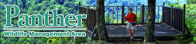
“Panther State Forest (and Wildlife Management Area), located on the border of West Virginia and Kentucky, is the state’s southernmost state forest. It occupies 7,810 rugged acres, and its heavily wooded surroundings offer a range of outdoor amenities like camping, hiking trails, scenic overlooks, fishing, picnicking, swimming and hunting.”
“Panther State Forest gets its name from Panther Creek, a tributary of the Tug Fork where a pioneer reportedly killed a panther. It was established in 1940 after the Welch Daily News spearheaded a “Pennies for Panther” campaign that raised more than $9,000 in community donations.”
(Formerly a State Forest, Panther is now a Wildlife Management Area; facilities are limited.)
Explore WV DNR’s “Panther State Forest” Website
View WV DNR’s “Panther State Wildlife Management Area” Brochure pdf (2011)
———————————————————————————————————————
SENECA State Forest
“Seneca State Forest is West Virginia’s oldest and second largest forest. Surrounded by nature in rugged Pocahontas County, Seneca offers peace and solitude for guests searching for a quiet getaway. Recreational opportunities abound in the forest’s 11,684 acres of lush woodlands. Hiking and biking the forest’s 23 miles of winding trails, and boating and swimming Seneca Lake and the Greenbrier River are all popular activities. Hunting and fishing by properly licensed individuals is permitted on forest grounds. Seneca is, perhaps, best known for its 65-foot tall fire tower, which provides incredible views of the forest and miles upon miles of surrounding woodlands.”
“Most of the land that is now Seneca State Forest was acquired by the West Virginia Game and Fish Commission in 1924. At that time, most of the forest’s timber had been cut. In the following decade, the Civilian Conservation Corps managed reforestation, timber stand improvement and game and fish management programs. The state built the fire tower in 1924, and construction of the state’s first campground was completed in 1928. That year, the state also opened its first tree nursery. The forest’s recreation facilities opened to the public in the summer of 1937, and hunting was allowed the following year. By 1938, access roads, trails, picnic areas, eight cabins and a lake had been constructed.”
ABOUT SENECA STATE FOREST
“Located in central Pocahontas County, along the banks of the Greenbrier River, Seneca State Forest is the oldest of West Virginia’s State Forests. The Greenbrier River Trail and the Allegheny Trail both traverse the forest, while 10 other trails provide 14 miles of hiking opportunities. Logging roads provide an additional eight miles of hiking trails.
“The area that is now Seneca State Forest has been a heavily forested, upland wildlife enclave since pre-historic times. Scientists believe that in the latter pre-Columbian era this land had no permanent human residents. The region did, however, serve as a bountiful hunting ground for several different Native American groups who came to the vicinity to hunt, fish and gather other food stuffs from as far away as Ohio, New York and the Carolinas. An occasional skirmish between these competing groups over control of the area was not unknown.
“Around 1722, settlers from the coastal plain and Piedmont areas of Virginia migrated to the vicinity and began to homestead the land. This led to conflict with the aboriginal users, ending with the conquest and occupation of the land by the newcomers. In 1751, Seneca, and much of the surrounding area, was granted to General Andrew Lewis for service to the Crown. The claim was never enforced due to opposition from the original settlers.
“The character of the property changed very little over the next century. After the Civil War the abundance of timber brought development of a thriving wood products industry. From Seneca, and the surrounding area, large volumes of white pine were removed. This, of course, changed the character of the land significantly and set the stage for large fires to ravage the land. The area was burned repeatedly. Extensive grazing also occurred due to free ranging livestock. In spite of this, a few deer, bear and turkey managed to survive. Although the timber boom subsided around 1920, the Greenbrier Valley has continued to supply a healthy but less prominent wood products industry right through to the current day. This State Forest has contributed more than 5 million board feet of timber to the local industry.
“The bulk of the State Forest was purchased by the state of West Virginia in early 1924. The stated purpose was to ensure timber and wildlife resources for the future. The first priority was to provide protection for the forest and a fire tower was constructed on Michael Mountain in 1924. In the first two years of the state’s ownership, 10 fires burned on the Forest, consuming only 88 acres. This was a tremendous reduction in the devastation from previous years. The Michael Mountain tower was later replaced by a newer version on Thorny Mountain in 1935. This tower was manned seasonally until the mid 1980s. Currently, the Thorny Mountain tower is listed on the National Historic Lookout Register and is still available for duty should the need arise. Today, even though fire remains a serious concern, prevention efforts have curtailed this threat on the forest.
“The state created a tree nursery on Seneca State Forest in 1928. Seedlings were sold to the public at cost in the early 1930s. By 1933, with the help of the CCC (Civilian Conservation Corps), most of the development of the roads and recreation facilities had taken place. These young men also reduced fire hazards and implemented forest stand improvement work. Two large cabins were built along the Greenbrier River and six small cabins on the shore of Seneca Lake. During this period, Seneca State Forest was home to the largest and most varied populations of wildlife to be found anywhere in West Virginia.
“By the late 1970s, the forest had matured and significant volumes of merchantable timber were growing on there. Consequently, timber management augmented recreation and wildlife management on Seneca State Forest. The focus of the prescriptions was to improve the growing conditions for the oak timber that developed following the fires at the beginning of the 20th century. White pine also has steadily made a comeback throughout the entire Greenbrier River Valley. Some small volumes have been harvested from the forest in conjunction with management practices. Management projections are for white pine and oak to increase in volume and quality during the period of the current management plan.” (This information/history is from a deactivated Division of Forestry website.)
Explore WV DNR’s “Seneca State Forest” Website
View WV DNR’s “Seneca State Forest” Brochure pdf (2009)
Explore WV Division of Forestry’s “Seneca State Forest” Website
(3:01/2021/On the Road in West Virginia: Our 55 Counties)
—————————————————————————————————————————————————————–
“WEST VIRGINIA STATE NATURAL AREA”

“FORKS OF COAL State Natural Area”
“ The West Virginia Division of Natural Resources received the Forks of Coal State Natural Area in the fall of 2015 as a donation from Jack Workman on behalf of himself and his late wife Claudia L. Workman. The facility is located in Alum Creek on 102 acres of land that borders US Rt. 119 (Corridor G) on the southern and eastern sides and extends north to the confluence of the Big Coal and Little Coal Rivers, forming the triangular shaped property.”
 “In 2016, the Forks of Coal State Natural Area Foundation (FOC) was established to preserve, protect, and enhance the Forks of Coal State Natural Area. Together, the WVDNR and the Forks of Coal Foundation have built The Claudia L. Workman Wildlife Education Center. The facility is located in Alum Creek on 102 acers of land that boarders Corridor G on the eastern side and extends to the confluence of the Big Coal and Little Coal Rivers, forming the triangular shaped property. The center honors Claudia L. Workman, from whom the land was donated. She loved the outdoors and wished to educate the youth in West Virginia about wildlife and conservation.
“Once completed in fall 2021, the Claudia L. Workman Education Center serve as a hub for students and families to learn about wildlife and the beautiful nature that the state has to offer. Additionally, the center will offer an aquarium, exhibits and a bird watching station, classrooms, and an amphitheater.
“Three scenic trails already traverse the property across ridges and along the rivers, with more development to come. Signage along trails explain the history and culture of the Coal River watershed.”
View WV DNR’s Forks of Coal State Natural Area “Map and Trails” pdf
“WVDNR nears completion of new wildlife education center”
February 21, 2021
 “ALUM CREEK, W.VA. — The West Virginia Division of Natural Resources is getting ready to open a new wildlife education center in Kanawha County. Construction of the Claudia L. Workman Wildlife Education Center near Alum Creek is on schedule and the $5 million, 9,500-square-foot facility is expected to open to the public later this summer.” (4:37/2021/WV Department of Commerce)
“The Claudia L. Workman Wildlife Education Center at the Forks of Coal State Natural Area in Alum Creek, West Virginia features wildlife displays and nature exhibits that showcase the Mountain State’s unmatched natural beauty. The center is open to the public Tuesdays through Saturdays from 9 a.m. to 4:30 p.m. Admission is free.” (2:12/2022/West Virginia Department of Commerce)
—————————————————————————————————————————————————————–
“WEST VIRGINIA STATE WILDLIFE MANAGEMENT AREAS”

“West Virginia’s mountainous forest lands are home to some of the most diverse wildlife in the east. The West Virginia Division of Natural Resources maintains [almost 100] wildlife management areas (WMAs) all over the state, providing visitors and residents with undisturbed hunting, fishing and other outdoor recreation.”
“The Statewide Wildlife Management Program is designed to conserve and manage high quality habitats for a variety of wildlife species and to improve public access to these resources. Management activities on state and national forest lands include planting of trees and shrubs for food and cover, the establishment of wildlife habitat, maintenance of food plots, and the development of wetlands. In addition to conserving and managing high quality wildlife habitat, development projects improve public access and recreational opportunities. Construction of roads, parking lots, trails, and public shooting ranges are vitally important to wildlife management programs.
“Wildlife Management Areas offer a variety of natural areas that are accessible to the public.”
“… 1.4 million acres, representing eight percent of the state’s total land area, are managed by the DNR’s Wildlife Resources Section for public wildlife-associated recreation.”
“DNR closing recreational attractions at four WV parks”
 Jan 07, 2016
“The Division of Natural Resources Director, Robert Fala, … sent WVVA this statement:
“The recent four-percent budget cuts affect all DNR Sections but in particular, the Parks and Recreation Section, which is most reliant upon state General Revenue. After careful deliberation with the Cabinet and DNR Executive Staff, I would like to describe how the current cuts will affect us. But first, we want you to know that top priority was given to retaining all of our valuable staff while maintaining a management presence at the affected facilities. Addressing various federal-aid related audit findings added to our decision making. That is, federal revenues dedicated to Parks and those to Fish and Wildlife Restoration must do just that. Also, some activities or aspects of facilities have costs far in excess of their revenue.
“With that in mind, it was decided, effective January 9, 2016, to return the Berwind, Bluestone, Laurel Lake and Plum Orchard Wildlife Management Areas (WMA’s) to the Wildlife Resources Section, ending the Parks and Recreation Section role at these facilities. Moving forward, this will help the Parks and Recreation Section focus more on their core State Park facilities. In short, Fish and Wildlife oriented recreation such as hunting, fishing and birding will take precedence over Park oriented recreation such as swimming, picnicking and tennis at the subject facilities, which effectively will return them to their pre-1977 status as WMA’s.”
[The brochures for Berwind Lake, Bluestone, Laurel Lake and Plum Orchard Lake have been archived and will remain available here for historical purposes.]
———————————————————————————————————————
BERWIND LAKE WMA
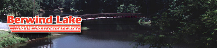
View WV DNR’s “Berwind Lake State Wildlife Management Area” Brochure pdf (2010)
———————————————————————————————————————
BLUESTONE WMA
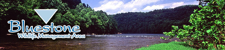
“Bluestone Wildlife Management Area offers visitors a variety of outdoor recreational opportunities on 17,632 acres. Being adjacent to Bluestone Lake, the state’s second largest body of water, the area offers guests boating, canoeing and fishing opportunities. Hunting is offered due to the wildlife management area status, and Bluestone has over 330 primitive campsites and picnic sites. Avid fishermen can enjoy float fishing and stocked trout fishing in Indian Creek. Hiking and equestrian trails are also popular.”
View WV DNR’s “Bluestone State Wildlife Management Area” Brochure pdf (2010)
———————————————————————————————————————
LAUREL CREEK WMA

View WV DNR’s “Laurel Lake State Wildlife Management Area” Brochure pdf (2010)
———————————————————————————————————————
PLUM ORCHARD LAKE WMA
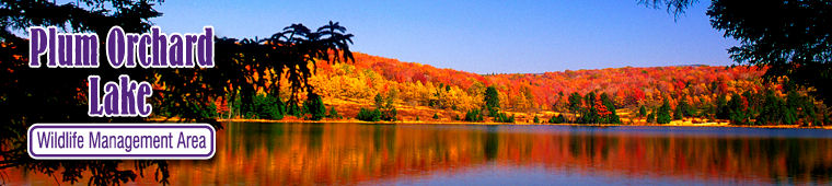
View WV DNR’s “Plum Orchard Lake State Wildlife Management Area” Brochure pdf (2009)
In late 2016, West Virginia State Parks adopted a new logo:
![]()
By 2019, the logo had been modified:![]()
We still like the old one better:
![]()
![]()
West Virginia State Parks / West Virginia State Forests
West Virginia State Rail Trails / West Virginia State Wildlife Management Areas
WV State Parks and State Forests / West Virginia State Parks