West Virginia National Parks, Forests, Heritage Areas,
Landmarks, Refuges, Natural Features – MH3WV
West Virginia Studies



West Virginia National Parks and National Forests
National Natural Landmarks, National Heritage Areas, National Historic Landmarks, National Wildlife Refuges
and More Natural Features in West Virginia
<< Here are the topics on this page; Click to jump/scroll down >>
“US FOREST SERVICE” – US Department of Agriculture
 “Established in 1905, the U.S. Department of Agriculture Forest Service is a Federal agency that manages public lands in national forests and grasslands, as well as other congressionally designated areas. The Forest Service is also the largest forestry research organization in the world, and provides technical and financial assistance to state and private forestry agencies.
“The mission of the Forest Service is to sustain the health, diversity, and productivity of the nation’s forests and grasslands to meet the needs of present and future generations.
“Gifford Pinchot, the first Chief of the Forest Service, summed up the mission of the Forest Service— ‘to provide the greatest amount of good for the greatest amount of people in the long run.'”
Explore US Dept. of Agriculture’s “US Forest Service” Website
West Virginia National Parks and Forests – Natural Landmarks, Historic Landmarks, Heritage Areas, and More
“National Forests in West Virginia” (3)
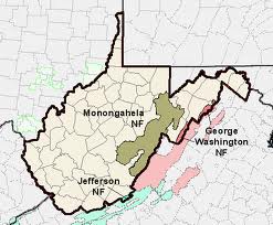
West Virginia has all or part of 3 National Forests within its borders.
1 – “Monongahela National Forest”

 “The Monongahela National Forest was established in 1920. Located in the north central highlands of West Virginia, the Monongahela straddles the highest ridges in the State. Elevation ranges from just under 1000′ to 4863′ above sea level. Variations in terrain and precipitation have created one of the most ecologically diverse National Forests in the country.
“Visitors to this beautiful place will enjoy breathtaking vistas, peaceful country roads, gently flowing streams, and glimpses of the many species of plants and animals that inhabit the Forest. You will also see a ‘working’ forest, which produces timber, water, grazing, minerals and recreational opportunities for the region and nation.”
Headquarters for the Monongahela National Forest is in Elkins.
Explore US Forest Service’s “About the Monongahela National Forest” Website
“Special Places” – Monongahela National Forest
“Highlighted Areas” – Monongahela National Forest
 Click on Names below for more information on each area:
- Cranberry Mountain Nature Center
- Spruce Knob-Seneca Rocks National Recreation Area
- Highland Scenic Highway
- Seneca Rocks Discovery Center
- Falls Of Hills Creek
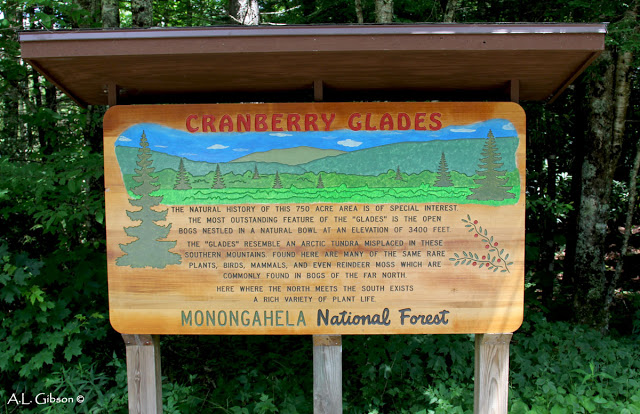
- Cranberry Glades Botanical Area
“Wilderness Areas” – Monongahela National Forest
 “We are proud that the Monongahela National Forest has eight Wildernesses totaling over 115,000 acres designated under the NWPS.”
Explore Monongahela National Forest’s “Wilderness Areas” Website
Click on Names below for more information on each area:
- Big Draft Wilderness
- Cranberry Wilderness
- Dolly Sods Wilderness
- Laurel Fork Wilderness (North and South)
- Otter Creek Wilderness
- Roaring Plains West
- Spice Run Wilderness
“Spruce Knob-Seneca Rocks National Recreation Area” – Monongahela National Forest
 “Encompassing 100,000 acres, the scenic Spruce Knob-Seneca Rocks National Recreation Area (NRA) contains the highest peak in West Virginia, some of the best rock climbing on the east coast, outstanding views and a chance to enjoy America’s great outdoors.”
Explore Monongahela National Forest’s “Spruce Knob-Seneca Rocks National Recreation Area” Website
“Seneca Rocks” – Monongahela National Forest

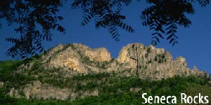 “Purchased by the federal government in 1969, Seneca Rocks is one of the best-known landmarks in West Virginia. These rocks have long been noted as a scenic attraction and are popular with rock climbers.
“The rocks are a magnificent formation rising nearly 900 feet above the North Fork River. Eastern West Virginia contains many such formations of the white/gray Tuscarora quartzite. Seneca Rocks and nearby Champe Rocks are among the most imposing examples. The quartzite is approximately 250 feet thick and is located primarily on exposed ridges as caprock or exposed crags. The rock is composed of fine grains of sand that were laid down approximately 440 million years ago, in an extensive sheet at the edge of ancient ocean. Years of geologic activity followed, as the ocean was slowly destroyed and the underlying rock uplifted and folded. Millions of years of erosion stripped away the overlaying rock and left remnants of the arching folds in formations such as Seneca Rocks. . . “
Explore Monongahela National Forest’s “Seneca Rocks Overview/Background” Website to continue reading
Explore “The Legend of Seneca Rocks” – “The Betrothal of Snow Bird, Princess of the Seneca Indians”
“Seneca Rocks” (0:19/2023/daily304)
“Hiking Seneca Rocks”
 “This hike takes place in the Spruce Knob-Seneca Rocks Recreation Area, within the Monongahela National Forest. The trail reaches the highest point of Seneca Rocks. Seneca Rocks is best known for technical rock climbing, however the Seneca Rocks Trail is a wide, graded and graveled footpath. Though the trail is fairly steep there are benches, and some stairs to accommodate those with small children or physical issues. There are no fees associated with this hike. The trail is easily accessed from the visitor center or the homestead parking lot. The Trail crosses the North Fork South Branch Potomac River on a footbridge. Soon after entering the forest there is an intersection, stay to the left. Stay on the main trail. You will climb a set of stairs, then a couple of switchbacks before reaching the top. At the summit area there is an observation platform. Beyond that are loose rocks and the rock wall. There is a sign indicating the danger at the top so proceed with care. Return the way you came.” (4:08/2016/EasternHIKERS)
“Spruce Knob and Spruce Knob Observation Tower” – Monongahela National Forest


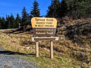
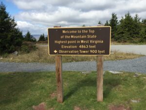
“At 4,863 feet above sea level, Spruce Knob is West Virginia’s highest peak. This area offers backpacking and day hiking opportunities for the visitors looking to get a splendid view of the gorgeous natural scenery surrounding the area. From this rugged alpine peak, you can view grassy openings and pastures or look down on forested ridges as far as the eye can see. The vegetation here has adapted to a harsh environment. One-sided red spruce deformed by constant exposure to strong westerly winds cling to the high rocky ridges. Blueberry and huckleberry plants hug the ground.
“Spruce Knob Tower – A stone and steel observation tower sits atop the Knob, providing visitors with a vantage point from which to enjoy a breathtaking view. The half-mile Whispering Spruce Trail circles the knob and provides panoramic views. Interpretive signs along the gentle, graveled trail describe the high country vegetation, geology and animal life.”
Explore Monongahela National Forest’s “Spruce Knob and Spruce Knob Observation Tower” Website
“Summit of Spruce Knob, West Virginia”
 “Base to summit of Spruce Knob, West Virginia. Spruce Knob is the highest point in the state of West Virginia at 4,863 feet above sea level. This is Katherine’s 3rd state highpoint. Enjoy!” (5:46/2014/Peakbaggers)
“Spruce Knob – West Virginia High Point”
 “We took a trip to West Virginia today to claim another one of the peaks on our State High Point list. This peak is Spruce Knob, at 4,863 feet above sea level. The trees here are stunted in growth and tend to be full on one side and bare on the other from the prevailing winds. The road is windy and skinny to get to this peak. At first I thought it was a one-way road, but it is indeed two ways. Be careful, as there is quite a bit of traffic on it and when cars meet, both need to borrow a bit of the shoulder (if there is any!!). There is ample parking up top, many hiking trails, a privy, garbage cans, picnic tables with grill boxes, and a picnic shelter. Also, of course, is the Spruce Knob Observation Tower about 0.2 miles down a very easy trail. This is a great, easy to climb, steel and stone tower with a huge viewing platform up top. Views are excellent in all directions. The trails are well worn and scented with spruce that remind me of some of the trails on the top of Cannon Mountain in NH. We did the easy, 0.7 mile, loop around the summit. Although a long drive out to the “middle of nowhere, WV”, it was a pleasant one. . .” (6:35/KrizAkoni/2017)
“Smoke Hole Canyon” – Monongahela National Forest

 “About 185 million years ago, a seven-mile thick sheet of sedimentary rocks began to buckle and fold. Wind and water wore away the softer layers, wearing down the mountains, and creating a region of rolling plains. Then the plains themselves were violently uplifted and broken. The rivers that had previously rolled gently over the plains turned into raging torrents that cut deep gorges and canyons. One such gorge is the Smoke Hole, where the South Branch of the Potomac River squeezes between North Mountain and Cave Mountain. For over 20 miles the river has carved a half-mile deep canyon, with nearly vertical walls.
“The misty fog that often lies along the river as it runs through the “hole” makes the name appropriate. Where the name really came from is uncertain. Some old timers call the canyon “Smoke Holes” and claim Native Americans used the caves for smoking meat. Others say it was the moonshiner’s stills that gave the gorge its name. Regardless, the canyon is considered by many to be one of the most beautiful areas in West Virginia. The remote, rugged landscape provides a unique recreation experience, whether you are fishing, hunting, hiking, canoeing or camping. The roads into the area are narrow and winding: take your time and enjoy the scenery.”
Explore Monongahela National Forest’s “Smoke Hole Canyon” Website
“Dolly Sods : The Movie” (4 parts)
 A seven day hiking trip to Dolly Sods by a couple from Western NY. Great videography and music selections showing the wilderness area.
Part 1 of 4 (14:10/2013/ric00man)
Part 2 of 4 (13:27/2013/ric00man)
Part 3 of 4 (6:30/2013/ric00man)
Part 4 of 4 (14:24/2013/ric00man)
“Falls of Hills Creek” – Pocahontas Co.
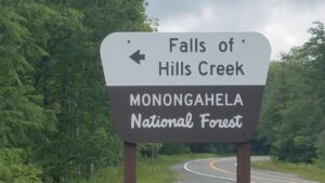

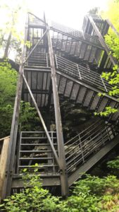 “Tucked away in a narrow gorge just off the Highland Scenic Highway is a hidden treasure known as the Falls of Hills Creek Scenic Area. This popular 114 acre area contains three waterfalls – 25 feet, 45 feet, and 63 feet. The lower falls, at 63 feet is the second highest waterfall in West Virginia.”
Upper Falls 0:00-0:37 Middle Falls 0:37-1:07 Lower Falls 1:07-1:44 (1:44/2013/colong7034)
 “The Falls of Hills Creek are nestled in the Monongahela National Forest, easily accessible on Route 39 between Marlinton and Mill Point, five miles west of the Cranberry Mountain Nature Center. However if you blink, you’ll miss the turn-off, as it’s unmarked aside from a small brown National Parks Service sign that says “Scenic Area.” Once you turn on the road, there is a paved parking area at the trailhead followed by a 3/4-mile descent to access all three falls. The first waterfall, called Upper Falls, cascades 25 feet and is handicapped accessible via a paved walkway. But, the view isn’t spectacular. If you are able, continue …”
Explore West Virginia Travel Queen’s “Falls of Hills Creek” Website — very limited advertisements
“From Wasteland to Treasure”
![]() May 4, 2020
May 4, 2020
 “Effort to turn logged-over land back into wilderness began over 100 years ago” “Stretching across 921,000 acres in 10 West Virginia counties, the Monongahela National Forest encompasses the state’s highest peaks, cleanest streams, largest expanses of forests, and most remote tracts of wilderness. . .”
Explore Charleston Gazette-Mail’s “From Wasteland to Treasure” article to continue reading (pdf)
“Weeks Act Helped Create Monongahela National Forest”
![]() January 12, 2020
January 12, 2020
 “One of the most important pieces of environmental legislation ever enacted by Congress was the passage of the Weeks Act on March 1, 1911. Named for its chief sponsor, Congressman John Weeks, R-Mass., it was to have a profound effect on West Virginia by providing the statutory authority to create the Monongahela National Forest in 1920. This year marks the 100th anniversary of the forest. . . “
“Mon Forest Towns”
 “Almost one million acres, ten WV counties, and more than four hours travel from top to bottom, the Monongahela National Forest touches not only our pilot towns, but dozens more communities.
“Today, an approximate 1.3 million visitors come to the Monongahela National Forest each year. It is a place where visitors can enjoy breathtaking vistas, peaceful country roads, gently flowing streams, and glimpses of many plants and animals. . .”
Explore “Mon Forest Towns” Website to continue reading
“Not Your Father’s Mon Forest”
June 19, 2020
“Mon towns team up to move toward recreation future”
 “There’s a new bear in the Monongahela National Forest.The black bear in the logo showing up on signage in towns that border the national forest presents a sleeker image than old Smokey Bear, the venerable mascot of the Forest Service. But don’t worry — Smokey isn’t going away. The new bear on. . . “
Explore Daily-Mail WV’s “Not Your Father’s Mon Forest” article to continue reading: (2 pdfs) Part 1 Part 2
“West Virginia” – The Buckeye Botanist


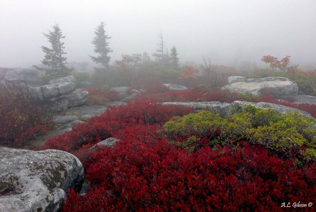
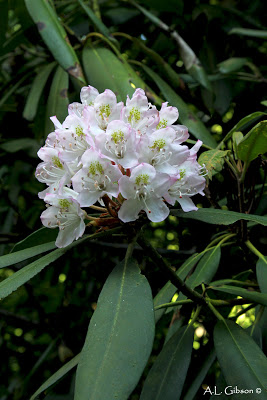
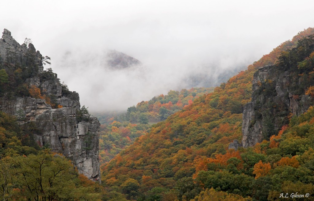
Blog posts by a botanist from Southeastern Ohio of trips to WV. Includes many stunning photographs of flora and landscapes.
Click on each title below to explore each post — WV posts are down the middle of the page — margins on either side show other posts/topics:
- “A Foggy and Soggy Dolly Sods Wilderness”
- “West Virginia’s Seneca and Champe Rocks” — also includes — “Flashback to Fall in the Dolly Sods Wilderness” (scroll down to it)
- “Cranberry Glades Botanical Area of West Virginia” — also includes — “Cranberry Glades of West Virginia” (scroll down to it)
- “Memorial Day Weekend in Wild and Wonderful West Virginia”
“This nature blog is a reflection of my interests, travels and research in the botanical world and beyond. I currently work as a field botanist for the Ohio Division of Natural Areas & Preserves, where I’m afforded the opportunity to survey, monitor and manage Ohio’s rare flora and habitats. I was born and raised on the glaciated till plains of west-central Ohio but have called the rolling hills of southeastern Ohio home for a while. Studied plant biology and ecology at Ohio University in Athens, as well as wildlife biology and management at Hocking College. My biggest botanical passions and areas of expertise are Orchidaceae, Cyperaceae and the rare/unusual. Thanks for stopping by!”
Explore “The Buckeye Botantist’s” Blog
WV National Parks and Forests – Natural Landmarks, Historic Landmarks, Heritage Areas, and More
2 & 3 – “George Washington and Jefferson National Forests”

 “The George Washington and Jefferson National Forests stretch along the ruggedly beautiful Appalachian Mountains, extending from one end of Virginia to the other and even crossing into parts of West Virginia and Kentucky. Whether you are driving a back-country road, enjoying our glorious fall colors, using binoculars to spot colorful neo-tropical birds, or savoring the peacefulness of wilderness, remember that national forests are special places.”
(The George Washington and Jefferson National Forests are managed as one entity, with headquarters in Roanoke, VA.)
Explore US Forest Service’s “George Washington and Jefferson National Forests” Website
“Trout Pond Recreation Area” – George Washington and Jefferson National Forests

 “Trout Pond Recreation Area boasts two beautiful lakes: Rock Cliff Lake and Trout Pond. Relax on a sandy mountain beach or fish for stocked trout while kids splash in the cool waters of Rock Cliff Lake. Trout Pond, home to native Brook trout, is the only natural lake in West Virginia. A designated swimming area, easy lakeside trails, and a children’s playground make this a perfect family destination.”
Explore George Washington and Jefferson National Forests’ “Trout Pond Recreation Area” Website
“Mountain Lake Wilderness” – George Washington and Jefferson National Forests

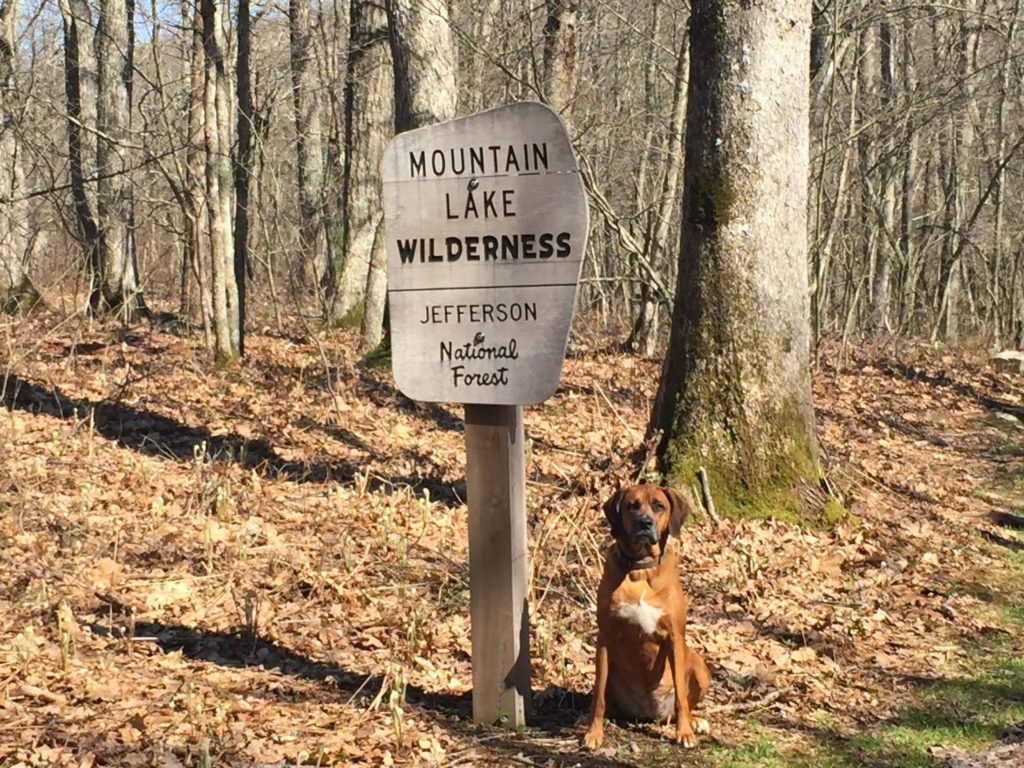 A total of 15,096 acres; approximately 12,375 acres in Virginia; approximately 2,721 acres in West Virginia
WV National Parks and Forests – Natural Landmarks, Historic Landmarks, Heritage Areas, and More
“Fernow Experimental Forest” – US Forest Service

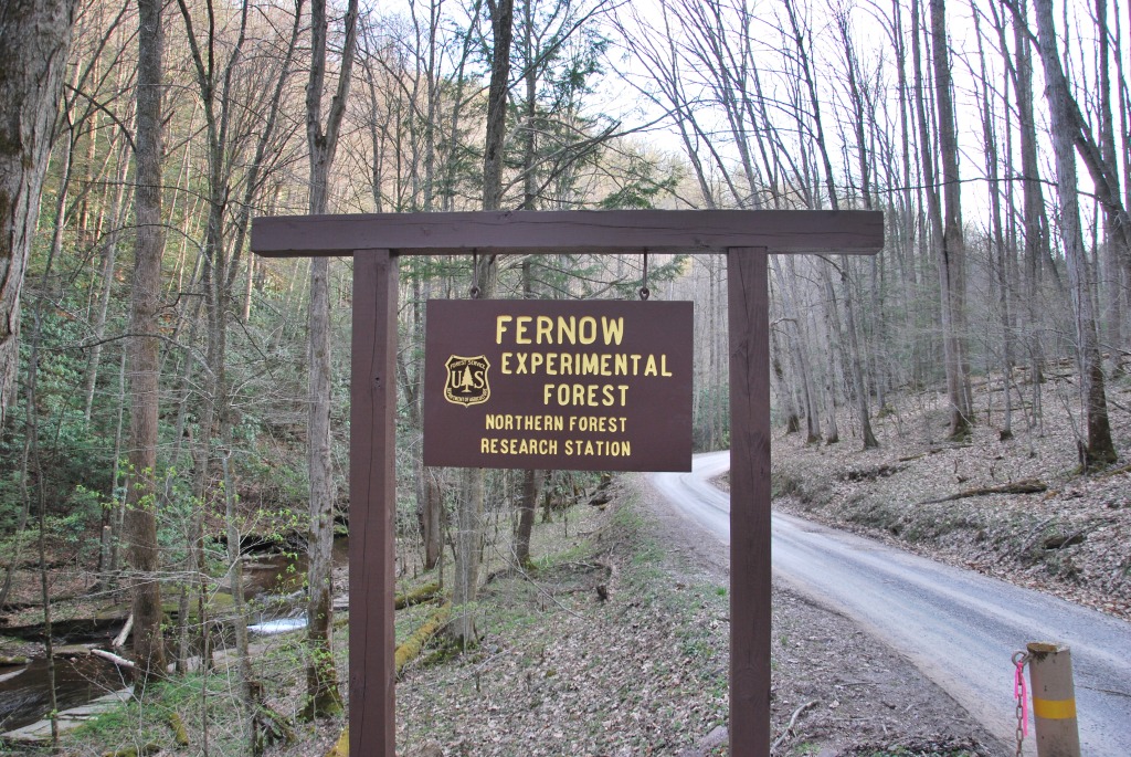 “The USDA Forest Service’s Experimental Forests (EF) are dedicated to long-term research on ecosystem processes, silviculture and forest management options, wildlife habitat characteristics, and forest growth and development.
“The Fernow Experimental Forest was established on March 28, 1934, to address water quantity, water quality, and timber quality issues. Today, forest health and clean water are still a focus, but data from the Fernow Experimental Forest are also contributing to research of issues that had not been identified 80 years ago, such as biodiversity, endangered species management, carbon sequestration, atmospheric deposition, and climate change.”
Explore US Forest Service’s “Fernow Experimental Forest” Website
West Virginia National Parks and Forests – Natural Landmarks, Historic Landmarks, Heritage Areas, and More
“NATIONAL PARK SERVICE” – US Department of the Interior

 “Since 1916, the American people have entrusted the National Park Service with the care of their national parks. With the help of volunteers and park partners, we are proud to safeguard these more than 400 places and to share their stories with more than 275 million visitors every year. But our work doesn’t stop there.
“We are proud that tribes, local governments, nonprofit organizations, businesses, and individual citizens ask for our help in revitalizing their communities, preserving local history, celebrating local heritage, and creating close to home opportunities for kids and families to get outside, be active, and have fun.
“Taking care of the national parks and helping Americans take care of their communities is a job we love, and we need-and welcome-your help and support.”
Explore US Dept. of the Interior’s “National Park Service” Website
Explore National Park Service’s “West Virginia Parks” Website — includes short descriptions of National Park units in WV, with multiple links–also check out “By the Numbers” in the right margin for additional information and links.
WV National Parks and Forests – Natural Landmarks, Historic Landmarks, Heritage Areas, and More
“National Parks in West Virginia” (6)
1 – “Appalachian National Scenic Trail” – CT, GA, MA, MD, ME, NC, NH, NJ, NY, PA, TN, VA, VT, WV


“FOOTPATH FOR THE PEOPLE”
“The Appalachian Trail is a 2,180+ mile long public footpath that traverses the scenic, wooded, pastoral, wild, and culturally resonant lands of the Appalachian Mountains. Conceived in 1921, built by private citizens, and completed in 1937, today the trail is managed by the National Park Service, US Forest Service, Appalachian Trail Conservancy, numerous state agencies and thousands of volunteers.”
Appalachian Trail Conservancy Headquarters is in Harpers Ferry.
Explore National Park Service’s “Appalachian National Scenic Trail” Website
WV National Parks and Forests – Natural Landmarks, Historic Landmarks, Heritage Areas, and More
2 – “Bluestone National Scenic River”


“BEAUTIFUL BLUESTONE”
“The Bluestone River and the rugged and ancient gorge it has carved is a richly diverse and scenic area of the southern Appalachians. Bluestone National Scenic River is preserved as a living landscape that provides an unspoiled experience for visitors and a haven for a variety of plants and animals. The park protects a 10.5-mile section of the Bluestone River in southern West Virginia.”
Explore National Park Service’s “Bluestone National Scenic River” Website
—–
HISTORY AND CULTURE — “American Indians called the Bluestone River “Momongosenka” (Big Stone River) supposedly inspired by their travels along ancient pathways through the boulder strewn lower gorge. Many native prehistoric sites, from nomadic Paleo-Indian hunting camps dating back to the times of Ice -Age mammoth and mastodon, through hundreds of generations of village and burial sites of the Archaic and Woodland cultures, to the Delaware, Cherokee and Shawnee tribes of the 1600 and 1700s, have been documented throughout the Bluestone River watershed. In the mid 1700s European and African peoples began to explore and establish subsistence homesteads along the river . . .”
PEOPLE: The Bluestone Gorge once provided a route of transportation and migration through a rugged, untamed wilderness. Throughout time, people have passed through the gorge and sometimes settled here. Their stories combine to form the rich cultural history preserved as a part of Bluestone National Scenic River.
- Thomas Ingles — Learn about Thomas Ingles’ amazing story of survival and perseverance.
- Mary Draper Ingles — The story of Mary Draper Ingles’ capture by the Shawnees and subsequent journey to freedom is one of the great stories of survival.
PLACES: Walking along the Bluestone Turnpike today, it is hard to believe that this was once a major thoroughfare used by Native Americans and later by early settlers and subsistence farmers who settled along the Bluestone River. Small farms were found throughout the Bluestone Gorge.
- The Lost Town of Lilly — Once the largest town in the Bluestone Gorge, only the traces of a few foundations remain today.
STORIES: Walking through Bluestone National Scenic River today, one will find traces of the past; an old stone wall, a chimney or foundation protruding from the undergrowth, a headstone or cemetery seemingly lost in the forest. These tangible remains help to tell and preserve the stories of those who came before us.
- Moonshing on the Blue — The story of moonshining in this area is a testament to the subsistence lifestyles of those who once lived on the rugged land.
WV National Parks and Forests – Natural Landmarks, Historic Landmarks, Heritage Areas, and More
3 – “Chesapeake & Ohio Canal National Historical Park” – DC, MD, WV

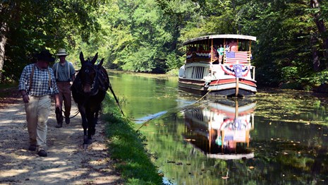
“184.5 MILES OF ADVENTURE!”
“Preserving America’s early transportation history, the C&O Canal began as a dream of passage to Western wealth. Operating for nearly 100 years the canal was a lifeline for communities along the Potomac River as coal, lumber and agricultural products floated down the waterway to market. Today it endures as a pathway for discovering historical, natural and recreational treasures!”
Explore National Park Service’s “Chesapeake and Ohio Canal National Historical Park” Website
WV National Parks and Forests – Natural Landmarks, Historic Landmarks, Heritage Areas, and More
4 – “Gauley River National Recreation Area”


“WILD AND WONDERFUL”
“The 25 miles of free-flowing Gauley River and the six miles of the Meadow River pass through scenic gorges and valleys containing a wide variety of natural and cultural features. The Gauley River contains several class V+ rapids, making it one of the most adventurous white water boating rivers in the east.”
Explore National Park Services’ “Gauley River National Recreation Area” Website
—–
“The Gauley River and its gorge have been a barrier as well as a corridor for human activity. The area was used for fishing and hunting by Native Americans for 10,000 years and was populated by Europeans in the late 1700s. . .”
WV National Parks and Forests – Natural Landmarks, Historic Landmarks, Heritage Areas, and More
5 – “Harpers Ferry National Historical Park” – WV, VA, MD

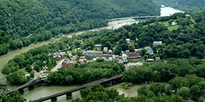
“STEP BACK IN TIME”
“Find yourself at the confluence of history and nature. Experience John Brown’s Raid, a flash point that ignited the Civil War. Find your story in the struggle for freedom, education, and civil rights at Storer College. Explore the rolling Blue Ridge mountains and rushing waters of the Shenandoah and Potomac rivers that powered industry and the nation’s second armory. . . A visit to this quaint, historic community, at the confluence of the Potomac and Shenandoah rivers, is like stepping into the past. Stroll the picturesque streets, visit exhibits and museums, or hike our trails and battlefields.”
Explore National Park Service’s “Harpers Ferry National Historical Park” Website
—–
HISTORY AND CULTURE: “The history of Harpers Ferry has few parallels in the American Drama. It is more than one event, one date, or one individual. It is multi-layered – involving a diverse number of people and events that influenced the course of our nation’s history. Harpers Ferry witnessed the first successful application of interchangeable manufacture, the arrival of the first successful American railroad, John Brown’s attack on slavery, the largest surrender of Federal troops during the Civil War, and the education of former slaves in one of the earliest integrated schools in the United States.”
PEOPLE: “From Robert Harper arriving in the 1740s to the last president of Storer College in the 1950s, numerous people contributed to the story of Harpers Ferry for over 200 years:”
- John Brown
- James H. Burton
- Frederick Douglass
- W.E.B Du Bois
- John H. Hall
- Robert Harper
- Thomas J. (Stonewall) Jackson
- Thomas Jefferson
- Meriwether Lewis
- Don Redman
- George Washington
PLACES:
- Jefferson Rock
- John Brown’s Fort
- Loudoun Heights
- Maryland Heights
- The Point
STORIES:
- John Brown’s Raid
- The Civil War
- African-American History
- Industry
- Transportation
- Natural Heritage
WV National Parks and Forests – Natural Landmarks, Historic Landmarks, Heritage Areas, and More
6 – “New River Gorge National Park and Preserve”


(The “New River Gorge National River” became the “New River Gorge National Park and Preserve” at the beginning of 2021)
“A RIVER RUNS THROUGH IT”
“A rugged, whitewater river flowing northward through deep canyons, the New River is among the oldest rivers on the continent. The park encompasses over 70,000 acres of land along the New River, is rich in cultural and natural history, and offers an abundance of scenic and recreational opportunities.”
Explore National Park Service’s “New River Gorge National Park and Preserve” Website
—–
HISTORY AND CULTURE: “The New River is like a ribbon tying together all the people, places, and events sharing its course through time. New River Gorge National River protects a rich variety of this history: from the subsistence lives of the native peoples and the later pioneers, to the coming of the railroad and the many peoples involved in the ensuing boom and bust of the coal mining and logging industries.
You can visit the remains of the former boomtown of Thurmond, retrace the path of pioneer Mary Draper Ingles’ amazing journey, learn of the legend and the facts of the “Steel Driving Man”, John Henry, or read the oral history of an immigrant coal miner from the 1800s.”
PEOPLE: Read the stories of the many people who contributed to the rich cultural history of New River Gorge. The story of New River Gorge is the combined stories of the many people who lived and died here. Each left something behind that contributes to the rich cultural history of this unique place.
- Mother Jones — The “Miner’s Angel” who spent much of her life fighting for the fair treatment of coal miners.
- Joeph Beury — Colonel Joseph Beury established the town of Quinnimont and was the operator of the first coal mine in the New River Gorge.
- Mary Draper Ingles — The story of Mary Draper Ingles’ capture by the Shawnees and subsequent journey to freedom is one of the great stories of survival.
- Carter G. Woodson — Carter G Woodson, the “Father of Black History,” began his career, and gained inspiration for his pioneering work, in the New River Gorge.
- John Nuttal — John Nuttall founded the coal town of Nuttallburg, one of the most significant coal towns in the gorge.
PLACES: The history of the coal, railroad, and timber towns, farmsteads, churches, schools, and homes are all a part of the New River Gorge story. Hiking or driving through New River Gorge today will provide glimpses of old stone walls, foundations of homes and buildings, coal mine entrances, and coke ovens decaying alongside the railroad tracks. These places provide tangible reminders of the days when the coal coming out of New River Gorge fueled the industrialization of our nation.
- Thurmond — A historic RR town, Thurmond recaptures the days when steel rails, steam, and coal were the major themes in our nation’s history.
- Nuttalburg — The remains of a tipple, coal conveyor, coke ovens, and buildings tell the story of one of the gorge’s most significant coal mining towns.
- Glade Creek/Hamlet — The piers of the abandoned Glade Creek Bridge today mark the site of a former lumber mill and the remains of company logging towns.
- Army Camp — Camp Prince, or Army Camp, served as a training and testing ground for assembling floating bridges during the Korean War.
- Royal — Now nearly totally reclaimed by the forest, the town of Royal was once the site of the first coal mining company in Raleigh County.
- McKendree Hospital — Also know as Miner’s Hospital Number 2, McKendree Hospital opened its doors in 1901 to provide medical care for injured miners.
- Sandstone School — Now the site of the Sandstone Visitor Center, Sandstone School educated local students from 1925 through 1994.
- Quinnimont — The first coal shipped out of New River Gorge in 1873 came from the town of Quinnimont, named for the five mountains that surround it.
- Trump-Lilly Farm — The collection of buildings preserved at Trump-Lilly Farm take visitors back to the early days of Appalachian subsistence farming.
- Prince Brothers Store — Early newspaper’s claimed that the Prince Brothers General Store was “the most important store in the county.”
- Prince — The small town of Prince still has an operating railroad depot and is the jumping off place for the drive to Glade Creek.
- Prince Depot — The Prince Depot, constructed in 1946, is still active today, serving passengers on the Amtrak Cardinal.
- Camp Brookside — Learn about the history and view historic photos of Camp Brookside.
STORIES: The New River Gorge area is full of wonderful, dreadful, exciting, and unusual stories. The geology of the gorge tells a story that dates back millions of years. There are stories of disasters, both natural and man-made. Floods, droughts, blights, coal mine explosions, and fires have all been a part of its history, as has the story of the struggle of the people making a life in this rough and rugged land.
There are many positive stories too – the beauty of the area, the plants and animals that thrive in the gorge, and most of all the people who lived, worked and played here. From the Native Americans that hunted, fished and traveled the gorge to the children that visit the park today, people have made stories that they will remember and pass on.
New River Gorge National Park and Preserve protects not only the natural resources of the park, but also the stories. By collecting and saving oral histories, photographs, artifacts, and records, the park hopes to keep these stories alive and help people create their own New River Gorge stories.
- Coal Mine Disasters — Layland, Red Ash, and Rush Run were the locations of some of the worst coal mining disasters in the New River Gorge.
- Batteaux on the New — Long before the coming of the whitewater rafting industry, commerce along the New River was carried out by long, flat bottomed batteaux.
- John Henry and the Coming of the Railroad — Construction of the Great Bend Tunnel on the C&O Railway just south of New River Gorge spawned the legend of John Henry.
- Berry Holler and the Big Branch Trail — Discover this popular hiking trail through the stories of Bertha Huffman, who grew up on Big Branch.
- Arrowheads of the Past and Present — Learn about the Native American story at New River Gorge.
—–
Additional New River Gorge National Park and Preserve Websites — Click on name to explore the website
—–
“The Forgotten Ghost Town Of Thurmond West Virginia”
![]() “Thurmond is a town in Fayette County, West Virginia, United States, on the New River. The population was five at the 2010 census. During the heyday of coal mining in the New River Gorge, Thurmond was a prosperous town with a number of businesses and facilities for the Chesapeake and Ohio Railway. The town was the filming location for John Sayles’ 1987 movie Matewan since it still possesses many of the characteristics of a 1920s Appalachian coal town. Today, much of Thurmond is owned by the National Park Service for the New River Gorge National River. The C&O passenger railway depot in town was renovated in 1995 and now functions as a Park Service visitor center. The entire town is a designated historic district on the National Register of Historic Places.” (7:41/2020/SkyCamWV) video to come
“Thurmond is a town in Fayette County, West Virginia, United States, on the New River. The population was five at the 2010 census. During the heyday of coal mining in the New River Gorge, Thurmond was a prosperous town with a number of businesses and facilities for the Chesapeake and Ohio Railway. The town was the filming location for John Sayles’ 1987 movie Matewan since it still possesses many of the characteristics of a 1920s Appalachian coal town. Today, much of Thurmond is owned by the National Park Service for the New River Gorge National River. The C&O passenger railway depot in town was renovated in 1995 and now functions as a Park Service visitor center. The entire town is a designated historic district on the National Register of Historic Places.” (7:41/2020/SkyCamWV) video to come
![]() “I took the drone out to the old historic town of Nuttalburg and captured some of the rich history found there. This is my first attempt of a voice over so bear with me on that. Hope you enjoy the video.” (5:38/2020/SkyCamWV)
“I took the drone out to the old historic town of Nuttalburg and captured some of the rich history found there. This is my first attempt of a voice over so bear with me on that. Hope you enjoy the video.” (5:38/2020/SkyCamWV)
“Sandstone Falls – New River, West Virginia”
![]() “Sandstone Falls is the largest waterfall on the New River, Sandstone Falls spans the river where it is 1500 feet wide. Divided by a series of islands, the river drops 10 to 25 feet. Sandstone Falls marks the transition zone of the New River from a broad river of large bottomlands, to a narrow mountain river roaring through a deep boulder strewn V- shaped gorge. The falls form the dramatic starting line for the New Rivers final rush trough the New River Gorge to its confluence with the Gauley river to form the Kanawha River.” (5:57/2020/SkyCamWV)
“Sandstone Falls is the largest waterfall on the New River, Sandstone Falls spans the river where it is 1500 feet wide. Divided by a series of islands, the river drops 10 to 25 feet. Sandstone Falls marks the transition zone of the New River from a broad river of large bottomlands, to a narrow mountain river roaring through a deep boulder strewn V- shaped gorge. The falls form the dramatic starting line for the New Rivers final rush trough the New River Gorge to its confluence with the Gauley river to form the Kanawha River.” (5:57/2020/SkyCamWV)
“Ghost Town: Royal, West Virginia”
“Royal was once a booming coal town. Now it’s just some metal artifacts, stone walls, and gravestones.” (7:58/2009 / West Virginia Public Broadcasting)
“Ghost Town: Kaymoor, West Virginia”
“Kaymoor is an abandoned coal town in the New River Gorge. Nature will reclaim anything if given a chance. Former resident Orvil King remembers the community into which he was born.” (10:52/2009 / West Virginia Public Broadcasting)
“West Virginia’s New River Gorge is America’s Newest National Park”

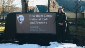 “Visitors have been drawn to West Virginia by its mountains, winding roads, and wild rivers, but until last week, America’s 35th state had no national park. New River Gorge was awarded the honor of becoming the nation’s newest park – and the only national park in West Virginia.” (6:36/2021/CBS This Morning)
WV National Parks and Forests – Natural Landmarks, Historic Landmarks, Heritage Areas, and More
“National Heritage Areas” (4)
 “National Heritage Areas (NHAs) are designated by Congress as places where natural, cultural, and historic resources combine to form a cohesive, nationally important landscape. Through their resources,NHAs tell nationally important stories that celebrate our nation’s diverse heritage. NHAs are lived-in landscapes. Consequently, NHA entities collaborate with communities to determine how to make heritage relevant to local interests and needs.” There are approximately 55 NHAs nationwide.
West Virginia has four National Heritage Areas, two of which are shared with other states:
1 -“National Coal Heritage Area”
2 -“Wheeling National Heritage Area”
3 -“Appalachian Forest National Heritage Area” (MD, WV)
4 -“The Journey Through Hallowed Ground National Heritage Area” (MD, PA, VA, WV)
Explore National Park Services’ “National Heritage Areas” Website
1 – “National Coal Heritage Area” – WV

 “The National Coal Heritage Area encompasses 13 counties and is situated in the heart of the formidable Appalachian Mountains, displaying coalfield history captured in time.”
“It is a rugged industrial landscape that showcases the stories of miners of many ethnicities who labored to extract and transport coal, and their wives, who struggled to maintain homes under primitive conditions. Coalfield history and culture contains key elements of a unique social and economic history including the stories of industrial might, the struggle for labor unions, and the growth of distinctive cultural communities among different ethnic groups who worked side-by-side and lived together in the ‘company towns’ of the region.”
Explore National Park Services’ “National Coal Heritage Area” Website
Explore “National Coal Heritage” Website — Includes: “Birth of the Industry, Three Railroads, King Coal, Coal Miners, Company Towns, United Mine Workers, End of an Era, Coal Camp Baseball,” and more.
2 – “Wheeling National Heritage Area” – WV

 “The Wheeling National Heritage Area preserves and celebrates the city’s dramatic setting, resources, and history, including its role as the birthplace of the state of West Virginia during the Civil War. It celebrates 19th century westward expansion and industrialization. Throughout the 19th century, Wheeling served as the “Crossroads of America,” playing an important role in the settlement of the Nation. It is also the site of many industries including iron and steel, nails, textiles, boat building, glass manufacturing, and stogie and tobacco manufacturing. LaBelle Cut Nails, one of two manufacturers in the nation, continues to produce cut nails with equipment and a process that is over 150 years old.”
Explore National Park Services’ “Wheeling National Heritage Area” Website
Explore “Wheeling National Heritage Area” Website
3 – “Appalachian Forest National Heritage Area” – MD, WV

 “The Appalachian Forest National Heritage Area (AFNHA) works to conserve, enhance, interpret, and promote a regional network of forest heritage resources in the central Appalachian Highlands. Designated a National Heritage Area in 2019, AFNHA covers sixteen counties in West Virginia (Barbour, Braxton, Grant, Greenbrier, Hampshire, Hardy, Mineral, Morgan, Nicholas, Pendleton, Preston, Pocahontas, Randolph, Tucker, Upshur, Webster) and two counties in western Maryland (Garrett, Allegany).”
“The Appalachian Forest National Heritage Area celebrates the central Appalachian forest — its history, culture, natural history, forest management and products. We focus on cultural heritage, conservation, and place-based tourism to support rural community development.“
 “Forest heritage is the ongoing story how the forest shapes history and culture, and how both nature and humans shape the forest. The mountains and forests have played a central role in central Appalachian life since the first indigenous inhabitants, and the landscape continues to cultivate local traditions, folkways, language, crafts, dance, music, festivals, and fairs. Logging after the Civil War fueled the industrial revolution and provided an important livelihood for workers, but the demand for timber decimated the forests. Today, scientific forestry and public land holdings have allowed the forests to regrow, providing sustainable forest products while offering an abundance of outdoor recreational opportunities, including hiking, biking, fishing, hunting, camping, climbing, and skiing. The history of the region is represented by its plentiful historical societies, museums, and historic preservation efforts. Forest communities and main streets offer a variety of small town experiences, with arts, shopping, local foods, and a hearty welcome for visitors.”
4 – “The Journey Through Hallowed Ground National Heritage Area” – MD, PA, VA, WV

 “The Journey Through Hallowed Ground National Heritage Area encompasses four states spanning 180 miles from Gettysburg to Monticello. It includes the homes and birthplaces of nine US Presidents (including Jefferson, Madison and Monroe), 13 National Parks, and a handful of battlefields commemorating the French and Indian War, Revolutionary War, the War of 1812, and the Civil War.
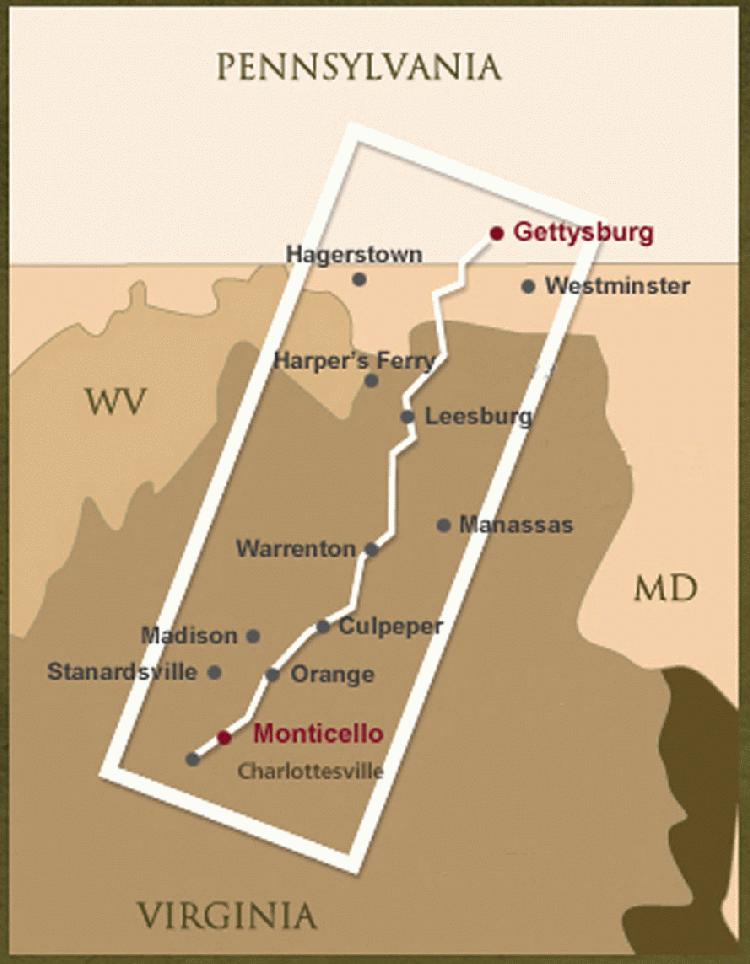 “The Journey encompasses a scenic and historically rich landscape, including Native American settlements; sites from the French and Indian, and Revolutionary Wars; Civil War troop movements; World War I and II history and the struggle for Civil Rights. Most significant, perhaps, is the region’s role as a cradle of democracy and its key position in the Civil War. World leaders have often found respite and inspiration in the creation of some of the most important doctrines of our Time – the Declaration of Independence, the US Constitution, the Monroe Doctrine, the Emancipation Proclamation, the Gettysburg Address, and the Marshall Plan.”
“The Journey Through Hallowed Ground in National Heritage Area” includes only Harpers Ferry in West Virginia.
Explore National Park Services’ “The Journey Through Hallowed Ground National Heritage Area” Website
Explore “The Journey Through Hallowed Ground National Heritage Area” Website
WV National Parks and Forests – Natural Landmarks, Historic Landmarks, Heritage Areas, and More
“National Historic Landmarks Program”


“National Historic Landmarks (NHLs) are nationally significant historic places designated by the Secretary of the Interior because they possess exceptional value or quality in illustrating or interpreting the heritage of the United States. Today, just over 2,500 historic places bear this national distinction. “
(This is NOT the “National Register of Historic Places,” which is a much longer list with at least 1,030 locations in WV and more than 95,000 nationwide)
Explore National Park Services’ “National Historic Landmarks Program” Website
Explore National Park Services’ “List of NHLs by State” Website – scroll down to state name.
National Historic Landmarks in WV (17)
![]()
There are 17 National Historic Landmark sites located within the state of West Virginia.
1 – ANDREWS METHODIST EPISCOPAL CHURCH – Taylor Co.
2 – BALTIMORE AND OHIO RAILROAD MARTINSBURG SHOPS – Berkeley Co.
3 – CAMPBELL MANSION – Brooke Co.
4 – CLOVER SITE – Cabell Co.
5 – DAVIS AND ELKINS HISTORIC DISTRICT – Randolph Co.
6 – ELKINS COAL AND COKE COMPANY HISTORIC DISTRICT – Preston Co.
7 – GRAVE CREEK MOUND – Marshall Co.
8 – THE GREENBRIER – Greenbrier Co.
9 – MATEWAN HISTORIC DISTRICT – Mingo Co.
10 – OLD MAIN, BETHANY COLLEGE – Brooke Co.
11 – REBER RADIO TELESCOPE – Pocahontas Co.
12 – TRAVELLER’S REST – Jefferson Co.
13 – ALEXANDER WADE HOUSE – Monongalia Co.
14 – WEST VIRGINIA INDEPENDENCE HALL – Ohio Co.
15 – WESTON HOSPITAL – Lewis Co.
16 – WHEELING SUSPENSION BRIDGE – Ohio Co.
17 – JEFFERSON COUNTY COURTHOUSE – Jefferson Co. (Jefferson County Courthouse became a National Historical Landmark in December, 2023)
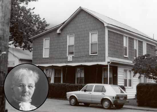 An additional National Historic Landmark had its designation withdrawn: The Mother Jones Prison in Pratt, WV; Designated an NHL: April 27, 1992; Designation withdrawn: September 22, 1997, because the owner demolished it in 1996.
Photo: The Mother Jones Prison and a portrait of Mother Mary Harris Jones.
WV National Parks and Forests – Natural Landmarks, Historic Landmarks, Heritage Areas, and More
“National Natural Landmarks Program”

 “The National Natural Landmarks (NNL) Program recognizes and encourages the conservation of sites that contain outstanding biological and geological resources, regardless of landownership type. It is the only natural areas program of national scope that recognizes the best examples of biological and geological features in both public and private ownership. NNLs are owned by a variety of land stewards, and participation in the program is voluntary. Nearly 600 landmarks have received the NNL designation.”
Explore National Park Services’ “National Natural Landmarks” Website
Explore National Park Services’ “National Natural Landmarks Directory” Website
National Natural Landmarks in WV (16)

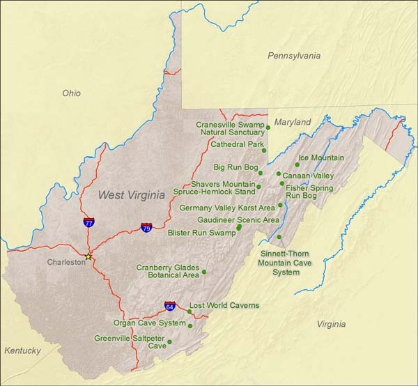 “There are 15 [now 16] National Natural Landmark sites located within the state of West Virginia. (One is shared with Maryland.) Natural features represented include the largest cave system in West Virginia, a high altitude balsam fir swamp at its southernmost extension, and one of the largest intermountain karst areas in the country. Thirteen sites received the NNL designation within a ten-year period from 1965 to 1974. Ice Mountain is the most recent addition to the Natural Landmarks Registry, receiving NNL status in 2012. Sites are owned by a variety of landowners including U.S. Fish and Wildlife Service, U.S. Forest Service, West Virginia Division of Natural Resources and private individuals.”
1 – Big Run Bog – Tucker Co.
2 – Blister Run Swamp – Randolph Co.
3 – Canaan Valley – Tucker Co.
4 – Cathedral (State) Park – Preston Co.
5 – Cranberry Glades Botanical Area – Pocahontas Co.
6 – Cranesville Swamp Nature Sanctuary – Preston Co./Garrett Co. MD
7 – Fisher Spring Run Bog – Tucker Co.
8 – Gaudineer Scenic Area – Pocahontas Co./Randolph Co.
9 – Germany Valley Karst Area – Pendleton Co.
10 – Greenville Saltpeter Cave – Monroe Co.
11 – Ice Mountain – Hampshire Co.
12 – Lost World Caverns – Greenbrier Co.
13 – Organ Cave System – Greenbrier Co.
14 – Shavers Mountain Spruce-Hemlock Stand – Randolph Co.
15 – Sinnett-Thorn Mountain Cave System – Pendleton Co.
16 – Bear Rocks and Allegheny Front Preserve — Grant Co./Tucker Co. (Bear Rocks and Allegheny Front Preserve became a National Natural Landmark in January, 2021)
Explore National Park Services’ “Listing of WV National Natural Landmarks”
Explore Charleston Gazette-Mail’s article “Preserving Natural Spaces” (pdf)
WV National Parks and Forests – Natural Landmarks, Historic Landmarks, Heritage Areas, and More
WV National Parks and Forests – Natural Landmarks, Historic Landmarks, Heritage Areas, and More
“US FISH & WILDLIFE SERVICE” – US Department of the Interior
“Conserving the Nature of America”

 The Mission
 “The mission of the U.S. Fish and Wildlife Service is working with others to conserve, protect, and enhance fish, wildlife, plants, and their habitats for the continuing benefit of the American people.”
The Vision
“We will continue to be a leader and trusted partner in fish and wildlife conservation, known for our scientific excellence, stewardship of lands and natural resources, dedicated professionals, and commitment to public service.”
Explore “US Fish and Wildlife Service” Website
“This Is the U.S. Fish & Wildlife Service”
 “Meet the U.S. Fish and Wildlife Service and what we stand for. We’re conserving the nature of America through our conservation principles: Service, Science, Partnerships, Stewardship, People, Professionalism and Legacy.” (:59/2012/USFWS)
WV National Parks and Forests – Natural Landmarks, Historic Landmarks, Heritage Areas, and More
“National Wildlife Refuge System” – US Fish and Wildlife Service
 “A hundred years in the making, the National Wildlife Refuge System is a network of habitats that benefits wildlife, provides unparalleled outdoor experiences for all Americans, and protects a healthy environment.
“Today, there are more than 560 national wildlife refuges and 38 wetland management districts, including one within an hour’s drive of most major metropolitan areas. National wildlife refuges provide habitat for more than 700 species of birds, 220 species of mammals, 250 reptile and amphibian species and more than 1,000 species of fish. More than 380 threatened or endangered plants or animals are protected on wildlife refuges. Each year, millions of migrating birds use refuges as stepping stones while they fly thousands of miles between their summer and winter homes.”
Explore US Fish and Wildlife Service’s “National Wildlife Refuge System” Website
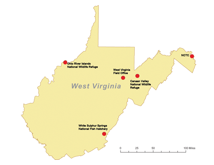
“National Wildlife Refuges in West Virginia” (2)
1 – “Ohio River Islands National Wildlife Refuge”
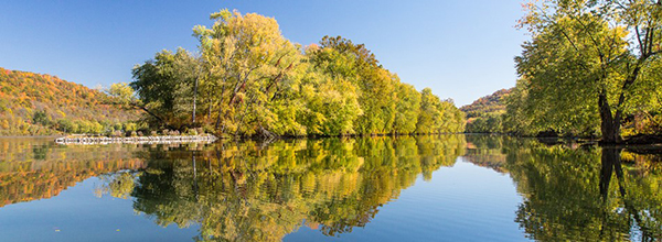
“The Ohio River Islands National Wildlife Refuge (ORINWR) was established in 1990 and consists of 3,354 acres (13.57 km2) of land and underwater habitat. The refuge consists of twenty-two islands and four mainland tracts scattered along 362 miles of the upper Ohio River. Prior to its establishment, West Virginia was the only state of the United States without a NWR (It now has two).” Its headquarters is near Williamstown, WV.
“Ohio River Islands National Wildlife Refuge” (6:30/2012/Jeff Quitney)
2 – “Canaan Valley National Wildlife Refuge”

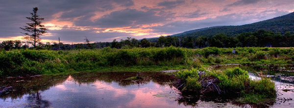
“Canaan Valley National Wildlife Refuge, the nation’s 500th, was established on August 11, 1994, with the purchase of 86 acres. The refuge currently is 16,550 acres. The refuge works to preserve the unique wetlands and uplands of this high elevation, moist valley.”
Explore USFWS National Wildlife Refuge System’s “Canaan Valley National Wildlife Refuge” Website
“Canaan Valley National Wildlife Refuge” “Visit America’s 500th National Wildlife Refuge!” (9:45/2013/USFWS)
WV National Parks and Forests – Natural Landmarks, Historic Landmarks, Heritage Areas, and More
“White Sulphur Springs National Fish Hatchery”


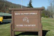 “White Sulphur Springs National Fish Hatchery (WSSNFH) is located along the historic Midland Trail in the heart of the Allegheny Highlands of southeast West Virginia. Established in 1900 to produce fish for the American Public, WSSNFH became part of the National Broodstock Program in 1976. Since then hatchery personnel have shipped millions of disease-free rainbow trout eggs to hatcheries across the country. In 1995, the hatchery added a new program, freshwater mussel conservation,… with a high-tech aquatic research center, raising native mussels and crayfish for restoration and recovery of imperiled and endangered species.”
Explore USFWS’ “White Sulphur Springs National Fish Hatchery” Website
“National Conservation Training Center”

 “Conserving the Nature of America.
“The National Conservation Training Center supports the mission of the U.S Fish and Wildlife Service in five critical ways:
- Home and Heritage: NCTC serves as the physical and virtual “home” of the U.S. Fish and Wildlife Service, where the history and heritage of the Service are preserved and shared;
- Training for the Mission: NCTC provides exemplary training and professional development tailored to support Service employees and conservation partners in accomplishing the agency’s mission;
- Youth in Conservation: NCTC helps the Service engage, educate, and employ the next generation of conservationists who reflect our diverse society, ensuring that our natural resource legacy is left in capable hands;
- Partnerships: NCTC helps solve urgent conservation challenges, such as climate change, by bringing together diverse partners representing multiple points of view;
- Sustainability: NCTC is a national leader in the conservation community for its state-of-the art facility and green practices.
“The National Conservation Training Center, or frequently referred to as NCTC, is located just 60 miles or just over 1 hour outside the Washington DC metropolitan beltway. We are part of the Shepherdstown, West Virginia community also known for the nearby state college just down the road from us.”
Explore USFWS’ “National Conservation Training Center” Website
WV National Parks and Forests – Natural Landmarks, Historic Landmarks, Heritage Areas, and More
“OTHER NATURAL FEATURES”
“West Virginia Land Trust”
 “Founded in 1995, the West Virginia Land Trust (Land Trust) is the only statewide nonprofit 501 (C) 3 land trust dedicated to protecting West Virginia’s natural lands and scenic areas forever. Through voluntary conservation easements, the Land Trust has protected thousands of acres throughout West Virginia.”
Explore “West Virginia Land Trust” Website
“West Virginia Land Trust – We protect special places…
“A special place is more than land and water. A special place takes you to a time and to a memory, it brings you peace, and feels like “home.” A farmer’s special place may be his field, a wildlife watcher’s place is in the forest, a sportsman’s may be a remote stretch of woods, a hiker’s an entire expanse of mountains, and a child’s a field of green where he can run and play or a creek to explore.”
Explore West Virginia Land Trust’s “Our Protected Land” Website
“The Nature Conservancy in West Virginia”
 “Our Mission: conserve the lands and waters on which all life depends. The Nature Conservancy is the leading conservation organization working around the world to protect ecologically important lands and waters for nature and people.”
Explore “The Nature Conservancy in West Virginia” Website
“Places We Protect” — “Preserves” & “Landscapes”
 “With your help, The Nature Conservancy has protected nearly 120,000 acres of critical natural lands in West Virginia.”
Click names for more information on each Preserve or Landscape:
PRESERVES
LANDSCAPES
WV National Parks and Forests – Natural Landmarks, Historic Landmarks, Heritage Areas, and More
“The Sinks of Gandy”

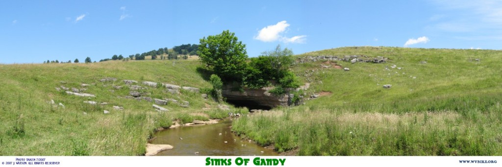
“The Sinks of Gandy are located above Whitmer, WV in Randolph County. Even though they are privately owned, they still attract caving enthusiasts, geologists, and tourists alike with their rugged beauty and mysterious past.”
Explore Information from Harman School’s “The Sinks of Gandy” (deactivated) Website
“Mountain State Monday: Sinks of Gandy”
 “West Virginia is no stranger to caves as our natural mountain landscape is home to many of them. Some of the more intricate caves, or caverns, have even been commercialized and are open for tours. However one of the most intriguing caves to me is one I had heard about for years but never visited, until recently, due to its rural location. And that cave is known as the Sinks of Gandy, in the beautiful countryside in Randolph County. . .”
“Cathedral Falls” – Fayette Co.
“Located east of Gauley Bridge.” (:46/2013/colong7034)
“Ice Mountain”
 “Ice Mountain is a mountain running along the North River just north of North River Mills where the old colonial road from Winchester to the South Branch came down from Sandy Ridge and Grape Ridge along Hiett Run and crossed North River. The mountain contains a set of stone chimneys called “Raven Rocks” and a large talus. At the base of the talus is an area where small caves hold ice most of the year.”
Explore Historic Hampshire’s “Ice Mountain” Website
“Ice Mountain, a giant natural refrigerator in West Virginia”
![]() “West Virginia is full of natural wonders, including one that stays cool all year round. Ice Mountain is located in remote Hampshire County, West Virginia, but the plants that grow there are from much further north and normally only grow in the boreal region below the Arctic Circle. . . “
“West Virginia is full of natural wonders, including one that stays cool all year round. Ice Mountain is located in remote Hampshire County, West Virginia, but the plants that grow there are from much further north and normally only grow in the boreal region below the Arctic Circle. . . “
Explore WBOY’s “Ice Mountain, a giant natural refrigerator in West Virginia” article
“Lab 304: A Trip to Ice Mountain”
 “Producer Emily Corio explores the West Virginia treasure known as Ice Mountain and how global climate change is impacting it.” (9:57/2008/West Virginia Public Broadcasting)
WV National Parks and Forests – Natural Landmarks, Historic Landmarks, Heritage Areas, and More
“Caving in West Virginia”
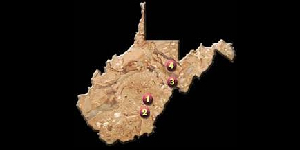
“Lab 304: Underground West Virginia”

“Producer Chuck Frostick takes us into West Virginia’s caves – a subterranean realm of hundreds of miles of interconnected passageways running under parts of our state. This was produced as part of WV PBS’s show “Outlook.” (9:59/2008/WV Public Broadcasting)
Click on Cave/Cavern Logo below to explore commercial websites:
WV National Parks and Forests – Natural Landmarks, Historic Landmarks, Heritage Areas, and More
“West Virginia Watersheds”
 “West Virginia has 32 watersheds divided according to the USGS (US Geological Survey) hydrologic unit codes (HUC) that contribute to the Chesapeake Bay and the Gulf of Mexico. The waters west of the eastern continental divide flow into the Ohio River. The Ohio joins the Mississippi River at Cairo, IL. The Mississippi flows into the Gulf of Mexico at New Orleans, LA. The eastern continental divide changes the course of five of our eastern rivers towards the Potomac River. The Potomac enters the Chesapeake Bay southeast of Washington DC. A few streams in the southeastern corner of the state flow towards the James River.”
Explore WVDEP’s “Watersheds” Website
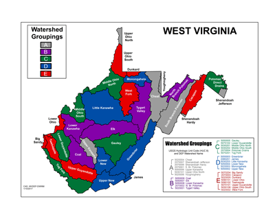
Explore WVDEP’s “Watersheds” Map jpg
“3 Rivers: The Bluestone, Gauley and New” – West Virginia Public Broadcasting
 “A 90-minute documentary from West Virginia Public Broadcasting explores the economic, environmental, cultural, historical and geographic impact of the largest federally protected system of rivers east of the Mississippi. 3 Rivers: The Bluestone, Gauley and New examines the ongoing relationship between mankind and nature in this region. The film is a combination of travelogue, examination of efforts to improve the environment, and a mechanism for promoting economic development through tourism.”
Watch Video on West Virginia Public Broadcasting’s Website
or Here: (1:26:56/2013/West Virginia Public Broadcasting)
WV National Parks and Forests – Natural Landmarks, Historic Landmarks, Heritage Areas, and More
US ARMY CORPS OF ENGINEERS
“Lakes and Dams – Flood Control Projects in West Virginia” (10)
 “These are dams which hold a pool of water behind, forming a lake and storing runoff from rainfall and snowmelt events. The stored runoff is then released in a controlled process to prevent or reduce flood damages.” They also create prime recreational areas. Some have been built and/or retrofitted to produce hydroelectric power.
<<For Navigation Locks and Dams on the Ohio, Great Kanawha and Monongahela Rivers, see the MH3WV “Transportation” page>>
1 – “Beech Fork Lake”

“Beech Fork Dam is near the community of Lavalette, Wayne County, WV, approximately 10 miles south of Huntington. Beech Fork Lake opened for recreational activities in May 1978 and was created by damming the Beech and Miller Forks of Twelvepole Creek.”
Explore USACE’s “Beech Fork Lake” Website
2 – “Bluestone Lake”

“Bluestone Dam spans the New River at Hinton, WV forming Bluestone Lake, the third largest lake in West Virginia.
It was completed for operational purposes in January 1949 and completely finished in January 1952.”
Explore USACE’s “Bluestone Lake” Website
3 – “Burnsville Lake”

“Burnsville Dam is located in Braxton County on the Little Kanawha River 124 miles above its confluence with the Ohio River and approximately 3 miles above the town of Burnsville, WV. It became operational for flood control in December 1978.”
Explore USACE’s “Burnsville Lake” Website
4 – “East Lynn Lake”

“The East Lynn Dam, a rolled earth fill dam, is a flood control facility along East Fork of Twelvepole Creek, 10 miles south of Wayne, WV.”
Explore USACE’s “East Lynn Lake” Website
5 – “Jennings Randolph Lake”
“The Jennings Randolph Dam, of rolled earth and rock fill, is on the North Branch of the Potomac River near Elk Garden, WV. The project (originally called Bloomington Lake) became operational in 1981.”
Explore USACE’s “Jennings Randolph Lake” Website
6 – “R.D. Bailey Lake”

“The R.D. Bailey Dam is on the Guyandotte River near the southern West Virginia town of Justice in Wyoming County. Work on the dam began in 1974; construction began in 1977 and was completed in 1980. Engineers call this type of structure a ‘rockfill’ dam. It is a carefully designed mound of closely compacted rock. A layer of steel-reinforced concrete was placed on the upstream face (on the lakeside) to reduce seepage through the rock. R.D. Bailey was the first concrete-faced dam built by the Corps of Engineers.”
Explore USACE’s “R.D. Bailey Lake” Website
7 – “Stonewall Jackson Lake”
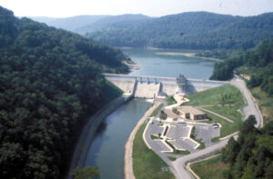
“Completed in 1990, Stonewall Jackson Dam is located on the West Fork River, three miles south of Weston, WV and 73 miles upstream from the river’s mouth.”
Explore USACE’s “Stonewall Jackson Lake” Website
8 – “Summersville Lake”

“The Summersville Dam is on the Gauley River near the town of Summersville in Nicholas County, WV and was built between 1960 and 1966. It is the second largest rock-fill dam in the eastern United States.”
Explore USACE’s “Summersville Lake” Website
9 – “Sutton Lake”

“Sutton Dam is located just above the town of Sutton, WV, 101 miles above the mouth of the Elk River in Charleston.
It controls a 537 square mile drainage area, including the upper Elk River, and the Holly River. Construction began in
October 1949, but was interrupted by the Korean War. Work restarted in 1956 and the dam was finally completed in 1961.”
Explore USACE’s “Sutton Lake” Website
10 – “Tygart Lake”
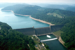
“Authorized by the Rivers and Harbors Act of 1935, Tygart Dam was the first of 16 flood control projects in the Pittsburgh District. The project provides flood protection for the Tygart Valley River as well as the Monongahela and upper Ohio Rivers. Located near Grafton, WV, it held the honor for several years as having the most concrete in any dam east of the Mississippi River with a staggering 324,000 cubic yards.”
Explore USACE’s “Tygart Lake” Website

WV National Parks and Forests
West Virginia WV National Parks, WV National Forests
WV National Parks & Forests , National Parks in WV
National Wildlife Refuges, National Landmarks, Caves, Caverns, Watersheds, Natural Features
Natural Landmarks, Heritage Areas, Historic Landmarks, and More.
